More From Contributor

£34.95
Southeast England & the Midlands Postcode District Map at 1:320, 000, encapsulated version, in a series of postcode district maps from Map Marketing showing the boundaries of the first half of the postcode (or the Outward Code). Enlargements show Birmingham, Bristol & London in greater detail. Coverage extends north to Nottingham, & west to Hereford. Map Marketing’s series of postcode district maps covers Great Britain on six titles, each available only as a flat map, either on paper or encapsulated for greater durability. The Area & District boundaries are shown in red, with County & Unitary Authority boundaries displayed in violet. The map base shows motorways plus primary, ‘A’ & ‘B’ roads, & features conurbation shapes highlighting major towns & cities. The maps include all of the postcode changes from the most recent Royal Mail Postcode Update. Some district sheets also contain large scale city plans within the sheet’s catchment area. To see the list of all the titles in this series please click on the series link.LAMINATED & ENCAPSULATED WALL MAPS:- LAMINATED wall maps have a thin layer of plastic usually applied to the printed side only. They can be written on with suitable marker pens without any damage to the map but, unless laminated on both sides, they are not damp-proof.- ENCAPSULATED wall maps are sealed between two sheets of plastic. They are more rigid & heavier than laminated maps of the same size. They are damp-proof & do not crinkle in humid conditions. Encapsulation gives the map a shiny surface, similar to being displayed behind glass.- PLEASE NOTE: many publishers & retailers often use these two terms interchangeably. Our map titles & descriptions follow the definitions provided above. ...
Archived Product
£24.95
Southeast England & the Midlands Postcode District Map at 1:320, 000, paper version, in a series of postcode district maps from Map Marketing showing the boundaries of the first half of the postcode (or the Outward Code). Enlargements show Birmingham, Bristol & London in greater detail. Coverage extends north to Nottingham, & west to Hereford. Map Marketing’s series of postcode district maps covers Great Britain on six titles, each available only as a flat map, either on paper or encapsulated for greater durability. The Area & District boundaries are shown in red, with County & Unitary Authority boundaries displayed in violet. The map base shows motorways plus primary, ‘A’ & ‘B’ roads, & features conurbation shapes highlighting major towns & cities. The maps include all of the postcode changes from the most recent Royal Mail Postcode Update. Some district sheets also contain large scale city plans within the sheet’s catchment area. To see the list of all the titles in this series please click on the series link. ...
Archived Product
£4.99
Southeast England in the AA 100 Walks Series, exploring the 100 best walks of between 2 & 10 miles in Berkshire, Buckinghamshire, East Sussex, Hampshire, Isle of Wight, Kent, London, Surrey & West Sussex. Information panels introduce each walk in summary detail prior to the more in depth route descriptions, & also include suggestions for nearby car parks & details of relevant Ordnance Survey maps & grid references. Walks are organised by county within the guide & are portrayed on basic route maps which cover rural & urban areas, as well as park & woodl&. Walks are graded according to difficulty & steepness, with easy to follow guidelines. ...
Archived Product
£10.00
` Neither the old man nor Boga ever said more than was needed. & yet they understood each other perfectly.` For years, Boga & the old man have worked side by side on the banks of the Parana river, cutting reeds to sell to local basketweavers. But when the old man falls sick & dies, Boga abandons himself entirely to the river & the life of solitary drifting he has long yearned for. Echoes of John Berger sound throughout the densely descriptive prose of this great Argentian writer. A twentieth-century classic, Southeaster is a central work in Haroldo Conti`s oeuvre. ...
Archived Product
£17.99
Europe s sea-and sun-blessed southeast is ripe for adventure. Explore epic Greek remains, sophisticated Croatian resorts, Turkish spice bazaars the wild forests of Romania & the medieval towns of Montenegro. Getting you to the heart of a place
    Amazing experiences Inspirational images, author recommendations & the best of local knowledge. Plan the perfect trip Planning features & top itineraries give you the freedom to create your ideal trip. Find hidden travel gems Our authors uncover local secrets that will make your trip unique. Special Features Countries at a glance Region-wide itineraries Practical tips Tours of top sights We tell it like it is Our job is to make amazing travel experiences happen. We visit the places we write about each & every edition. We never take freebies for positive coverage, so you can always rely on us to tell it like it is.
...
Archived Product
£5.99
Southeastern USA at 1:2, 400, 000 is a fully indexed map in the Michelin Regional USA series for motorists & tourists which is comprised of three maps at 1:2, 400, 000 covering the USA & southern Canada & two maps at a more detailed scale of 1:500, 000 which cover the north-eastern seaboard from northern Virginia & DC to Southern Maine. Road classification as interstate or state highways include details of the number of lanes, intermediate driving distances, toll roads & rest areas. Minor & un-surfaced roads are also shown, as are ferry routes & airports. Scenic routes are highlighted where applicable. Native Indian land & land belonging to the U.S military are clearly designated on the maps, as are state capitals & boundaries, border crossings & time zone limits. Minimal grey relief shading is shown, as is each state ...
Archived Product
£6.99
Southeastern USA on an overview road map from the National Geographic with 16 panels showing road access to main towns, street plans of central Washington DC & New Orleans, maps of main national parks, & general notes about the states covered by the map. The main map at approx. 1:3, 500, 000 shows extends south from Philadelphia & Pittsburg & west to the Mississippi, covering Southern Pennsylvania & Ohio, the Virginias, Kentucky, Tennessee, the Carolinas, Georgia, Alabama, Mississippi & Florida. The map shows the network of the interstate highways & connecting main roads & highlights national parks & various other places of interest. An enlargement presents the Washington – Baltimore area in greater detail, plus 16 more panels show main roads in & around: Richmond plus Norfolk – Virginia Beach – Newport News VA, Charleston WV, Lexington & Louisville KY, Raleigh & Charlotte NC, Charleston SC, Savanna & Atlanta GA, Memphis & Nashville TN, Jackson MS, Birmingham AL, Orlando with Disney World, Tampa – St. Petersburg & the Miami – Fort Lauderdale – West Palm Beach in Florida. Street plan cover central DC plus the French Quarter of New Orleans. Also included are overview maps of Shenandoah, Great Smoky Mountains & Everglades National Parks. All are annotated with places of interest. ...
Archived Product
£5.99
South-eastern USA at 1:2, 400, 000 (1” to 38 miles) on an indexed road map from Michelin with coverage extending southwards from Washington DC, Indianapolis & Denver, & from the Atlantic coast westwards to Albuquerque in New Mexico & El Paso in Texas. The map is part of Michelin’s series covering USA on three maps at this scale. Road network indicates toll roads & clearly shows road numbers of interstate & state highways plus on selected local roads. Driving distances are marked on main routes in both miles & kilometres, & on selected state roads in kilometres only. State borders are clearly marked & the maps also show time zone boundaries. Topography is indicated by relief shading, with colouring for national/state parks & forests, Indian lands & restricted entry military zones. The maps have no geographical coordinates; each title is indexed. To see all the titles in this series, including more detailed coverage of New England & the Mid-Atlantic States, please click on the series link. ...
Archived Product
£5.99
This is NOT a guide book. This little book brings together past & present to offer a taste of Southend-on-Sea. Learn more about the movers & shakers who shaped this fantastic city. The great & the good; the bad & the ugly. Small wonders, tall stories, TRIUMPH & tragedy BEST places
- Worst Places Local lingo, architecture, green spaces, events, traditions, fact, fiction Origins, evolution, FUTURE Written by a local who knows what makes SOUTHEND-on-SEA tick!
...
Archived Product
£4.95
Southend Street Atlas at 1:19, 000 / 3.33 to a mile, in an indexed, glove box size paperback format, with national grid referencing. Street atlas covers Southend-on-Sea, Basildon, Billericay, Burnham-on-Crouch, Canvey Isl&, Rayleigh, Rochford, Southminster, Wickford, South Woodham Ferrers & Stanford-le-Hope. Motorways, A roads, B roads, dual carriageways, one way streets, pedestrianized/restricted access roads & car parks are shown. The run of street numbers on A & B roads is also indicated, as are the locations of fixed speed cameras & their mph limits. Tracks & footpaths are mapped, as are selected cycleways, railways, stations, level crossings & rail bridges. Colour coding distinguishes land use, e.g. shopping centre, educational establishment or industrial building. Post offices, churches, tourist information centres & emergency services are located, as are public toilets with & without disabled access. Post town & postcode boundaries are demarcated & the atlas is indexed by street name & places of particular interest. Current edition of this atlas
- 2009
...
Archived Product

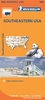
Southeastern States BRISTOL TRANSFER - DO NOT PUT ON THE WEBSITE

Part of the American Road Map series, this is a map designed for the independent traveller. Containing practical details such as inset street maps for major cities, it also includes a useful touring section, place/street name index, index of national parks and more. Scenic routes are highlighted and airports, lakes and reservoirs, places of interest and campsites are also marked. City maps include tourist details such as top attractions and AAA approved hotels whilst place/street names are indexed for ease of reference.
RIP - This product is no longer available on our network. It was last seen on 25.09.2019

This page now acts as a permanent archive for this product. Add more information using the comments box below to ensure it can still be found by future generations.

Use our search facility to see if it is available from an alternative contributor.
  • Availability: Out Of Stock
  • Supplier: Stanfords
  • SKU: 9780749536589
Availability: In Stock
£3.99

Product Description

Part of the American Road Map series, this is a map designed for the independent traveller. Containing practical details such as inset street maps for major cities, it also

Includes::
a useful touring section, place/street name index, index of national parks & more. Scenic routes are highlighted & airports, lakes & reservoirs, places of interest & campsites are also marked. City maps include tourist details such as top attractions & AAA approved hotels whilst place/street names are indexed for ease of reference.

Reviews/Comments

Add New

Intelligent Comparison

Oooops!
We couldn't find anything!
Perhaps this product's unique.... Or perhaps we are still looking for comparisons!
Click to bump this page and we'll hurry up.

Price History

Vouchers

No voucher codes found.
Do you know a voucher code for this product or supplier? Add it to Insights for others to use.

Facebook

Jargon Buster

Road - a manmade lane or a path that is used to speed up travel.
Practical - Weather a task is easy to carry out and realistically succeed.
Reference - To prove evidence with a back up source.

Supplier Information

Stanfords
Stanfords was established in 1853 and opened their iconic Covent Garden flagship store in 1901. They have become the top retailer of maps, travel books and accessories in the UK and arguably offer the largest selection of maps and travel books worldwide. Famous names such as Captain Robert Falcon Scott, Ranulph Fiennes and Michael Palin have purchased from Stanfords. They now have a shop in Bristol and both stores together with other venues operate a calendar of events including talks, book signings and exhibitions. As a specialist map retailer, the map selection is comprehensive and includes road maps, street maps and walking maps from worldwide destinations, as well as a selection of world atlases and wall maps. Books include travel guides and travel literature. Stanfords also stock globes, from miniatures made of blue marble to magnificent floor-standing globes. The website features a selection of interesting articles on travel topics.
Page Updated: 2023-11-12 20:15:36

Community Generated Product Tags

Oh No! The productWIKI community hasn't generated any tags for this product yet!
Menu