
 United Kingdom
 France
 Germany
 Netherlands
 Sweden
 USA
USA
 Italy
Italy
 Spain
Spain
More From Contributor


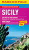
Sicily Flexi Map
Sicily on a laminated, tear-resistant Insight Flexi Map, with a road map of the island, an enlargement of the Mount Etna area, street plans of central Palermo and Catania, all indexed, plus extensive tourist information.On one side is an indexed road map of Sicily at 1:550, 000. Relief shading gives some indication of its topography, with numerous peaks and heights marked right across the whole island. National parks and other protected areas are highlighted. The map presents the road and rail networks, including selected local roads, with driving distance shown on main routes. Interesting town and villages are highlighted and symbols mark other sights. The map has no geographical coordinates.On the reverse are indexed street plans of central Palermo (1:8, 000) and Catania (1:15,
000). Public buildings, places of interest and selected hotels are prominently highlighted.Also provided is an indexed enlargement at 1:185, 000 showing the Mount Etna area in greater detail, including the coastline from Taormina and Giardini-Naxos to Catania.A special feature of the Insight Flexi series are panels with additional tourist information: 22 main sights, neatly grouped into sections covering Major Attractions, Beaches and Scenery, plus Other Points of Interest, are given brief descriptions and are prominently highlighted on the relevant maps. Further panels provide information on Getting Around and Facts for Visitors, including tourist information offices, public holidays, opening times, money, telecommunication and monthly climate charts.
000). Public buildings, places of interest and selected hotels are prominently highlighted.Also provided is an indexed enlargement at 1:185, 000 showing the Mount Etna area in greater detail, including the coastline from Taormina and Giardini-Naxos to Catania.A special feature of the Insight Flexi series are panels with additional tourist information: 22 main sights, neatly grouped into sections covering Major Attractions, Beaches and Scenery, plus Other Points of Interest, are given brief descriptions and are prominently highlighted on the relevant maps. Further panels provide information on Getting Around and Facts for Visitors, including tourist information offices, public holidays, opening times, money, telecommunication and monthly climate charts.
Product Description
Reviews/Comments
Add New
Intelligent Comparison
Archived Product
Seoul Flexi Map Stanfords
£4.99
Archived Product
Milan Flexi Map Stanfords
£4.99
Archived Product
Italy Flexi Map Stanfords
£6.99
Archived Product
Sydney Flexi Map Stanfords
£4.99
Archived Product
Taipei Flexi Map Stanfords
£4.99
Archived Product
Venice Flexi Map Stanfords
£4.99
Archived Product
Hawaii Flexi Map Stanfords
£4.99
Archived Product
Stockholm Flexi Map Stanfords
£4.99
Vouchers
No voucher codes found.
Do you know a voucher code for this product or supplier? Add it to Insights for others to use.
Do you know a voucher code for this product or supplier? Add it to Insights for others to use.
 Denmark