More From Contributor
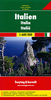
£17.99
Italy in the Eyewitness guide series from Dorling Kindersley; lavishly illustrated & particularly concerned with providing the visitor with detailed background information to sightseeing in the chosen destination & a broad cultural introduction. Popular historical buildings & museums are often described with cutaway diagrams allowing you to view ...
Archived Product
£17.99
The DK Eyewitness Travel Guide: Italy is your indispensable guide to this beautiful part of the world. The fully updated guide


...
Archived Product
£10.99
Freytag & Berndt’s large, double-sided road map of Italy at 1:600, 000, with a separate booklet attached to the map cover providing street plans of the country’s 12 main cities plus an extensive index listing all localities with their postcodes. Bold relief shading with plenty of names of geographical features provides a good presentation of the country’s topography, both in the northern part where the coverage extends to include most of southern Switzerland & the Austrian Alps south of Innsbruck, & along the spine of the Apennines. Road network

Includes::
many small local roads, most with driving distances. Gradients are marked on steep roads. The railway network & ferry connections are included. Symbols highlight some places of interest, including national parks, but the map is basically designed to show the road network rather than the country’s great artistic & historical heritage. The map has latitude & longitude lines at intervals of 30’. Multilingual map legend

Includes::
English.A separate booklet attached to the map cover contains an index, listing all localities with their postcodes & providing street plans of Ancona, Bari, Cagliari, Bolzano, Florence, Genoa, Milan, Naples, Palermo, Rome, Turin & Venice.


...
Archived Product
£10.99
Freytag & Berndt’s road map of Italy at 1:1, 000, 000, designed to present the country’s motorway network & connecting primary & secondary roads, rather than show local roads in detail. Coverage

Includes::
most of Slovenia & extends along the eastern Adriatic to Dubrovnik. The map also shows ferry connections between the mainland & the islands, including Corsica & the Croatian coast. Main mountain & hill ranges are names & UNESCO heritage sites are highlighted. The map has latitude & longitude lines at intervals of 1°. Multilingual map legend

Includes::
English. The index, showing all localities with their postcodes, is in a separate booklet attached to the map cover.


...
Archived Product
£20.99
Road Atlas of Italy at 1:200, 000 from Freytag & Berndt in an A4 spiral-bound format, with good presentation of the country’s topography & highlighting of interesting locations, indexed street plans of 24 towns, & mapping of the whole country at 1:1, 000, 000 of easy route planning. Road network is annotated with information showing motorway services & junction names, toll routes, seasonal closures, permanent entry restrictions, routes not recommended for caravans, steep gradients, tourist routes & scenic roads, etc. Driving distances are marked on most local roads. Railway lines are shown with stations; ferry connections & local airports are also marked. Towns, villages & other interesting locations are highlighted. Symbols also indicate campsites, mountain refuges, etc. Topography is shown by relief shading with spot heights, colouring for forested areas, & plenty of names of mountain ranges, peaks, valleys, etc. National parks & other protected areas are highlighted. The maps have latitude & longitude lines at 10’ intervals. Extensive index lists locations with their postcodes. Map legend

Includes::
English. The atlas also provides indexed street plans of 24 cities indicating main traffic arteries & important buildings & mapping of Italy at 1:1, 000, 000 for easy route planning,

...
Archived Product
£7.99
Italy at a scale of 1:1, 000, 000 on a laminated, tear-resistant, indexed Insight Flexi Map which favours cultural touring in the country, has over 90 significant points of visitor interest enumerated on the legend, & comes with enlarged city street plans of Rome, Milan & Venice at a scale of 1:16, 000. The map

Includes::
coverage of Sicily & Sardinia. Road network shown covers motorways, dual carriageways, trunk roads, main & secondary roads. Motorway junctions are marked, along with petrol stations & road side service stations. Airports, rail lines & ferry lines are marked. The map is indexed by both important place name & the country

...
Archived Product
£6.99
Blue Guide’s “ Italy Food Companion” is a pocket-sized guide for holidays & at home reference. The book gives you all the basics you’ll need to know, such as understanding the menu & more in-depth coverage of the kinds of dishes you’ll expect to see & eat. It looks at pizza, pasta, rare regional delicacies, fine wines, & more; separate sections are included for Mediterranean fish, wines, aperitifs, & Italian chefs. There is also a phrases section, divided into ‘what it means’ & ‘how to ask for’. ...
Archived Product
£16.99
Most visitors to Italy flock to the crowded tourist centres, but in Italy for the Gourmet Traveller, Fred Plotkin takes us beyond the traditional tourist experience & lures us to special places, whether in big cities or out-of-the-way villages, often overlooked by the uninitiated. Under his discerning eye, we learn about the food, wines, local bakeries, olive oil distilleries, ice cream parlours, cheeses, markets, restaurants & best kept secrets of Italy`s culinary world. Lovingly drawn portraits of the people who make its world-famous regional specialities, & a smattering of local history make each village, town & city come alive. Maps encourage the intrepid traveller to head off the beaten track, while evocative black & white photographs add to the immense charm of this vastly readable guide. ...
Archived Product
£12.99
Italy at 1:1, 000, 000 from Hallwag on an indexed touring map with a special ” Distoguide” incorporated into the cover showing road distances between several locations, plus enlargements of road access to 10 main cities. Road & rail networks are easy to see on a clear base with faint relief shading & colouring presenting the topography & woodlands, with spot heights & names of mountain ranges, peaks & valleys, etc. Road network emphasizes motorways & connecting regional or provincial roads, showing motorway services, driving distances, toll routes, seasonal closures & restricted entry roads, steep gradients, etc. Small symbols highlight various places of interest including campsites, cultural & historical sites, recreational areas, etc. Latitude lines are drawn at 30’ intervals with longitude at 1°. The index is in a separate booklet attached to the map cover. Map legend

Includes::
English. The map also

Includes::
enlargements showing in greater detail roads around & main routes across 10 main cities: Rome, Palermo, Naples, Florence, Messina, Genoa, Venice, Bologna, Turin & Milan. Publishers’ special feature is a ” Distoguide” incorporated into the map cover, showing at a glance road distances from 24 main cities to over 50 other locations in Italy.


...
Archived Product
£1.99
The perfect patriotic accessory to wave the Jubilee Festival in with, these Union Jack flags will make a great addition to your street party or day out on the town. The first choice accessory this summer for the urbane street partier rather than the last refuge of a scoundrel... ...
Archived Product

Italy Flexi Map

Italy at a scale of 1:1, 000, 000 on a laminated, tear-resistant, indexed Insight Flexi Map which favours cultural touring in the country, has over 90 significant points of visitor interest enumerated on the legend, and comes with enlarged city street plans of Rome, Milan and Venice at a scale of 1:16, 000. The map includes coverage of Sicily and Sardinia. Road network shown covers motorways, dual carriageways, trunk roads, main and secondary roads. Motorway junctions are marked, along with petrol stations and road side service stations. Airports, rail lines and ferry lines are marked.The map is indexed by both important place name and the country
RIP - This product is no longer available on our network. It was last seen on 25.09.2019

This page now acts as a permanent archive for this product. Add more information using the comments box below to ensure it can still be found by future generations.

Use our search facility to see if it is available from an alternative contributor.
  • Availability: Out Of Stock
  • Supplier: Stanfords
  • SKU: 9789812822987
Availability: In Stock
£6.99

Product Description

Italy at a scale of 1:1, 000, 000 on a laminated, tear-resistant, indexed Insight Flexi Map which favours cultural touring in the country, has over 90 significant points of visitor interest enumerated on the legend, & comes with enlarged city street plans of Rome, Milan & Venice at a scale of 1:16, 000. The map

Includes::
coverage of Sicily & Sardinia. Road network shown covers motorways, dual carriageways, trunk roads, main & secondary roads. Motorway junctions are marked, along with petrol stations & road side service stations. Airports, rail lines & ferry lines are marked. The map is indexed by both important place name & the country

Reviews/Comments

Add New

Price History

Vouchers

No voucher codes found.
Do you know a voucher code for this product or supplier? Add it to Insights for others to use.

Facebook

Jargon Buster

Milan - A city in Italy
Italy - a country in Europe.
Network - A link and communication between things. Often computers or people.
Road - a manmade lane or a path that is used to speed up travel.
Resistant - Something that can repel against something.
Laminated - A thin layer of plastic that gives a coating and shine to a material.

Supplier Information

Stanfords
Stanfords was established in 1853 and opened their iconic Covent Garden flagship store in 1901. They have become the top retailer of maps, travel books and accessories in the UK and arguably offer the largest selection of maps and travel books worldwide. Famous names such as Captain Robert Falcon Scott, Ranulph Fiennes and Michael Palin have purchased from Stanfords. They now have a shop in Bristol and both stores together with other venues operate a calendar of events including talks, book signings and exhibitions. As a specialist map retailer, the map selection is comprehensive and includes road maps, street maps and walking maps from worldwide destinations, as well as a selection of world atlases and wall maps. Books include travel guides and travel literature. Stanfords also stock globes, from miniatures made of blue marble to magnificent floor-standing globes. The website features a selection of interesting articles on travel topics.
Page Updated: 2023-11-12 20:15:36

Community Generated Product Tags

Oh No! The productWIKI community hasn't generated any tags for this product yet!
Menu