More From Contributor
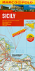
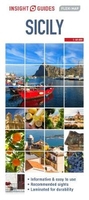
£7.99
DK Eyewitness Top 10 Travel Guide: Sicily will lead you straight to the very best that Italy`s largest & most varied region has to offer. Whether you`re looking for the top 10 ancient sites to visit, or want to find the top 10 top nightspots, this guide is the perfect pocket-sized companion. With dozens of top 10 lists, from the top 10 festivals to the top 10 children`s activities, & even a list of the top 10 things to avoid, this guide will allow you to get the best out of your holiday. The guide is divided by area with restaurant reviews for each, as well as recommendations for hotels, bars & places to shop. You`ll find the insider knowledge every visitor needs & explore every corner of Sicily effortlessly with DK Eyewitness Top 10 Travel Guide: Sicily & its free pull-out map. ...
Archived Product
£10.99
Sicily at a detailed scale of 1:150, 000 on a large, double-sided map in Freytag & Berndt’s very popular “ Top 10 Tips” series. A booklet attached to the map cover provides descriptions of the region’s 10 best sights, Street plans, included on the map itself rather than in the booklet, show central Palermo, Catania, Messina & Siracusa. Many place names are in large print to make navigating easier.PLEASE NOTE: the same mapping but with route highlighting & additional information for cycling is also available in the publishers’ set covering Sicily on two more handy size, double-sided maps – please click on the series link to see the set & other titles in this series. Maps in this “ Top 10 Tips” F&B series for Italy have topography well presented by subtle hill-shading with spot heights, plus colouring for woodlands; national & regional parks are highlighted. Road network emphasizes motorways & regional roads, but also

Includes::
small local roads & selected country tracks, most annotated with driving distances. Scenic routes are highlighted & the maps show roads closed to motor vehicles and/or not recommended for caravans, winter closures, toll routes, etc. Names of larger local towns are in bold print, making navigating in unfamiliar terrain much easier. Railway lines & ferry routes are included & local airports are marked. Picturesque locations are highlighted & in each title 10 best places of interest are prominently marked & briefly described in a booklet attached to the map cover. Symbols indicate various landmarks & facilities, e.g. archaeological sites, churches & castles, campsites, hostels, etc. Latitude & longitude lines are drawn at 10` intervals. The index, listing all the localities with their postcodes, is in the booklet attached to the map cover. The booklet also provides street plan (s) of the region’s main town (s). Map legend & the descriptions include English.

...
Archived Product
£16.99
Sicily at 1:150, 000 in a set of two double-sided, GPS compatible maps from Freytag & Berndt highlighting for recommended cycle routes & best sights, with descriptions in the accompanying booklet; plus street plans of central Palermo, Catania, Messina & Siracusa. The mapping is similar to the publishers’ “ Top 10 Tips” one-sheet map of Sicily at this scale, but with additional information for cyclists. Topography is presented by relief shading & spot heights, with protected areas prominently highlighted. Many place names are in large print to make navigating easier. Road network

Includes::
selected local tracks & shows motorway services, toll routes, entry restrictions & seasonal closures, roads not recommended for caravans, steep gradients, etc; driving distances are included on many local routes. Scenic roads & routes recommended for cycling are highlighted. Railway lines are shown with stations & ferry connections are marked. The maps indicate locations worth visiting, with 10 best sights cross-referenced to their descriptions in the accompanying booklet. Symbols show other places of interest including campsites & youth hostels. The maps have latitude & longitude lines at intervals at 10’ & include street plans of central Palermo, Catania, Messina & Siracusa. Accompanying 46-page booklet provides an index listing locations with their postcodes, descriptions of the 10 best sights highlighted on the maps, a street plan of a wider part of Palermo, plus descriptions of five cycling routes. Map legend & all the text include English. To see the other titles in F&B’s “ Top 10 Tips” series for Italy, including the one-sheet map of Sicily, please click on the series link.

...
Archived Product
£4.99
Sicily on a laminated, tear-resistant Insight Flexi Map, with a road map of the isl&, an enlargement of the Mount Etna area, street plans of central Palermo & Catania, all indexed, plus extensive tourist information. On one side is an indexed road map of Sicily at 1:550, 000. Relief shading gives some indication of its topography, with numerous peaks & heights marked right across the whole isl&. National parks & other protected areas are highlighted. The map presents the road & rail networks, including selected local roads, with driving distance shown on main routes. Interesting town & villages are highlighted & symbols mark other sights. The map has no geographical coordinates. On the reverse are indexed street plans of central Palermo (1:8, 000) & Catania (1:15, 000). Public buildings, places of interest & selected hotels are prominently highlighted. Also provided is an indexed enlargement at 1:185, 000 showing the Mount Etna area in greater detail, including the coastline from Taormina & Giardini-Naxos to Catania.A special feature of the Insight Flexi series are panels with additional tourist information: 22 main sights, neatly grouped into sections covering Major Attractions, Beaches & Scenery, plus Other Points of Interest, are given brief descriptions & are prominently highlighted on the relevant maps. Further panels provide information on Getting Around & Facts for Visitors, including tourist information offices, public holidays, opening times, money, telecommunication & monthly climate charts. ...
Archived Product
£5.99
Sicily on a laminated, tear-resistant Insight Flexi Map, with a road map of the isl&, an enlargement of the Mount Etna area, street plans of central Palermo & Catania, all indexed, plus extensive tourist information. On one side is an indexed road map of Sicily at 1:550, 000. Relief shading gives some indication of its topography, with numerous peaks & heights marked right across the whole isl&. National parks & other protected areas are highlighted. The map presents the road & rail networks, including selected local roads, with driving distance shown on main routes. Interesting town & villages are highlighted & symbols mark other sights. The map has no geographical coordinates. On the reverse are indexed street plans of central Palermo (1:8, 000) & Catania (1:15, 000). Public buildings, places of interest & selected hotels are prominently highlighted. Also provided is an indexed enlargement at 1:185, 000 showing the Mount Etna area in greater detail, including the coastline from Taormina & Giardini-Naxos to Catania.A special feature of the Insight Flexi series are panels with additional tourist information: 22 main sights, neatly grouped into sections covering Major Attractions, Beaches & Scenery, plus Other Points of Interest, are given brief descriptions & are prominently highlighted on the relevant maps. Further panels provide information on Getting Around & Facts for Visitors, including tourist information offices, public holidays, opening times, money, telecommunication & monthly climate charts. ...
Archived Product
£11.00
Sicilian cuisine is known as curtigghiu
- of the courtyard
- with recipes passed from door to door & from generation to generation

...
Archived Product
£7.99
Sicily in the Pocket Guide series from Insight provides detailed commentary on a collection of itinerary based trips in a handy pocket format. Each guide has an historical & cultural introduction, profiling the growth of the region or city. There is also a large selection of localised & pedestrian friendly tour itineraries designed to take in the major sites, as well as a chapter on excursions to other destinations within easy reach. Further sections detail leisure activities including shopping, eating out, nightlife, festivals & local events with accompanying addresses & contact details where relevant. There is also practical guidance on transport, local services, language & accommodation. Each guide also has a large selection of colour photographs & a pull-out pocket map giving an overview of the region. ...
Archived Product
£7.99
The Marco Polo Guide to Sicily is the perfect companion for your trip to Sicily, featuring practical information & insightful tips on how to make the most of your time in Sicily. Most travellers want to have fun & feel relaxed from the moment they arrive at their holiday destination
- that’s what Marco Polo Guides are all about. This new series will appeal to all types of travellers, including those who haven’t bought a travel guide in the past! Marco Polo’s unique insider tips are peppered throughout the guide
- offering a real insight into the destination.

Includes::
special tips for when it rains, things to do for free, chill out & relax. Where to start – tells the reader the ideal starting point to explore the city / destination, how to get there: by car or public transport, where to park the car… & much more! The perfect day / perfect route – the best way to get to know a destination for those with limited time. Practical information on shopping, food & drink & much more – plus a phrasebook section. Also

Includes::
a fully indexed street atlas & a pull-out map.


...
Archived Product
£5.99
Sicily at 1:200, 000 from Marco Polo Travel Publishing with special features to aid navigation & route planning. The index booklet

Includes::
street plans of central Catania, Messina & Palermo. A fold-out extension of the map cover gives at-a-glance overview of Sicily with the adjoining mainl&, making it much easier to find various places on the main map and/or plan a route. A set of seven peel-on/peel-off stickers, removable without damaging the map, is provided to make routes or locations more prominent when navigating. The map boldly stresses main roads & motorways in strong colours & selected towns in large letters, but also shows minor roads & villages in considerable detail. Road information

Includes::
toll roads, traffic restrictions & seasonal closures, gradient marking for steep roads, scenic routes, etc. Motorway services clearly indicate types of facilities available there. Railway lines are shown with stations. Cartography from the renowned German publishers Mair Dumont is particularly good for identifying geographical

Features:
mountain & hill chains, valleys, national parks, etc. Picturesque towns & places of interest are given star rating, & other tourist information

Includes::
campsites & youth hostels, landmarks, recreational facilities etc. Latitude & longitude grid is drawn at intervals of 10`. Multilingual map legend & all information include English.A booklet attached to the map cover contains street plans of central Catania, Messina & Palermo, plus an extensive index of place names including geographical features such as rivers, lakes, mountains, etc, as well as places of interest. Also provided is a table with distances/traveling times, plus main traffic & speed regulations.


...
Archived Product
£9.99
Sicily in the Marco Polo Spiral Guides series is a practical guide presenting the most important things to see & do in the region in a nutshell, & aimed at travellers who don’t have a lot of time to prepare & research for a trip. The guide highlights the top 10 sights, suggests tours & great ideas for exciting days out, & features colour photographs & a pull-out regional map & atlas pages. The guide opens with introductory chapters offering general information about the region, its history, art, geography & the people & things that make it worth visiting. Then, the guide divides the area into sections, & for each offers more specific information organised by Getting Your Bearings, Perfect Days giving examples of planned itineraries, the Top 10, Don’t Miss & At Your Leisure. There are planned day itineraries for each area including the best places to eat & drink along the way, accompanied by local map extracts & dotted with useful tips. An additional chapter offers inspirations for walks & tours. The guide concludes with general & practical information, regional atlas pages & a removable pull-out map, conveniently stored in a plastic pocket on the back cover. The format is designed with practicality in mind; the spiral binding & the colour coding makes it easy to keep the book open where is needed & render orientation fast & easy, ideal for travellers on the go. ...
Archived Product

Sicily Flexi Map

Sicily on an Insight Flexi Pocket Map in their new format introduced to provide more convenient access to the special features of this series: various additional maps and/or street plans plus tourist information including a list of must-see sights. The map is tear-resistant, waterproof, and can be written on with non-permanent marker pens. On one side is a map of Sicily at 1:450, 000 showing its road network on a base with altitude colouring, spot heights and names of mountain ranges. The map has no geographical coordinates and is indexed for places and points of interest.On the reverse are this title’s additional features:- A street plan of central Palermo at 1:8, 500, indexed for streets and points of interest.- Small panels showing Sicily with the surrounding islands, plus
Lampedusa, Ustica, Egadi Islands and Lipari (Aeolian) Islands, indicating ferry connections and indexed for islands, places and points of interest.- 21 main sights, neatly grouped into sections covering Major Attractions, Beaches and Scenery, plus Other Points of Interest are given brief descriptions and are prominently highlighted on the relevant maps.- Information about Getting Around and Facts for Visitors, including tourist information, money, public holidays, opening times, tipping, telecommunications, plus monthly climate charts.To see the list of other Insight Flexi titles in this series please click on the series link.
RIP - This product is no longer available on our network. It was last seen on 25.09.2019

This page now acts as a permanent archive for this product. Add more information using the comments box below to ensure it can still be found by future generations.

Use our search facility to see if it is available from an alternative contributor.
  • Availability: Out Of Stock
  • Supplier: Stanfords
  • SKU: 9781786719126
Availability: In Stock
£5.99

Product Description

Sicily on an Insight Flexi Pocket Map in their new format introduced to provide more convenient access to the special features of this series: various additional maps and/or street plans plus tourist information including a list of must-see sights. The map is tear-resistant, waterproof, & can be written on with non-permanent marker pens. On one side is a map of Sicily at 1:450, 000 showing its road network on a base with altitude colouring, spot heights & names of mountain ranges. The map has no geographical coordinates & is indexed for places & points of interest. On the reverse are this title’s additional

Features:
- A street plan of central Palermo at 1:8, 500, indexed for streets & points of interest.- Small panels showing Sicily with the surrounding islands, plus Lampedusa, Ustica, Egadi Islands & Lipari (Aeolian) Islands, indicating ferry connections & indexed for islands, places & points of interest.- 21 main sights, neatly grouped into sections covering Major Attractions, Beaches & Scenery, plus Other Points of Interest are given brief descriptions & are prominently highlighted on the relevant maps.- Information about Getting Around & Facts for Visitors, including tourist information, money, public holidays, opening times, tipping, telecommunications, plus monthly climate charts. To see the list of other Insight Flexi titles in this series please click on the series link.

Reviews/Comments

Add New

Intelligent Comparison

Oooops!
We couldn't find anything!
Perhaps this product's unique.... Or perhaps we are still looking for comparisons!
Click to bump this page and we'll hurry up.

Price History

Vouchers

No voucher codes found.
Do you know a voucher code for this product or supplier? Add it to Insights for others to use.

Facebook

Jargon Buster

Waterproof - Resistant to water, usualy specified by depth in metres
Network - A link and communication between things. Often computers or people.
Small - something that takes up less space than normal.
Road - a manmade lane or a path that is used to speed up travel.
Permanent - Something that is long term and most likely to be around forever.
Resistant - Something that can repel against something.
Altitude - Something that can be quite high in relation to sea or ground level.
Pocket - A bag shaped insert in clothing used to carry items
Convenient - Something that suits and fits well to other activities.

Supplier Information

Stanfords
Stanfords was established in 1853 and opened their iconic Covent Garden flagship store in 1901. They have become the top retailer of maps, travel books and accessories in the UK and arguably offer the largest selection of maps and travel books worldwide. Famous names such as Captain Robert Falcon Scott, Ranulph Fiennes and Michael Palin have purchased from Stanfords. They now have a shop in Bristol and both stores together with other venues operate a calendar of events including talks, book signings and exhibitions. As a specialist map retailer, the map selection is comprehensive and includes road maps, street maps and walking maps from worldwide destinations, as well as a selection of world atlases and wall maps. Books include travel guides and travel literature. Stanfords also stock globes, from miniatures made of blue marble to magnificent floor-standing globes. The website features a selection of interesting articles on travel topics.
Page Updated: 2023-11-12 20:15:36

Community Generated Product Tags

Oh No! The productWIKI community hasn't generated any tags for this product yet!
Menu