More From Contributor
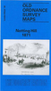
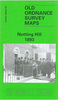
£14.99
This is the story of Notting Hill, from its beginning in the Ladbroke Estate to its current incarnation as one of the most cosmopolitan & fashionable London neighbourhoods. The spacious crescents, stuccoed houses & leafy communal gardens that give Notting Hill its charm were developed during the 19th century. This elegance existed cheek by jowl with the Potteries, one of London`s worst slums, where in the mid-19th century average life expectancy was 11 years & 7 months. After the First World War many buildings fell into disrepair, houses were converted into flats & bed-sits, & the area went into decline. During the 1950s there was an influx of immigrants from the Caribbean, who were exploited by unscrupulous landlords. The race riots of 1958 marked a low point for Notting Hill. But the incomers inspired the Notting Hill Carnival, which has become a popular tourist attraction, as has the Portobello Road with its antiques & fruit & vegetable market, while the area has been regenerated by new wealth (not to mention a starring role in the film Notting Hill). All contribute to the cosmopolitan, fashionable area Notting Hill is today. ...
Archived Product
£2.99
There are a multitude of ` London Calling` cards in the collection at Rocket 68. This lively illustrated range of London themed prints & cards aims to portray the vibrancy & beauty of London`s architecture, areas, life & communities. Each card is supplied with quality Gunpowder grey envelope in a cellophane wrapper. These cards are all illustrated by Jill White & printed in the UK on a lovely soft Calisto FSC accredited board. ...
Archived Product
£14.50
In the convenient A-Z format, the author, a Blue Badge Guide, describes this fascinating melting pot of London. Renowned for recreation, & fashion, this diverse area was the birthplace of Norland Nannies, the Left Book Club & Britain`s first purpose-built car factory. Home to Chesterton, Orwell, & Herbert Hoover, it also numbered amongst its residents China`s most renowned 20th-century writer. Notting Hill is synonymous with Carnival, & Holland Park with its genteel origins. ...
Archived Product
£3.50
Notting Hill in 1871 in a fascinating series of reproductions of old Ordnance Survey plans in the Alan Godfrey Editions, ideal for anyone interested in the history of their neighbourhood or family. Three versions of this map cover the area from White City eastward to Pembridge Square & St Stephen`s Square, & capture the part of Kensington known as Notting Hill. In the north-east is a portion of the Paddington parish, including Westbourne Park station; to the west is a part of Hammersmith parish, rural in the early map but later developed to include White City. The 1871 map (actually largely surveyed in 1863-5) shows the Ladbroke Estate already largely developed around Ladbroke Grove, Lansdowne Crescent, Ladbroke Square, Kensington Park Road & other well set out streets. The area was previously known as Notting Dale or ` The Kensington Potteries`. Further west development is less complete & beyond Latimer Road there are still farms. Several railways run through the map: the West London Junction Railway, the Hammersmith & City Railway, with Notting Hill station, & a small section of the GWR with Westbourne Grove station & engine sheds. At the north of the map is more countryside with Portobello Farm & Notting Barn. Extreme top right is Paddington Workhouse. About the Alan Godfrey Editions of the 25” OS Series: Selected towns in Great Britain & Ireland are covered by maps showing the extent of urban development in the last decades of the 19th & early 20th century. The plans have been taken from the Ordnance Survey mapping & reprinted at about 15 inches to one mile (1:4, 340). On the reverse most maps have historical notes & many also include extracts from contemporary directories. Most maps cover about one mile (1.6kms) north/south, one & a half miles (2.4kms) across; adjoining sheets can be combined to provide wider coverage.FOR MORE INFORMATION & A COMPLETE LIST OF ALL AVAILABLE TITLES PLEASE CLICK ON THE SERIES LINK. ...
Archived Product
£3.50
Notting Hill in 1893 in a fascinating series of reproductions of old Ordnance Survey plans in the Alan Godfrey Editions, ideal for anyone interested in the history of their neighbourhood or family. Three versions cover the area from White City eastward to Pembridge Square & St Stephen`s Square, & capture the part of Kensington known as Notting Hill. In the north-east is a portion of Paddington parish, including Westbourne Park station; to the west is a part of Hammersmith parish, rural in the early map but later developed to include White City. The 1893 map shows Notting Hill entirely built up, with streets & houses as far as Latimer Road, which now has a station. Features include Mary Place Workhouse, Phoenix Brewery, Avondale Park, Kensington Public Baths, St Charles RC College, Franciscan Convent, Carmelite Convent, St Quintin Park, St Quintin & Wormwood Scrubbs station. Beyond the West London Railway is an area of brickfields & (apparently) piggeries. On the reverse are street directories for Ladbroke Grove, Ladbroke Square & Lancaster Road. About the Alan Godfrey Editions of the 25” OS Series: Selected towns in Great Britain & Ireland are covered by maps showing the extent of urban development in the last decades of the 19th & early 20th century. The plans have been taken from the Ordnance Survey mapping & reprinted at about 15 inches to one mile (1:4, 340). On the reverse most maps have historical notes & many also include extracts from contemporary directories. Most maps cover about one mile (1.6kms) north/south, one & a half miles (2.4kms) across; adjoining sheets can be combined to provide wider coverage.FOR MORE INFORMATION & A COMPLETE LIST OF ALL AVAILABLE TITLES PLEASE CLICK ON THE SERIES LINK. ...
Archived Product
£20.00
This illustrated map print is illustrated by Clare Owen Clare Owen`s imagery is delicate & precise. Her pastel palette perfectly captures the charming atmosphere of Notting Hill. Clients of the Bristol illustrator include Elle, Marks & Spencer, Urban Outfitters, The Guardian & Lush Cosmetics. ...
Archived Product
£13.50
A walking guide to this historic London neighbourhood, uncovering its countercultural roots.A delightful English/ Japanese pocket-size guide to London`s most popular district. Through four walks London writer Julian Mash uncovers the history, culture & fascinating characters that have made Notting Hill so iconic. Beautifully laid out including several photographic images & four h&-drawn maps, the guide will appeal to both tourists & residents alike. Key Points: Good sales potential to tourists visiting this hugely popular area of London. Appeals to residents as it uncovers the lesser-known Notting Hill. Stylish pocket-size guide illustrated with hand drawn maps & photographs. Taps into the burgeoning interest in literary walks & psychogeography made popular by writers such as Ian Nairn, Iain Sinclair, Matthew Beaumont ...
Archived Product
£6.39
A detailed topographic map of Nottingham from the Ordnance Survey Explorer series, covering Vale of Belvoir. Edition A2; Publication date September 2008 About this series: These highly detailed maps show all the administrative boundaries, settlements as small as isolated farms, the road network down to unfenced roads & country tracks, & field boundaries (hedges & drystone walls) which make navigation across the countryside much easier. Steep gradients on roads are indicated. Various landmarks, e.g. powerlines, archaeological sites, windmills, churches & lighthouses are shown & additional graphics indicate natural terrain features such as cliffs, scree, mud & vegetation variations. The contour interval is 5 metres in the lower parts of the country & 10 metres in the uplands, & spot heights are marked. Each map covers an area of 30 x 20km (i.e. approx. 19 x 12 miles), with some double-sided maps covering more, as indicated in the individual descriptions. The maps are fully GPS compatible, with the National Grid shown at 1km intervals & latitude & longitude indicated by margin ticks at 1'. The Explorer series has replaced the earlier, green-cover Pathfinder maps. The Explorer series is now complete & covers all of Engl&, Wales & Scotl&. Some sheets for popular areas like the National Parks are still branded as Outdoor Leisure (OL) maps, but are now included in this series as the cartography is the same as that in the Explorer Maps. The Explorer maps offer a substantial improvement on the Pathfinder series, with greater use of colour, larger area per map, & stronger emphasis on information for ramblers & tourists. This series is ideal for walking & other outdoor pursuits & each map shows a large amount of information for ramblers & tourists. Public rights of way are shown (except in Scotland), together with other routes with public access: National Trails & Recreational Paths, permitted paths & bridleways, & selected cycle routes. Open access land created under the Countryside & Rights of Way Act 2000 is marked. Tourist information

Includes::
caravan & camp sites, Park & Ride locations, recreation/leisure/sport centres, museums, historic buildings, English Heritage & National Trust sites, rural pubs, etc. The map legend is in English only, except for the tourist information content which is also in French & German.

...
Archived Product
£6.99
Nottingham & Sherwood Forest in the Short Walks guide series, produced in association with Ordnance Survey & published by Crimson; comprising a range of walking guides to popular British destinations. Each title

Includes::
20 varied walks that are suitable for walkers of all ages & abilities & is accompanied by detailed Explorer 1:25, 000 Ordnance Survey mapping with colour-coded marked routes. The guides are structured in three main sections with different levels of difficulty- short & easy walks, those of modest length that may include uphill walking & more challenging routes that may be longer & over more rugged terrain- covering a total of 20 walks. Each walk has a mini summary & an information box with details of starting points, distance, approximate time, parking & any individual route features. There is also information on refreshments, local transport & public toilets en route. Appendices provide further useful information on walking safety, GPS, the Countryside Code, local organisations & Ordnance Survey maps.

...
Archived Product
£5.99
A new edition in the AA's ground breaking series of street atlases, covering Nottingham in a handy glovebox size. The atlas uses the latest digital data for Britain from Ordnance Survey & the AA & also

Includes::
National Grid Referencing as used by the emergency services. All of the maps clearly show recommended restaurants, hotels, one-way streets & car parks, with 24-hour petrol stations now highlighted. Featuring a clever use of colour to ensure they can be read under street lighting, these maps are all you need to keep you on the move.

...
Archived Product

Notting Hill 1914

Notting Hill in 1914 in a fascinating series of reproductions of old Ordnance Survey plans in the Alan Godfrey Editions, ideal for anyone interested in the history of their neighbourhood or family. Selected towns in Great Britain and Ireland are covered by maps showing the extent of urban development in the last decades of the 19th and early 20th century.In this title: three versions of this map have been published to show how the area developed across the years. The maps each cover the same area, from White City eastward to Pembridge Square and St Stephen's Square, and capture the area of Kensington known as Notting Hill. In the north-east is a portion of Paddington parish, including Westbourne Park station; to the west is a portion of Hammersmith parish, rural in the early map but
later developed to include White City. The area developed considerably over the years. The 1871 map (actually largely surveyed in 1863-5) shows the Ladbroke Estate already largely developed around Ladbroke Grove, Lansdowne Crescent, Ladbroke Square, Kensington Park Road and other well set out streets. The area was previously known as Notting Dale or 'The Kensington Potteries'. Further west development is less complete and beyond Latimer Road there are still farms. Several railways run through the map: the West London Junction Railway, the Hammersmith & City Railway, with Notting Hill station, and a small section of the GWR with Westbourne Grove station and engine sheds. At the north of the map is more countryside with Portobello Farm and Notting Barn. Extreme top right is Paddington
Workhouse. The 1893 map shows Notting Hill entirely built up, with streets and houses as far as Latimer Road, which now has a station. Features include Mary Place Workhouse, Phoenix Brewery, Avondale Park, Kensington Public Baths, St Charles RC College, Franciscan Convent, Carmelite Convent, St Quintin Park, St Quintin & Wormwood Scrubbs station. Beyond the West London Railway is an area of brickfields and (apparently) piggeries. On the reverse are street directories for Ladbroke Grove, Ladbroke Square and Lancaster Road. The 1914 map shows the area further developed, with tramways and Wood Lane station. The main new development in the south-western area of the map is the Olympic Stadium and the Great White City complex built for the Shepherds Bush Exhibition. Nearby is part of
the Central London Railway Depot.About the Alan Godfrey Editions of the 25
RIP - This product is no longer available on our network. It was last seen on 25.09.2019

This page now acts as a permanent archive for this product. Add more information using the comments box below to ensure it can still be found by future generations.

Use our search facility to see if it is available from an alternative contributor.
  • External links may include paid for promotion
  • Availability: Out Of Stock
  • Supplier: Stanfords
  • SKU: 9780850540598
Availability: In Stock
£2.95

Product Description

Notting Hill in 1914 in a fascinating series of reproductions of old Ordnance Survey plans in the Alan Godfrey Editions, ideal for anyone interested in the history of their neighbourhood or family. Selected towns in Great Britain & Ireland are covered by maps showing the extent of urban development in the last decades of the 19th & early 20th century. In this title: three versions of this map have been published to show how the area developed across the years. The maps each cover the same area, from White City eastward to Pembridge Square & St Stephen's Square, & capture the area of Kensington known as Notting Hill. In the north-east is a portion of Paddington parish, including Westbourne Park station; to the west is a portion of Hammersmith parish, rural in the early map but later developed to include White City. The area developed considerably over the years. The 1871 map (actually largely surveyed in 1863-5) shows the Ladbroke Estate already largely developed around Ladbroke Grove, Lansdowne Crescent, Ladbroke Square, Kensington Park Road & other well set out streets. The area was previously known as Notting Dale or ' The Kensington Potteries'. Further west development is less complete & beyond Latimer Road there are still farms. Several railways run through the map: the West London Junction Railway, the Hammersmith & City Railway, with Notting Hill station, & a small section of the GWR with Westbourne Grove station & engine sheds. At the north of the map is more countryside with Portobello Farm & Notting Barn. Extreme top right is Paddington Workhouse. The 1893 map shows Notting Hill entirely built up, with streets & houses as far as Latimer Road, which now has a station. Features include Mary Place Workhouse, Phoenix Brewery, Avondale Park, Kensington Public Baths, St Charles RC College, Franciscan Convent, Carmelite Convent, St Quintin Park, St Quintin & Wormwood Scrubbs station. Beyond the West London Railway is an area of brickfields & (apparently) piggeries. On the reverse are street directories for Ladbroke Grove, Ladbroke Square & Lancaster Road. The 1914 map shows the area further developed, with tramways & Wood Lane station. The main new development in the south-western area of the map is the Olympic Stadium & the Great White City complex built for the Shepherds Bush Exhibition. Nearby is part of the Central London Railway Depot. About the Alan Godfrey Editions of the 25

Reviews/Comments

Add New

Price History

Vouchers

No voucher codes found.
Do you know a voucher code for this product or supplier? Add it to Insights for others to use.

Facebook

Jargon Buster

Engine - A machine designed to convert fuel into motion
White - A colour combining all colours
Paddington - An area in the city of Westminster, London
History - Anything that happens in the past. An acedemic subject.
Railways - A set of tracks that have been laid for the purpose of trains to travel up and down them
Wood - A hard material found in trees. Used for tool making, fuel and construction.
Set - a group of items usually related to one another. Some objects cannot function without the complete set of items.
Small - something that takes up less space than normal.
Road - a manmade lane or a path that is used to speed up travel.
Junction - A point where two or more things come together, typically used to describe roads
Estate - A group of houses on the same land or area.
Ideal - Something that satisfies a perfect criteria.
Family - A group of people that live together made up from parents and children.

Supplier Information

Stanfords
Stanfords was established in 1853 and opened their iconic Covent Garden flagship store in 1901. They have become the top retailer of maps, travel books and accessories in the UK and arguably offer the largest selection of maps and travel books worldwide. Famous names such as Captain Robert Falcon Scott, Ranulph Fiennes and Michael Palin have purchased from Stanfords. They now have a shop in Bristol and both stores together with other venues operate a calendar of events including talks, book signings and exhibitions. As a specialist map retailer, the map selection is comprehensive and includes road maps, street maps and walking maps from worldwide destinations, as well as a selection of world atlases and wall maps. Books include travel guides and travel literature. Stanfords also stock globes, from miniatures made of blue marble to magnificent floor-standing globes. The website features a selection of interesting articles on travel topics.
Page Updated: 2023-11-12 20:15:36

Community Generated Product Tags

Godfrey edition online notting hill 1914 (1 person tagged the product this way)
Menu