More From Contributor
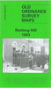
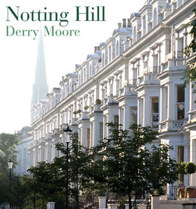
£10.99
This book contains further stories of members of the Drones Club & several adventures related by the Oldest Member of the golf club. Many old friends reappear
- Bingo Little & Mrs Bingo, Freddie Widgeon, Ambrose Gussett, Agnes Flack, Horace Bewstridge & many more. It
Includes:: ” The Shadow Passes”, ” Bramley is so Bracing”, ” Up From the Depths”, ” Feet of Clay”, ” Excelsior”, ” Rodney Has a Relapse”, ” Tangled Hearts”, ” Birth of a Salesman”, ” How`s That, Umpire?” & ” Success Story”.

...
Archived Product
£9.99
North Korea is Orwell`s 1984 made reality: it is the only country in the world not connected to the internet; Gone with the Wind is a dangerous, banned book; during political rallies, spies study your expression to check your sincerity. After the death of the country`s great leader Kim Il Sung in 1994, famine descended: people stumbled over dead bodies in the street & ate tree bark to survive. Nothing to Envy weaves together the stories of adversity & resilience of six residents of Chongin, North Korea`s third largest city. From extensive interviews & with tenacious investigative work, Barbara Demick has recreated the concerns, culture & lifestyles of North Korean citizens in a gripping narrative, & vividly reconstructed the inner workings of this extraordinary & secretive country. ...
Archived Product
£6.99
Nothing To See Here is a guide to the unusual places in Scotland overlooked by glossy brochures & coach parties. Step inside for illuminating writing & photographs of odd museums, quirky cafes, art-deco factories & Victorian public conveniences. Based on the website at `nothing to see here` which has been cataloguing unusual places to go worldwide since 2006, the book features material from its much loved country of origin. ...
Archived Product
£10.99
Notranjski Kras, Brkini, Dolenjska & Bela Krajina regions of southern Slovenia on a contoured & GPS compatible map at 1:75, 000 from the Ljubljana-based Kartografija. The map is double-sided &

Includes::
bilingual English/ Slovenian descriptions of the region’s best sights. Maps in this series from Kartografija, covering most of Slovenia at 50K or 75K, have contours at 20m intervals, enhanced by relief shading & plenty of spot heights, names of peaks, mountain chains, etc. Local hiking routes are highlighted & also marked are recommended cycling routes. Symbols indicate various types of accommodation including mountain huts, campsites, inns with lodgings, tourist farms or apartments, hotels & motels, as well as recreational facilities (golf, horse riding, swimming pools, etc), vineries, cultural & historical sites, etc. Road network shows locations of petrol stations. Railway lines are shown with stations & various types of mountain transport (gondolas, chair lifts, etc) are marked. The maps have a latitude & longitude grid at intervals of 2’30’’. The reverse side is covered by bilingual notes on the area’s places of interest. Map legend & all the text include English. To see other titles in this series please click on the series link.

...
Archived Product
£14.99
MONUmini is an iconic architectural model kit; a perfect memento or a fun gift for any design enthusiast. The kit

Includes::


...
Archived Product
£2.99
There are a multitude of ` London Calling` cards in the collection at Rocket 68. This lively illustrated range of London themed prints & cards aims to portray the vibrancy & beauty of London`s architecture, areas, life & communities. Each card is supplied with quality Gunpowder grey envelope in a cellophane wrapper. These cards are all illustrated by Jill White & printed in the UK on a lovely soft Calisto FSC accredited board. ...
Archived Product
£14.50
In the convenient A-Z format, the author, a Blue Badge Guide, describes this fascinating melting pot of London. Renowned for recreation, & fashion, this diverse area was the birthplace of Norland Nannies, the Left Book Club & Britain`s first purpose-built car factory. Home to Chesterton, Orwell, & Herbert Hoover, it also numbered amongst its residents China`s most renowned 20th-century writer. Notting Hill is synonymous with Carnival, & Holland Park with its genteel origins. ...
Archived Product
£3.50
Notting Hill in 1871 in a fascinating series of reproductions of old Ordnance Survey plans in the Alan Godfrey Editions, ideal for anyone interested in the history of their neighbourhood or family. Three versions of this map cover the area from White City eastward to Pembridge Square & St Stephen`s Square, & capture the part of Kensington known as Notting Hill. In the north-east is a portion of the Paddington parish, including Westbourne Park station; to the west is a part of Hammersmith parish, rural in the early map but later developed to include White City. The 1871 map (actually largely surveyed in 1863-5) shows the Ladbroke Estate already largely developed around Ladbroke Grove, Lansdowne Crescent, Ladbroke Square, Kensington Park Road & other well set out streets. The area was previously known as Notting Dale or ` The Kensington Potteries`. Further west development is less complete & beyond Latimer Road there are still farms. Several railways run through the map: the West London Junction Railway, the Hammersmith & City Railway, with Notting Hill station, & a small section of the GWR with Westbourne Grove station & engine sheds. At the north of the map is more countryside with Portobello Farm & Notting Barn. Extreme top right is Paddington Workhouse. About the Alan Godfrey Editions of the 25” OS Series: Selected towns in Great Britain & Ireland are covered by maps showing the extent of urban development in the last decades of the 19th & early 20th century. The plans have been taken from the Ordnance Survey mapping & reprinted at about 15 inches to one mile (1:4, 340). On the reverse most maps have historical notes & many also include extracts from contemporary directories. Most maps cover about one mile (1.6kms) north/south, one & a half miles (2.4kms) across; adjoining sheets can be combined to provide wider coverage.FOR MORE INFORMATION & A COMPLETE LIST OF ALL AVAILABLE TITLES PLEASE CLICK ON THE SERIES LINK. ...
Archived Product
£3.50
Notting Hill in 1893 in a fascinating series of reproductions of old Ordnance Survey plans in the Alan Godfrey Editions, ideal for anyone interested in the history of their neighbourhood or family. Three versions cover the area from White City eastward to Pembridge Square & St Stephen`s Square, & capture the part of Kensington known as Notting Hill. In the north-east is a portion of Paddington parish, including Westbourne Park station; to the west is a part of Hammersmith parish, rural in the early map but later developed to include White City. The 1893 map shows Notting Hill entirely built up, with streets & houses as far as Latimer Road, which now has a station. Features include Mary Place Workhouse, Phoenix Brewery, Avondale Park, Kensington Public Baths, St Charles RC College, Franciscan Convent, Carmelite Convent, St Quintin Park, St Quintin & Wormwood Scrubbs station. Beyond the West London Railway is an area of brickfields & (apparently) piggeries. On the reverse are street directories for Ladbroke Grove, Ladbroke Square & Lancaster Road. About the Alan Godfrey Editions of the 25” OS Series: Selected towns in Great Britain & Ireland are covered by maps showing the extent of urban development in the last decades of the 19th & early 20th century. The plans have been taken from the Ordnance Survey mapping & reprinted at about 15 inches to one mile (1:4, 340). On the reverse most maps have historical notes & many also include extracts from contemporary directories. Most maps cover about one mile (1.6kms) north/south, one & a half miles (2.4kms) across; adjoining sheets can be combined to provide wider coverage.FOR MORE INFORMATION & A COMPLETE LIST OF ALL AVAILABLE TITLES PLEASE CLICK ON THE SERIES LINK. ...
Archived Product
£2.95
Notting Hill in 1914 in a fascinating series of reproductions of old Ordnance Survey plans in the Alan Godfrey Editions, ideal for anyone interested in the history of their neighbourhood or family. Selected towns in Great Britain & Ireland are covered by maps showing the extent of urban development in the last decades of the 19th & early 20th century. In this title: three versions of this map have been published to show how the area developed across the years. The maps each cover the same area, from White City eastward to Pembridge Square & St Stephen's Square, & capture the area of Kensington known as Notting Hill. In the north-east is a portion of Paddington parish, including Westbourne Park station; to the west is a portion of Hammersmith parish, rural in the early map but later developed to include White City. The area developed considerably over the years. The 1871 map (actually largely surveyed in 1863-5) shows the Ladbroke Estate already largely developed around Ladbroke Grove, Lansdowne Crescent, Ladbroke Square, Kensington Park Road & other well set out streets. The area was previously known as Notting Dale or ' The Kensington Potteries'. Further west development is less complete & beyond Latimer Road there are still farms. Several railways run through the map: the West London Junction Railway, the Hammersmith & City Railway, with Notting Hill station, & a small section of the GWR with Westbourne Grove station & engine sheds. At the north of the map is more countryside with Portobello Farm & Notting Barn. Extreme top right is Paddington Workhouse. The 1893 map shows Notting Hill entirely built up, with streets & houses as far as Latimer Road, which now has a station. Features include Mary Place Workhouse, Phoenix Brewery, Avondale Park, Kensington Public Baths, St Charles RC College, Franciscan Convent, Carmelite Convent, St Quintin Park, St Quintin & Wormwood Scrubbs station. Beyond the West London Railway is an area of brickfields & (apparently) piggeries. On the reverse are street directories for Ladbroke Grove, Ladbroke Square & Lancaster Road. The 1914 map shows the area further developed, with tramways & Wood Lane station. The main new development in the south-western area of the map is the Olympic Stadium & the Great White City complex built for the Shepherds Bush Exhibition. Nearby is part of the Central London Railway Depot. About the Alan Godfrey Editions of the 25 ...
Archived Product

Notting Hill

This is the story of Notting Hill, from its beginning in the Ladbroke Estate to its current incarnation as one of the most cosmopolitan and fashionable London neighbourhoods. The spacious crescents, stuccoed houses and leafy communal gardens that give Notting Hill its charm were developed during the 19th century. This elegance existed cheek by jowl with the Potteries, one of London`s worst slums, where in the mid-19th century average life expectancy was 11 years and 7 months. After the First World War many buildings fell into disrepair, houses were converted into flats and bed-sits, and the area went into decline. During the 1950s there was an influx of immigrants from the Caribbean, who were exploited by unscrupulous landlords. The race riots of 1958 marked a low point for Notting
Hill. But the incomers inspired the Notting Hill Carnival, which has become a popular tourist attraction, as has the Portobello Road with its antiques and fruit and vegetable market, while the area has been regenerated by new wealth (not to mention a starring role in the film Notting Hill). All contribute to the cosmopolitan, fashionable area Notting Hill is today.
RIP - This product is no longer available on our network. It was last seen on 25.09.2019

This page now acts as a permanent archive for this product. Add more information using the comments box below to ensure it can still be found by future generations.

Use our search facility to see if it is available from an alternative contributor.
  • External links may include paid for promotion
  • Availability: Out Of Stock
  • Supplier: Stanfords
  • SKU: 9780711227392
Availability: In Stock
£14.99

Product Description

This is the story of Notting Hill, from its beginning in the Ladbroke Estate to its current incarnation as one of the most cosmopolitan & fashionable London neighbourhoods. The spacious crescents, stuccoed houses & leafy communal gardens that give Notting Hill its charm were developed during the 19th century. This elegance existed cheek by jowl with the Potteries, one of London`s worst slums, where in the mid-19th century average life expectancy was 11 years & 7 months. After the First World War many buildings fell into disrepair, houses were converted into flats & bed-sits, & the area went into decline. During the 1950s there was an influx of immigrants from the Caribbean, who were exploited by unscrupulous landlords. The race riots of 1958 marked a low point for Notting Hill. But the incomers inspired the Notting Hill Carnival, which has become a popular tourist attraction, as has the Portobello Road with its antiques & fruit & vegetable market, while the area has been regenerated by new wealth (not to mention a starring role in the film Notting Hill). All contribute to the cosmopolitan, fashionable area Notting Hill is today.

Reviews/Comments

Add New

Intelligent Comparison

Oooops!
We couldn't find anything!
Perhaps this product's unique.... Or perhaps we are still looking for comparisons!
Click to bump this page and we'll hurry up.

Price History

Vouchers

No voucher codes found.
Do you know a voucher code for this product or supplier? Add it to Insights for others to use.

Facebook

Jargon Buster

Vegetable - An edible plant
World - A physical grouping, commonly used to describe earth and everything associated with ti
Road - a manmade lane or a path that is used to speed up travel.
Caribbean - An area of islands within the Caribbean sea.
Popular - Something that is admired and liked by many people.
Estate - A group of houses on the same land or area.

Supplier Information

Stanfords
Stanfords was established in 1853 and opened their iconic Covent Garden flagship store in 1901. They have become the top retailer of maps, travel books and accessories in the UK and arguably offer the largest selection of maps and travel books worldwide. Famous names such as Captain Robert Falcon Scott, Ranulph Fiennes and Michael Palin have purchased from Stanfords. They now have a shop in Bristol and both stores together with other venues operate a calendar of events including talks, book signings and exhibitions. As a specialist map retailer, the map selection is comprehensive and includes road maps, street maps and walking maps from worldwide destinations, as well as a selection of world atlases and wall maps. Books include travel guides and travel literature. Stanfords also stock globes, from miniatures made of blue marble to magnificent floor-standing globes. The website features a selection of interesting articles on travel topics.
Page Updated: 2023-11-12 20:15:36

Community Generated Product Tags

Oh No! The productWIKI community hasn't generated any tags for this product yet!
Menu