
 United Kingdom
 France
 Germany
 Netherlands
 Sweden
 USA
USA
 Italy
Italy
 Spain
Spain
More From Contributor


Maidstone South 1868
Maidstone South in 1868 in a fascinating series of reproductions of old Ordnance Survey plans in the Alan Godfrey Editions, ideal for anyone interested in the history of their neighbourhood or family. The map covers the area to the south from King Street and High Street to a milestone marking One Mile from town. Tovil is in the south-western corner, including St Peter`s church, and corn, paper and oil mills. Principal features in Maidstone include All Saints church, Stone Street, Wrens Cross, King Street, Ashford Road, Knightrider Street and Kingsley Estate. West of the Medway are Tunbridge Road, part of The Fant, and the North Kent (SER) Railway with station. The map includes the rest of the commercial directory, K to Z (continued from the Maidstone map).About the Alan Godfrey
Editions of the 25” OS SeriesSelected towns in Great Britain and Ireland are covered by maps showing the extent of urban development in the last decades of the 19th and early 20th century. The plans have been taken from the Ordnance Survey mapping and reprinted at about 15 inches to one mile (1:4, 340). On the reverse most maps have historical notes and many also include extracts from contemporary directories. Most maps cover about one mile (1.6kms) north/south, one and a half miles (2.4kms) across; adjoining sheets can be combined to provide wider coverage.FOR MORE INFORMATION AND A COMPLETE LIST OF ALL AVAILABLE TITLES PLEASE CLICK ON THE SERIES LINK.
Editions of the 25” OS SeriesSelected towns in Great Britain and Ireland are covered by maps showing the extent of urban development in the last decades of the 19th and early 20th century. The plans have been taken from the Ordnance Survey mapping and reprinted at about 15 inches to one mile (1:4, 340). On the reverse most maps have historical notes and many also include extracts from contemporary directories. Most maps cover about one mile (1.6kms) north/south, one and a half miles (2.4kms) across; adjoining sheets can be combined to provide wider coverage.FOR MORE INFORMATION AND A COMPLETE LIST OF ALL AVAILABLE TITLES PLEASE CLICK ON THE SERIES LINK.

Product Description
Reviews/Comments
Add New
Intelligent Comparison
Archived Product

Maidstone North 1866 Stanfords
£3.50
Archived Product
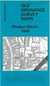
Windsor South 1868 Stanfords
£3.50
Archived Product

Margate South 1896 Stanfords
£3.50
Archived Product

Darlington South 1898 Stanfords
£3.50
Archived Product

Milton North 1898 Stanfords
£3.50
Vouchers
No voucher codes found.
Do you know a voucher code for this product or supplier? Add it to Insights for others to use.
Do you know a voucher code for this product or supplier? Add it to Insights for others to use.
 Denmark