
 United Kingdom
 France
 Germany
 Netherlands
 Sweden
 USA
USA
 Italy
Italy
 Spain
Spain
More From Contributor


Margate South 1896
Margate South in 1896 in a fascinating series of reproductions of old Ordnance Survey plans in the Alan Godfrey Editions, ideal for anyone interested in the history of their neighbourhood or family. The map covers the southern part of Margate, stretching from Marine Terrace eastward to Northdown Avenue and from Union Crescent southward to Drapers` Farm. Features include SER Margate Branch with terminus, stretch of LC&D railway (but station cut off by margin), Tivoli Gardens, Shottendane House, Drapers Almshouses, Deaf & Dumb Asylum, St John the Baptish church, The Brooks, East Margate area, much of Cecil Ward, Hawley Square, Hall by the Sea, Royal Assembly Rooms etc. On the reverse is a list of private residents, entries J to Z. About the Alan Godfrey Editions of the 25”
OS SeriesSelected towns in Great Britain and Ireland are covered by maps showing the extent of urban development in the last decades of the 19th and early 20th century. The plans have been taken from the Ordnance Survey mapping and reprinted at about 15 inches to one mile (1:4, 340). On the reverse most maps have historical notes and many also include extracts from contemporary directories. Most maps cover about one mile (1.6kms) north/south, one and a half miles (2.4kms) across; adjoining sheets can be combined to provide wider coverage.FOR MORE INFORMATION AND A COMPLETE LIST OF ALL AVAILABLE TITLES PLEASE CLICK ON THE SERIES LINK.
OS SeriesSelected towns in Great Britain and Ireland are covered by maps showing the extent of urban development in the last decades of the 19th and early 20th century. The plans have been taken from the Ordnance Survey mapping and reprinted at about 15 inches to one mile (1:4, 340). On the reverse most maps have historical notes and many also include extracts from contemporary directories. Most maps cover about one mile (1.6kms) north/south, one and a half miles (2.4kms) across; adjoining sheets can be combined to provide wider coverage.FOR MORE INFORMATION AND A COMPLETE LIST OF ALL AVAILABLE TITLES PLEASE CLICK ON THE SERIES LINK.

Product Description
Reviews/Comments
Add New
Intelligent Comparison
Archived Product

Margate North 1896 Stanfords
£3.50
Archived Product

Maidstone South 1868 Stanfords
£3.50
Archived Product
Maghull South 1906 Stanfords
£2.95
Archived Product
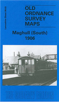
Maghull South 1906 Stanfords
£3.50
Archived Product

Darlington South 1898 Stanfords
£3.50
Archived Product

Oakengates South 1901 Stanfords
£3.50
Archived Product

Carshalton South 1895 Stanfords
£3.50
Archived Product
Grangemouth 1896 Stanfords
£2.95
Vouchers
No voucher codes found.
Do you know a voucher code for this product or supplier? Add it to Insights for others to use.
Do you know a voucher code for this product or supplier? Add it to Insights for others to use.
 Denmark