
 United Kingdom
 France
 Germany
 Netherlands
 Sweden
 USA
USA
 Italy
Italy
 Spain
Spain
More From Contributor


Maidstone North 1866
Maidstone North in 1866 in a fascinating series of reproductions of old Ordnance Survey plans in the Alan Godfrey Editions, ideal for anyone interested in the history of their neighbourhood or family. The map covers the area from Summerfield Terrace eastward to Gallows Wood and Huntsman Farm, and from Earl Street and Holy Trinity church northward to Medway Paper Mill and Thornhills. The County Gaol is a major feature by default, for it is left blank for security reasons. Depicted features include Perseverance Foundry, Sittingbourne Road, Union Street, Brewer Street, St Faith`s Street, Sandling Road, a stretch of the Medway, Perry Fields, numerous quarries and brickfields, Cavalry Barracks, Springfield Mills, Heathfield House. A stretch of the North Kent Railway is shown, but
the Sevenoaks & Maidstone Railway is `under construction`. On the reverse is a commercial directory A to K (continued on the Maidstone South map).About the Alan Godfrey Editions of the 25” OS SeriesSelected towns in Great Britain and Ireland are covered by maps showing the extent of urban development in the last decades of the 19th and early 20th century. The plans have been taken from the Ordnance Survey mapping and reprinted at about 15 inches to one mile (1:4, 340). On the reverse most maps have historical notes and many also include extracts from contemporary directories. Most maps cover about one mile (1.6kms) north/south, one and a half miles (2.4kms) across; adjoining sheets can be combined to provide wider coverage.FOR MORE INFORMATION AND A COMPLETE LIST OF ALL AVAILABLE TITLES
PLEASE CLICK ON THE SERIES LINK.

Product Description
Reviews/Comments
Add New
Intelligent Comparison
Archived Product

Maidstone South 1868 Stanfords
£3.50
Archived Product

Milton North 1898 Stanfords
£3.50
Archived Product

Margate North 1896 Stanfords
£3.50
Archived Product
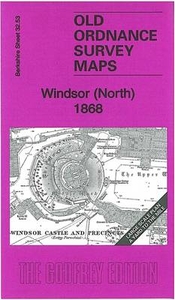
Windsor North 1868 Stanfords
£3.50
Archived Product

Darlington North 1896 Stanfords
£3.50
Vouchers
No voucher codes found.
Do you know a voucher code for this product or supplier? Add it to Insights for others to use.
Do you know a voucher code for this product or supplier? Add it to Insights for others to use.
 Denmark