
 United Kingdom
 France
 Germany
 Netherlands
 Sweden
 USA
USA
 Italy
Italy
 Spain
Spain
More From Contributor

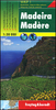
Madeira Flexi Map
Madeira on a laminated, tear-resistant Insight Flexi Map, with a street plans of Funchal plus an enlargement of its central area, all indexed, maps of Porto Santo and Ilhas Desertas, plus extensive tourist information.On one side is a map of Madeira at 1:85, 000. Topography is indicated by relief shading and names and/or heights of numerous peaks, as well as the network of the levadas. Protected areas are marked. The map shows the road network, including selected local tracks, with driving distances on main routes. Interesting locations and various sights are highlighted. The map has no geographical coordinates and is indexed for places and points of interest.On the reverse a two street plans of Funchal: the city with the holiday complex west of its centre at 1:15, 000, plus and
enlargement showing its central area at 1:7, 500. Both plans highlight public buildings, selected hotels and places of interest, and are indexed for streets, parks, hotels, public buildings and points of interest. Also included are maps at 1:85, 000 of the nearby Porto Santo and Islas Desertas.A special feature of the Insight Flexi series are panels with additional tourist information: 24 main sights, neatly grouped into sections covering In and Around Funchal, Natural Wonders, Shopping and Nightlife, plus Other Attractions, are given brief descriptions and are prominently highlighted on the relevant maps. Further panels provide information on Getting Around and Facts for Visitors, including tourist information offices, public holidays, opening times, money,
telecommunication and monthly climate charts.
Product Description
Reviews/Comments
Add New
Intelligent Comparison
Archived Product
Macau Flexi Map Stanfords
£4.99
Archived Product
Mallorca Flexi Map Stanfords
£4.99
Archived Product
Valencia Flexi Map Stanfords
£4.99
Archived Product
Warsaw Flexi Map Stanfords
£4.99
Archived Product
Taipei Flexi Map Stanfords
£4.99
Archived Product
Marrakesh Flexi Map Stanfords
£4.99
Archived Product
California Flexi Map Stanfords
£4.99
Archived Product
Perth Flexi Map Stanfords
£4.99
Vouchers
No voucher codes found.
Do you know a voucher code for this product or supplier? Add it to Insights for others to use.
Do you know a voucher code for this product or supplier? Add it to Insights for others to use.
 Denmark