
 United Kingdom
 France
 Germany
 Netherlands
 Sweden
 USA
USA
 Italy
Italy
 Spain
Spain
More From Contributor


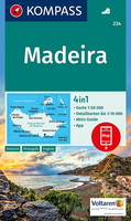
Madeira Kompass 234
Madeira on a detailed, contoured, GPS compatible map at 1;50, 000 from Kompass highlighting hiking routes, graded according to the degree of difficulty, and other places of interest, with a street plan of central Funchal.The map has contours at 50m intervals, enhanced by shading and graphic relief, with colouring for woodlands and vineyards, plus plenty of names of peaks and other geographical features. National parks and/or protected areas are indicated and the network of the levadas is also shown. Road network includes cart tracks and local paths, indicates restricted entry routes, and shows locations of bus stops and car parks. The map also shows cable railways. Waymarked hiking paths are highlighted, showing steep or strenuous trails. Symbols show various facilities and
places of interest, including campsites and selected hotels, beaches, sport and recreational facilities, etc. The map has a 2km UTM grid. *Map legend includes English.*The map includes a street plan of central Funchal which highlights the town’s main sites, car parks and selected accommodation. Also included are insets with Porto Santo and Ilhas Desertas at 1:75, 000. PLEASE NOTE: the map comes with a separate booklet with descriptions of various sites and other tourist information. The booklet, available in German only, is not necessary to use the map which, as described above, has English language map legend.
places of interest, including campsites and selected hotels, beaches, sport and recreational facilities, etc. The map has a 2km UTM grid. *Map legend includes English.*The map includes a street plan of central Funchal which highlights the town’s main sites, car parks and selected accommodation. Also included are insets with Porto Santo and Ilhas Desertas at 1:75, 000. PLEASE NOTE: the map comes with a separate booklet with descriptions of various sites and other tourist information. The booklet, available in German only, is not necessary to use the map which, as described above, has English language map legend.

Product Description
Reviews/Comments
Add New
Vouchers
No voucher codes found.
Do you know a voucher code for this product or supplier? Add it to Insights for others to use.
Do you know a voucher code for this product or supplier? Add it to Insights for others to use.
 Denmark