
 United Kingdom
 France
 Germany
 Netherlands
 Sweden
 USA
USA
 Italy
Italy
 Spain
Spain
More From Contributor

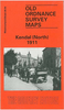


Kendall South 1911
South Kendall in 1911 in a fascinating series of reproductions of old Ordnance Survey plans in the Alan Godfrey Editions, ideal for anyone interested in the history of their neighbourhood or family. Selected towns in Great Britain and Ireland are covered by maps showing the extent of urban development in the last decades of the 19th and early 20th century.In this title: this detailed map covers the centre of Kendal, stretching from Sandes Avenue southward to Romney Road, and from Ghyll Brow eastward to Castle Street. Features include town centre with individual buildings neatly shown, Kendal Castle, Boot Factory, Stricklandgate and High Street area in detail, County Hospital, River Kent, Castle Mills, Abbot Hall, Sanatorium, Cemetery, Holy Trinity church, Serpentine Walks,
Dalton House, Goose Holme, Maude's Meadow, mills, Nether Bridge, Mill Bridge, Stramongate Bridge, Grammar School, The Lound, Gillingrove Brewery etc. A list of private residents from a contemporary directory is on the reverse. About the Alan Godfrey Editions of the 25
Dalton House, Goose Holme, Maude's Meadow, mills, Nether Bridge, Mill Bridge, Stramongate Bridge, Grammar School, The Lound, Gillingrove Brewery etc. A list of private residents from a contemporary directory is on the reverse. About the Alan Godfrey Editions of the 25
Product Description
Reviews/Comments
Add New
Vouchers
No voucher codes found.
Do you know a voucher code for this product or supplier? Add it to Insights for others to use.
Do you know a voucher code for this product or supplier? Add it to Insights for others to use.
 Denmark