More From Contributor

£2.95
North Kendall in 1911 in a fascinating series of reproductions of old Ordnance Survey plans in the Alan Godfrey Editions, ideal for anyone interested in the history of their neighbourhood or family. Selected towns in Great Britain & Ireland are covered by maps showing the extent of urban development in the last decades of the 19th & early 20th century. In this title: this detailed map covers the northern part of Kendal, stretching from the railway station northward to Mint Bridge & Middle Sparrowmire, & from Hallgarth eastward to Spital & Fowl Ing. Features include railway with station, goods station, Ale Stores, Auction Mart, Kendal Green, St Thomas church, Dockray Hall Mill, Mintsfeet, Sunny Brow, Workhouse, Airethwaite, Sparrowmire, Kentrigg, etc. About the Alan Godfrey Editions of the 25 ...
Archived Product
£2.95
South Kendall in 1911 in a fascinating series of reproductions of old Ordnance Survey plans in the Alan Godfrey Editions, ideal for anyone interested in the history of their neighbourhood or family. Selected towns in Great Britain & Ireland are covered by maps showing the extent of urban development in the last decades of the 19th & early 20th century. In this title: this detailed map covers the centre of Kendal, stretching from Sandes Avenue southward to Romney Road, & from Ghyll Brow eastward to Castle Street. Features include town centre with individual buildings neatly shown, Kendal Castle, Boot Factory, Stricklandgate & High Street area in detail, County Hospital, River Kent, Castle Mills, Abbot Hall, Sanatorium, Cemetery, Holy Trinity church, Serpentine Walks, Dalton House, Goose Holme, Maude's Meadow, mills, Nether Bridge, Mill Bridge, Stramongate Bridge, Grammar School, The Lound, Gillingrove Brewery etc. A list of private residents from a contemporary directory is on the reverse. About the Alan Godfrey Editions of the 25 ...
Archived Product
£29.99
Map No. 2920, Kenhardt, in South Africa’s official topographic survey at 1:250, 000 from the country’s national survey organization, the Chief Directorate of Surveys & Mapping. The maps have altitude colouring & contours at 50m or 100m intervals, depending on the map edition, plus spot heights. Deserts, marshes, dry pans, perennial & seasonal water features, etc, as well as protected areas are shown. The maps present the country’s road & rail networks & include the usual information expected on topographic mapping at this scale, although in more rapidly developing areas road information may not necessarily be up to date. Also indicated are magisterial district & provincial boundaries. Latitude & longitude values are shown in the margins at 5` intervals together with South African grid co-ordinates. Typically, each sheet covers an area of one degree of latitude & two degrees of longitude. The projection used is Gauss Conformal. The legend is in English & Afrikaans. ...
Archived Product
£11.95
Kennet & Avon Canal & River Thames Pearson`s Canal Companion from Wayzgoose, linking London with Oxford & Bristol & showing parts of the Thames, the Avon, the Kennet & the Kennet & Avon Canal. Pearson’s Canal Companions have for over 30 year now been presenting Britain’s network of inland waterways on handy size, informative guides which combine practical information with interesting descriptions & facts about the surrounding countryside. The routes are shown in sections on maps at approx. 2” to 1 mile, & are annotated with locks, towpaths & nearby facilities. Rather than providing a more technical picture of each waterway (depth, clearance, etc), these guides are indeed true “companions” with the accompanying descriptions full of interesting historical or literary references, little know facts, etc. Where appropriate the maps are also accompanied by recommendations for eating & drinking, shopping, things to do, & public transport connections. Each guide also

Includes::
a boating directory with hire bases, boatyards, ferries, etc. Please note: Pearson’s Canal Companions sometimes indicate facilities and/or places of interest without showing detailed road access to them; it’s perhaps advisable to use these charming companions with proper road maps of the surrounding countryside.

...
Archived Product
£5.99
A tourist map of the Kennet & Avon Canal & River Avon at 1:50, 000, running from Bristol in the west to Reading & the junction with the River Thames in the east. There are detailed town plans at 1:12, 500 for Bristol, Bath, Bradford-on-Avon, Devizes, Newbury, Hungerford & the centre of Reading. Suitable for both waterways & leisure users. The Kennet & Avon Canal is the most southerly broad beam canal in Engl&. With a rich industrial hertiage, spectacular scenery, & abundance of wildlife it is a great way to explore a relatively unspoilt corridor of southern Engl&. So whether by boat, bike or on foot it`s well worth a visit. This map gives detailed coverage of the Kennet & Avon Canal with emphasis on the waterways & information useful & relevant to users of the waterways without neglecting other leisure users. The map detail is complimented by information panels & photographs. The map

Includes::
navigation & historical information, visitor moorings, marinas & boatyards, boat hire centres, facilities for the boat user, shops & distance markers. The National Cycle Route 4 & crossing routes are also shown between Reading & Bristol. Information for visitors

Includes::
tourist information centres, places of interest, pubs, nature reserves, parks, churches, long distance footpaths, public toilets & caravan & camp sites. To see the list of other titles in this series please, click on the series link.


...
Archived Product
£3.50
Kennington & Walworth in 1871 in a fascinating series of reproductions of old Ordnance Survey plans in the Alan Godfrey Editions, ideal for anyone interested in the history of their neighbourhood or family. Three versions for this area have been published to show how it developed across the years, stretching from the east side of Vauxhall Bridge eastward to Walworth Road & a little beyond, & from the south end of Elephant & Castle station southward to Cranmer Road & Addington Square. Walworth Road & Kennington Park Road run north-south through the map, whose many features include the Oval cricket ground, Vauxhall & Walworth Road stations, tramways, Kennington Park, Vauxhall Park, London Pottery, Lambeth Pottery, the end of the Surrey Canal, Surrey Gardens, Lambeth Workhouse & many churches. The 1871 map has street directories for Kennington Oval, Princes Road, Upper Kennington Lane & Walworth Road, & the other maps have further extracts. About the Alan Godfrey Editions of the 25” OS Series: Selected towns in Great Britain & Ireland are covered by maps showing the extent of urban development in the last decades of the 19th & early 20th century. The plans have been taken from the Ordnance Survey mapping & reprinted at about 15 inches to one mile (1:4, 340). On the reverse most maps have historical notes & many also include extracts from contemporary directories. Most maps cover about one mile (1.6kms) north/south, one & a half miles (2.4kms) across; adjoining sheets can be combined to provide wider coverage.FOR MORE INFORMATION & A COMPLETE LIST OF ALL AVAILABLE TITLES PLEASE CLICK ON THE SERIES LINK. ...
Archived Product
£3.50
Kennington & Walworth in 1894 in a fascinating series of reproductions of old Ordnance Survey plans in the Alan Godfrey Editions, ideal for anyone interested in the history of their neighbourhood or family. Three versions for this area have been published to show how it developed across the years, stretching from the east side of Vauxhall Bridge eastward to Walworth Road & a little beyond, & from the south end of Elephant & Castle station southward to Cranmer Road & Addington Square. Walworth Road & Kennington Park Road run north-south through the map, whose many features include the Oval cricket ground, Vauxhall & Walworth Road stations, tramways, Kennington Park, Vauxhall Park, London Pottery, Lambeth Pottery, the end of the Surrey Canal, Surrey Gardens, Lambeth Workhouse & many churches. Each map has directory extracts. About the Alan Godfrey Editions of the 25” OS Series: Selected towns in Great Britain & Ireland are covered by maps showing the extent of urban development in the last decades of the 19th & early 20th century. The plans have been taken from the Ordnance Survey mapping & reprinted at about 15 inches to one mile (1:4, 340). On the reverse most maps have historical notes & many also include extracts from contemporary directories. Most maps cover about one mile (1.6kms) north/south, one & a half miles (2.4kms) across; adjoining sheets can be combined to provide wider coverage.FOR MORE INFORMATION & A COMPLETE LIST OF ALL AVAILABLE TITLES PLEASE CLICK ON THE SERIES LINK. ...
Archived Product
£3.50
Kennington & Walworth in 1914 in a fascinating series of reproductions of old Ordnance Survey plans in the Alan Godfrey Editions, ideal for anyone interested in the history of their neighbourhood or family. Three versions for this area have been published to show how it developed across the years, stretching from the east side of Vauxhall Bridge eastward to Walworth Road & a little beyond, & from the south end of Elephant & Castle station southward to Cranmer Road & Addington Square. Walworth Road & Kennington Park Road run north-south through the map, whose many features include the Oval cricket ground, Vauxhall & Walworth Road stations, tramways, Kennington Park, Vauxhall Park, London Pottery, Lambeth Pottery, the end of the Surrey Canal, Surrey Gardens, Lambeth Workhouse & many churches. Each map has directory extracts. About the Alan Godfrey Editions of the 25” OS Series: Selected towns in Great Britain & Ireland are covered by maps showing the extent of urban development in the last decades of the 19th & early 20th century. The plans have been taken from the Ordnance Survey mapping & reprinted at about 15 inches to one mile (1:4, 340). On the reverse most maps have historical notes & many also include extracts from contemporary directories. Most maps cover about one mile (1.6kms) north/south, one & a half miles (2.4kms) across; adjoining sheets can be combined to provide wider coverage.FOR MORE INFORMATION & A COMPLETE LIST OF ALL AVAILABLE TITLES PLEASE CLICK ON THE SERIES LINK. ...
Archived Product
£34.95
Conceived as a retrospective, this book illustrates Kenro Izus refined artistic research & the work that for over thirty years he has been carrying out, like a tireless pilgrim, in the worlds most evocative holy sites: from the Egyptian pyramids & the ancient stones of Stonehenge to the site of Angkor Wat in Cambodia, from Buddhist temples in India & Indonesia to the Syrian desert & Tibetan peaks. Fascinated by the sublime beauty of ancient remains, he returns to the styles & printing techniques of 19th-century photography as best able to capture the mystical atmosphere of the places examined. ...
Archived Product
£3.50
Kensal Green in 1935 in a fascinating series of reproductions of old Ordnance Survey plans in the Alan Godfrey Editions, ideal for anyone interested in the history of their neighbourhood or family. Four versions of this map have been published, with Kensal Green on the west side of the map, west Kilburn to the east, & Kensal New Town near the foot of the map. Stretches of the Hampstead Junction, LNWR & GWR railway lines & the Grand Junction Canal run through the map. On the 1865 version there is little development apart from Kensal New Town, buildings along Kensal Road, part of Westbourne Green in the extreme Ssouth-eastern corner, & early west Kilburn streets around Canterbury Road. Near the centre of the map is Chamberlain Wood Farm. Each map shows All Souls (or Kensal Green) Cemetery. The later maps are much more built up, with solid streets of housing between Kensal New Town & the LNWR railway, including Harrow Road, Kilburn Lane, Shirland Road & many more. Other features include gasworks, carriage sheds, Queen`s Park, Queen`s Park station. On the 1913 map Kensal Rise, north of the LNWR is also built up. The 1935 map

Includes::
the car factory for Talbot cars. The three later maps include extracts from street directories. The 1865 map

Includes::
a description of the cemetery from Walford`s Old & New London. About the Alan Godfrey Editions of the 25” OS Series: Selected towns in Great Britain & Ireland are covered by maps showing the extent of urban development in the last decades of the 19th & early 20th century. The plans have been taken from the Ordnance Survey mapping & reprinted at about 15 inches to one mile (1:4, 340). On the reverse most maps have historical notes & many also include extracts from contemporary directories. Most maps cover about one mile (1.6kms) north/south, one & a half miles (2.4kms) across; adjoining sheets can be combined to provide wider coverage.FOR MORE INFORMATION & A COMPLETE LIST OF ALL AVAILABLE TITLES PLEASE CLICK ON THE SERIES LINK.


...
Archived Product

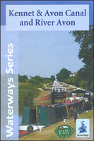
Kennet And Avon Canal And River Avon

Kennet and Avon Canal and River Avon double sided map at 1:50, 000 by Heron Maps offers both navigation and tourist information and includes many small detailed town plans at 1:12, 500.The map divides the canal in three sections and illustrates its corridor and its proximities. Colouring distinguishes urban, woodland and areas of outstanding beauty. Motorways A and B roads, railways lines and stations are marked as well as paths, tracks and National Cycle Routes. In particular, the map shows the National Cycle Route 4 and crossings routes between Reading and Bristol.Waterway information includes marinas and boatyards, towpath, distance indicator at 1 mile apart, winding areas, locks etc.Navigation information includes visitor moorings, boat hire centres, facilities for the boat
user, rowing, sailing and boat clubs, etc. Additionally, local navigation advice and warnings feature along the canal.Tourist information includes information centres, shops, places of interest, pubs, nature reserves, parks, churches, national cycle routes, long distance paths, public toilets, youth hostels, caravan and camp sites etc.One side of the map features the first (and navigable) section of the river Avon from Bristol to Melksham and the Kennet and Avon canal from Bath to Horton Bridge. It also includes small town plans inserts of Bristol, Bath, Bradford-on-Avon, Devizes and an interesting introduction to the history and facts of the canal.The reverse features the remaining two sections of the canal from Horton Bridge to Reading and town plans of, Hungerford,
and Reading.Both sides of the map are annotated with historical and tourist information of places of interest and illustrated with colour pictures.
RIP - This product is no longer available on our network. It was last seen on 25.09.2019

This page now acts as a permanent archive for this product. Add more information using the comments box below to ensure it can still be found by future generations.

Use our search facility to see if it is available from an alternative contributor.
  • Availability: Out Of Stock
  • Supplier: Stanfords
  • SKU: 9780956518323
Availability: In Stock
£5.99

Product Description

Kennet & Avon Canal & River Avon double sided map at 1:50, 000 by Heron Maps offers both navigation & tourist information &

Includes::
many small detailed town plans at 1:12, 500. The map divides the canal in three sections & illustrates its corridor & its proximities. Colouring distinguishes urban, woodland & areas of outstanding beauty. Motorways A & B roads, railways lines & stations are marked as well as paths, tracks & National Cycle Routes. In particular, the map shows the National Cycle Route 4 & crossings routes between Reading & Bristol. Waterway information

Includes::
marinas & boatyards, towpath, distance indicator at 1 mile apart, winding areas, locks etc. Navigation information

Includes::
visitor moorings, boat hire centres, facilities for the boat user, rowing, sailing & boat clubs, etc. in addition, local navigation advice & warnings feature along the canal. Tourist information

Includes::
information centres, shops, places of interest, pubs, nature reserves, parks, churches, national cycle routes, long distance paths, public toilets, youth hostels, caravan & camp sites etc. One side of the map features the first (and navigable) section of the river Avon from Bristol to Melksham & the Kennet & Avon canal from Bath to Horton Bridge. It also

Includes::
small town plans inserts of Bristol, Bath, Bradford-on-Avon, Devizes & an interesting introduction to the history & facts of the canal. The reverse features the remaining two sections of the canal from Horton Bridge to Reading & town plans of, Hungerford, & Reading. Both sides of the map are annotated with historical & tourist information of places of interest & illustrated with colour pictures.

Reviews/Comments

Add New

Price History

Vouchers

No voucher codes found.
Do you know a voucher code for this product or supplier? Add it to Insights for others to use.

Facebook

Jargon Buster

History - Anything that happens in the past. An acedemic subject.
Railways - A set of tracks that have been laid for the purpose of trains to travel up and down them
Colour - The categorised spectrum of light visable to humans
Small - something that takes up less space than normal.
Feature - An attribute that makes something stand out.

Supplier Information

Stanfords
Stanfords was established in 1853 and opened their iconic Covent Garden flagship store in 1901. They have become the top retailer of maps, travel books and accessories in the UK and arguably offer the largest selection of maps and travel books worldwide. Famous names such as Captain Robert Falcon Scott, Ranulph Fiennes and Michael Palin have purchased from Stanfords. They now have a shop in Bristol and both stores together with other venues operate a calendar of events including talks, book signings and exhibitions. As a specialist map retailer, the map selection is comprehensive and includes road maps, street maps and walking maps from worldwide destinations, as well as a selection of world atlases and wall maps. Books include travel guides and travel literature. Stanfords also stock globes, from miniatures made of blue marble to magnificent floor-standing globes. The website features a selection of interesting articles on travel topics.
Page Updated: 2023-11-12 20:15:36

Community Generated Product Tags

Oh No! The productWIKI community hasn't generated any tags for this product yet!
Menu