
 United Kingdom
 France
 Germany
 Netherlands
 Sweden
 USA
USA
 Italy
Italy
 Spain
Spain
More From Contributor


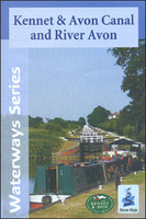
Kennet And Avon Canal & River Avon Heron Map
A tourist map of the Kennet & Avon Canal and River Avon at 1:50, 000, running from Bristol in the west to Reading and the junction with the River Thames in the east. There are detailed town plans at 1:12, 500 for Bristol, Bath, Bradford-on-Avon, Devizes, Newbury, Hungerford and the centre of Reading. Suitable for both waterways and leisure users.The Kennet and Avon Canal is the most southerly broad beam canal in England. With a rich industrial hertiage, spectacular scenery, and abundance of wildlife it is a great way to explore a relatively unspoilt corridor of southern England. So whether by boat, bike or on foot it`s well worth a visit.This map gives detailed coverage of the Kennet and Avon Canal with emphasis on the waterways and information useful and relevant to users of the
waterways without neglecting other leisure users. The map detail is complimented by information panels and photographs.The map includes navigation and historical information, visitor moorings, marinas and boatyards, boat hire centres, facilities for the boat user, shops and distance markers. The National Cycle Route 4 and crossing routes are also shown between Reading and Bristol. Information for visitors includes tourist information centres, places of interest, pubs, nature reserves, parks, churches, long distance footpaths, public toilets and caravan and camp sites. To see the list of other titles in this series please, click on the series link.
waterways without neglecting other leisure users. The map detail is complimented by information panels and photographs.The map includes navigation and historical information, visitor moorings, marinas and boatyards, boat hire centres, facilities for the boat user, shops and distance markers. The National Cycle Route 4 and crossing routes are also shown between Reading and Bristol. Information for visitors includes tourist information centres, places of interest, pubs, nature reserves, parks, churches, long distance footpaths, public toilets and caravan and camp sites. To see the list of other titles in this series please, click on the series link.

Product Description
Reviews/Comments
Add New
Vouchers
No voucher codes found.
Do you know a voucher code for this product or supplier? Add it to Insights for others to use.
Do you know a voucher code for this product or supplier? Add it to Insights for others to use.
 Denmark