
 United Kingdom
 France
 Germany
 Netherlands
 Sweden
 USA
USA
 Italy
Italy
 Spain
Spain
More From Contributor

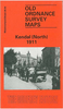
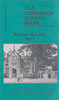

Kendall North 1911
North Kendall in 1911 in a fascinating series of reproductions of old Ordnance Survey plans in the Alan Godfrey Editions, ideal for anyone interested in the history of their neighbourhood or family. Selected towns in Great Britain and Ireland are covered by maps showing the extent of urban development in the last decades of the 19th and early 20th century.In this title: this detailed map covers the northern part of Kendal, stretching from the railway station northward to Mint Bridge and Middle Sparrowmire, and from Hallgarth eastward to Spital and Fowl Ing. Features include railway with station, goods station, Ale Stores, Auction Mart, Kendal Green, St Thomas church, Dockray Hall Mill, Mintsfeet, Sunny Brow, Workhouse, Airethwaite, Sparrowmire, Kentrigg, etc.About the Alan
Godfrey Editions of the 25
Godfrey Editions of the 25
Product Description
Reviews/Comments
Add New
Vouchers
No voucher codes found.
Do you know a voucher code for this product or supplier? Add it to Insights for others to use.
Do you know a voucher code for this product or supplier? Add it to Insights for others to use.
 Denmark