
 United Kingdom
 France
 Germany
 Netherlands
 Sweden
 USA
USA
 Italy
Italy
 Spain
Spain
More From Contributor
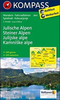

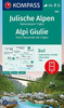
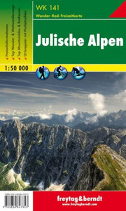
Julian Alps Freytag & Berndt Map
Hiking map of the Julian Alps with very clear cartography from Geodetski Zavod Slovenije. Contour interval is 20m, with additional hill-shading and graphic relief detail. An overprint highlights hiking paths, indicating poorly marked and difficult routes, also campsites and mountain refuges. Other details include: local bus stops, railways, chirlifts, skilifts, car parks, national parks, airfields, churches, castles and ruins. Margin ticks indicate latitude and longitude in steps of 5`. Map legend includes English. An accompanying booklet, in German only, includes descriptions of recommended hiking routes and places of interest.

Product Description
Reviews/Comments
Add New
Intelligent Comparison
Archived Product
Milan Freytag & Berndt Map Stanfords
£9.99
Archived Product
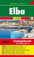
Elba Freytag & Berndt Map Stanfords
£4.99
Archived Product
Linz Freytag & Berndt Map Stanfords
£9.99
Archived Product
Mariazell Freytag & Berndt Map Stanfords
£4.50
Archived Product
Graz Freytag & Berndt Map Stanfords
£9.99
Archived Product
Cologne Freytag & Berndt Map Stanfords
£9.99
Archived Product
Villach Freytag & Berndt Map Stanfords
£9.99
Archived Product
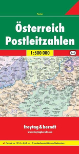
Austria Postcode Freytag & Berndt Map Stanfords
£10.99
Vouchers
No voucher codes found.
Do you know a voucher code for this product or supplier? Add it to Insights for others to use.
Do you know a voucher code for this product or supplier? Add it to Insights for others to use.
 Denmark