
 United Kingdom
 France
 Germany
 Netherlands
 Sweden
 USA
USA
 Italy
Italy
 Spain
Spain
More From Contributor

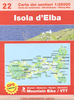

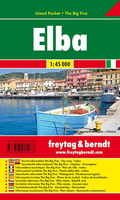
Elba Freytag & Berndt Map
Map of Elba, with contours at 25m intervals and some additional hill shading to help represent the relief. Main and local roads are shown, with driving distances marked, and hiking paths are clearly shown in red. Compared to the map published by Kompass, there is no offshore detail on this map, slightly less minor road detail and fewer symbols used to denote landmarks & tourist information etc.The symbols present show chairlifts, harbours & ferry ports, churches, castles & ruins, museums, campsites & spas. There`s also an extra symbol appearing all over the map but omitted from the legend... it seems to indicate baths or bathing beaches. An inset shows a very simple map of Isola di Montecristo.No index.

Product Description
Reviews/Comments
Add New
Vouchers
No voucher codes found.
Do you know a voucher code for this product or supplier? Add it to Insights for others to use.
Do you know a voucher code for this product or supplier? Add it to Insights for others to use.
 Denmark