
 United Kingdom
 France
 Germany
 Netherlands
 Sweden
 USA
USA
 Italy
Italy
 Spain
Spain
More From Contributor


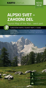
Julian Alps West
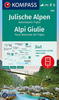
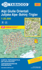
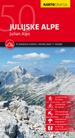
The western part of Slovenia’s Julian Alps on a contoured and GPS compatible map at 1:75, 000 from the Ljubljana-based Kartografija. Coverage includes the Triglav National Park, Kranjska Gora, Bovec, Bled, Jesenice, Tolmin, Škofja Loka, etc. On the reverse are bilingual English/Slovenian descriptions of the region’s best sights.Maps in this series from Kartografija, covering most of Slovenia at 50K or 75K, have contours at 20m intervals, enhanced by relief shading and plenty of spot heights, names of peaks, mountain chains, etc. Local hiking routes are highlighted and also marked are recommended cycling routes. Symbols indicate various types of accommodation including mountain huts, campsites, inns with lodgings, tourist farms or apartments, hotels and motels, as
well as recreational facilities (golf, horse riding, swimming pools, etc), vineries, cultural and historical sites, etc. Road network shows locations of petrol stations. Railway lines are shown with stations and various types of mountain transport (gondolas, chair lifts, etc) are marked. The maps have a latitude and longitude grid at intervals of 2’30’’. The reverse side is covered by bilingual notes on the area’s places of interest. Map legend and all the text include English. To see other titles in this series please click on the series link.
well as recreational facilities (golf, horse riding, swimming pools, etc), vineries, cultural and historical sites, etc. Road network shows locations of petrol stations. Railway lines are shown with stations and various types of mountain transport (gondolas, chair lifts, etc) are marked. The maps have a latitude and longitude grid at intervals of 2’30’’. The reverse side is covered by bilingual notes on the area’s places of interest. Map legend and all the text include English. To see other titles in this series please click on the series link.

Product Description
Reviews/Comments
Add New
Intelligent Comparison
Archived Product
Julian Alps East Stanfords
£9.95
Archived Product
Julian Alps Stanfords
£9.99
Archived Product
Julian Alps Stanfords
£14.99
Archived Product
Julian Alps Stanfords
£9.99
Archived Product
Julian Alps Stanfords
£11.99
Vouchers
No voucher codes found.
Do you know a voucher code for this product or supplier? Add it to Insights for others to use.
Do you know a voucher code for this product or supplier? Add it to Insights for others to use.
 Denmark