More From Contributor
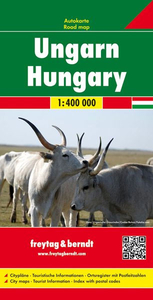
£4.99
Hungarian Phrase Book in a selection of language titles from Berlitz, to aid you before & during your travels. Berlitz have been producing language titles & promoting language learning for more than 125years. Catalogue selection comprising the following Berlitz series: Phrase books & Dictionaries, Phrase books & CDs, Shortcuts to ...
Archived Product
£5.99
This brand new Berlitz Hungarian Phrasebook & Dictionary features a fresh, crisp design with vivid colour photography, eye-catching colour-coding, & user-generated content, making it the phrasebook created by the people for the people! Sections such as Food & Drink & In an Emergency provide words & phrases you`ll hear used in everyday situations in Hungary, & there are snippets of useful information on etiquette, culture & travel. The handy bilingual dictionary at the back of the book contains over 1, 700 useful words, & our new content

Includes::
essential phrases such as ” What is the Wi Fi password?”, ”I`ll put the pictures on Facebook”, & much more. You`ll never be lost for words with a Berlitz phrasebook.

...
Archived Product
£3.99
The Lonely Planet Hungarian Phrasebook is not only an extensive list of useful phrases, but also an ideal tool to start getting to grips with a language & beginning two-way communication. Containing excellent sections on language basics such as numbers, question phrases, dates, phrase construction, grammar & pronunciation, as well as containing concise but well-rounded two-way dictionaries, Lonely Planet phrasebooks enable you to quickly & confidently construct your own phrases in addition to those given. The given phrases cover all the essential travel & tourism categories such as transport, communications, business meetings & accommodation, as well as in-depth categories such as health, food & social interaction. The phrasebooks are designed to enable more than just simple question-answer communication, allowing the start of two-way conversations ...
Archived Product
£12.95
Hungarian wine has never been so exciting. more than ever before, wine tourism is taking off in the country, revealing a beguiling mix of tradition & innovation. With ancient, underground, rock-hewn cellars & wineries of cutting-edge design, Hungary offers much to experts & amateurs alike. This new guide, written by Budapest resident & wine writer Robert Smyth, visits each of the country`s wine regions, meets the winemakers, tastes the wines & makes recommendations of who to watch. Broaden your palate with some classy new vintages & become familiar with some of the tongue-twisting native grape variets that are increasingly in demand on world wine lists. ...
Archived Product
£5.99
The Michelin National road map of Hungary at 1:400, 000 scale is ideal for route planning. The map gives comprehensive coverage of national road networks showing all major motorways, dual carriageways, national & regional main roads & some single-lane roads. [[ Also shows unsurfaced roads & tracks & major footpaths. Distances between major locations are marked along roads, with total distance & several intermediate distances shown. A quick-reference chart of distances & driving times between major locations is also included. The map also

Includes::
a grid-referenced index of principal place names. Clear, easy-to read cartography shows roads in reds, yellows & white with black outlines. [[ Major topography is indicated with relief shading.]] Woodland & forest is marked with green shading. Built-up urban areas are clearly marked in yellow. Airports, ferries, railways are also marked. National & administrative divisions are marked. Tourist sites are marked, such as castles, ruins & national parks; as are sports & recreational facilities. Also

Includes::
a quick reference panel giving national driving regulations, including speed limits, equipment requirements (e.g. bulb kits, warning triangles) & seatbelt rules. Town plans & regional enlargements:- Budapest at 1:1, 000 scale


...
Archived Product
£12.79
Hungary in the Countries & Regions series from Lonely Planet, market-leading comprehensive guides aimed at independent travellers & serving a large range of international destinations. Frank & informal in style, the guides explore an extensive range of sights, activities, accommodation, restaurants & nightlife & are designed for practical use while travelling on the road. Written & researched by a team of experts, each book is independent in its recommendations & suggestions, often offering individual takes on individual destinations. Widely recognised for their reliability, each Lonely Planet country & region guide has the same layout. Introductory sections profile the destination with individual chapters on particular highlights, getting started, (including when to go) itineraries, history, culture, arts, food & drink & the environment. Each guide is organised geographically by region, with individual sections detailing an extensive range of sights, places of interest, attractions, restaurants, nightlife, accommodation & any local activities. The guides have detailed explanations of historical context where relevant. There is also practical guidance on ...
Archived Product
£12.79
Hungary in the Countries, Regions & Cities series from Rough Guides; comprehensively detailed guidebooks specifically designed for independent travellers & serving a range of worldwide destinations. Widely recognised for their free editorial style, Rough Guide authors are allowed to express their personal opinions on a range of subjects. Although sometimes controversial, this editorial stance allows readers to experience more detailed & personal takes on each destination, a feature often more limited in other guidebooks. Cultural & historical nuances are explored in significant depth throughout the text & descriptions on the ambience of individual settings alongside personal recommendations, particularly in cities, are notably prevalent. Each Rough Guide in the Countries, Regions & Cities series has a similar layout. A ...
Archived Product
£14.99
The DK Eyewitness Hungary Travel Guide is your indispensible guide to this beautiful part of the world. The fully updated guide


...
Archived Product
£12.99
Hungary at 1:500, 000 on a clear road map from the Swiss cartographic publisher Kümmerly + Frey, with its index conveniently placed next to the map. Also included is an enlargement showing the environs of Budapest with road access to the city centre. Plain background with just faint relief shading & some spot heights makes rivers & lakes clearly visible. National parks & other protected areas are highlighted. Road network

Includes::
selected country tracks & gives driving distances on main & selected secondary routes. The motorways are particularly well presented with, where appropriate, both the numbers & the names of junctions. Railway lines are included. Picturesque towns & villages are prominently highlighted & symbols mark other places interest, including sport & recreational facilities, castles & monasteries, etc. The map has latitude & longitude lines at intervals of 30’. * Map legend

Includes::
English.* The index is next to the map. Also included is an enlargement showing road access to central Budapest.


...
Archived Product
£11.99
The MARCO POLO map of Hungary, in which consistently beautiful routes & places are marked. With the self-adhesive mark-it stickers in the envelope flap, the targeted route can be emphasized & thus easily rediscovered the next time you look at the map. ...
Archived Product

Hungary

Hungary on a large, double-sided indexed map at 1:300, 000 from MairDumont, with a plan of central Budapest and special features to aid route planning and navigation: a fold-out flap in the jacket gives an overview of the whole area covered by the map plus the adjoining regions and highlights popular locations, with the grid reference system in the margins making it easier to find places on the main map. A set of seven peel-on/peel-off stickers, removable without damaging the map surface, is provided for making selected locations more prominent when navigating.The map divides the country east/west, with the western side extending to Vienna and Bratislava. Road network includes minor local roads and selected unsurfaced tracks, indicates motorway services, toll stations, traffic
restrictions and routes not recommended for caravans, gradients, etc. and gives driving distances on main routes. Scenic routes and viewpoints are highlighted. Railway lines and local airports are included, as well as the country
RIP - This product is no longer available on our network. It was last seen on 25.09.2019

This page now acts as a permanent archive for this product. Add more information using the comments box below to ensure it can still be found by future generations.

Use our search facility to see if it is available from an alternative contributor.
  • External links may include paid for promotion
  • Availability: Out Of Stock
  • Supplier: Stanfords
  • SKU: 9783829738781
Availability: In Stock
£9.95

Product Description

Hungary on a large, double-sided indexed map at 1:300, 000 from Mair Dumont, with a plan of central Budapest & special features to aid route planning & navigation: a fold-out flap in the jacket gives an overview of the whole area covered by the map plus the adjoining regions & highlights popular locations, with the grid reference system in the margins making it easier to find places on the main map. A set of seven peel-on/peel-off stickers, removable without damaging the map surface, is provided for making selected locations more prominent when navigating. The map divides the country east/west, with the western side extending to Vienna & Bratislava. Road network

Includes::
minor local roads & selected unsurfaced tracks, indicates motorway services, toll stations, traffic restrictions & routes not recommended for caravans, gradients, etc. & gives driving distances on main routes. Scenic routes & viewpoints are highlighted. Railway lines & local airports are included, as well as the country

Reviews/Comments

Add New

Price History

Vouchers

No voucher codes found.
Do you know a voucher code for this product or supplier? Add it to Insights for others to use.

Facebook

Jargon Buster

Jacket - A type of garment worn on the upper body usualy outdoors. Also know as an anorak or parka
Set - a group of items usually related to one another. Some objects cannot function without the complete set of items.
Network - A link and communication between things. Often computers or people.
Large - something that takes up more space than normal.
Road - a manmade lane or a path that is used to speed up travel.
Popular - Something that is admired and liked by many people.
Reference - To prove evidence with a back up source.

Supplier Information

Stanfords
Stanfords was established in 1853 and opened their iconic Covent Garden flagship store in 1901. They have become the top retailer of maps, travel books and accessories in the UK and arguably offer the largest selection of maps and travel books worldwide. Famous names such as Captain Robert Falcon Scott, Ranulph Fiennes and Michael Palin have purchased from Stanfords. They now have a shop in Bristol and both stores together with other venues operate a calendar of events including talks, book signings and exhibitions. As a specialist map retailer, the map selection is comprehensive and includes road maps, street maps and walking maps from worldwide destinations, as well as a selection of world atlases and wall maps. Books include travel guides and travel literature. Stanfords also stock globes, from miniatures made of blue marble to magnificent floor-standing globes. The website features a selection of interesting articles on travel topics.
Page Updated: 2023-11-12 20:15:36

Community Generated Product Tags

Oh No! The productWIKI community hasn't generated any tags for this product yet!
Menu