
 United Kingdom
 France
 Germany
 Netherlands
 Sweden
 USA
USA
 Italy
Italy
 Spain
Spain
More From Contributor


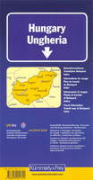
Hungary
Hungary at 1:500, 000 on a clear road map from the Swiss cartographic publisher Kümmerly + Frey, with its index conveniently placed next to the map. Also included is an enlargement showing the environs of Budapest with road access to the city centre.Plain background with just faint relief shading and some spot heights makes rivers and lakes clearly visible. National parks and other protected areas are highlighted. Road network includes selected country tracks and gives driving distances on main and selected secondary routes. The motorways are particularly well presented with, where appropriate, both the numbers and the names of junctions. Railway lines are included.Picturesque towns and villages are prominently highlighted and symbols mark other places interest, including sport and
recreational facilities, castles and monasteries, etc. The map has latitude and longitude lines at intervals of 30’. *Map legend includes English.*The index is next to the map. Also included is an enlargement showing road access to central Budapest.
recreational facilities, castles and monasteries, etc. The map has latitude and longitude lines at intervals of 30’. *Map legend includes English.*The index is next to the map. Also included is an enlargement showing road access to central Budapest.

Product Description
Reviews/Comments
Add New
Vouchers
No voucher codes found.
Do you know a voucher code for this product or supplier? Add it to Insights for others to use.
Do you know a voucher code for this product or supplier? Add it to Insights for others to use.
 Denmark