
 United Kingdom
 France
 Germany
 Netherlands
 Sweden
 USA
USA
 Italy
Italy
 Spain
Spain
More From Contributor


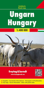
Hungary
The Michelin National road map of Hungary at 1:400, 000 scale is ideal for route planning. The map gives comprehensive coverage of national road networks showing all major motorways, dual carriageways, national & regional main roads and some single-lane roads. [[Also shows unsurfaced roads and tracks and major footpaths.Distances between major locations are marked along roads, with total distance and several intermediate distances shown. A quick-reference chart of distances & driving times between major locations is also included. The map also includes a grid-referenced index of principal place names.Clear, easy-to read cartography shows roads in reds, yellows and white with black outlines. [[Major topography is indicated with relief shading.]] Woodland & forest is marked with green
shading. Built-up urban areas are clearly marked in yellow. Airports, ferries, railways are also marked. National and administrative divisions are marked. Tourist sites are marked, such as castles, ruins and national parks; as are sports and recreational facilities.Also includes a quick reference panel giving national driving regulations, including speed limits, equipment requirements (e.g. bulb kits, warning triangles) and seatbelt rules.Town plans & regional enlargements:- Budapest at 1:1, 000 scale
shading. Built-up urban areas are clearly marked in yellow. Airports, ferries, railways are also marked. National and administrative divisions are marked. Tourist sites are marked, such as castles, ruins and national parks; as are sports and recreational facilities.Also includes a quick reference panel giving national driving regulations, including speed limits, equipment requirements (e.g. bulb kits, warning triangles) and seatbelt rules.Town plans & regional enlargements:- Budapest at 1:1, 000 scale
Product Description
Reviews/Comments
Add New
Intelligent Comparison
Archived Product

Hungary Stanfords
£9.95
Archived Product
Hungary Stanfords
£12.79
Archived Product

Hungary Stanfords
£12.79
Archived Product
Hungary Stanfords
£14.99
Archived Product
Hungary Stanfords
£12.99
Archived Product

Hungary Stanfords
£11.99
Archived Product
Hungary F&B Stanfords
£10.99
Archived Product

Hunger Stanfords
£9.99
Vouchers
No voucher codes found.
Do you know a voucher code for this product or supplier? Add it to Insights for others to use.
Do you know a voucher code for this product or supplier? Add it to Insights for others to use.
 Denmark