
 United Kingdom
 France
 Germany
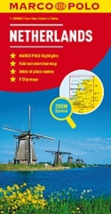
 Netherlands
 Sweden
 USA
USA
 Italy
Italy
 Spain
Spain
More From Contributor


Greece & The Islands Marco Polo Map
Greece at 1:300, 000 from Marco Polo Travel Publishing on a double-sided map with special features to aid navigation. Coverage: mainland without the eastern Thrace, Ionian Islands, Sporades, plus Cyclades on insets as either groups or individual islands. A fold-out extension of the map cover gives at-a-glance overview of the whole area covered by the map with the adjoining regions, highlighting main places of interest and making it much easier to find various localities on the main map and/or plan a route. A set of seven peel-on/peel-off stickers, removable without damaging the map, is provided to make routes or locations more prominent when navigating.The map aims to provide good coverage of the mainland, divided north/south around the town of Lamia and across northern Evia/Euboea.
It is not recommended for island hopping across the Aegean where not all the islands are shown in their proper geographical locations: southern Cyclades are on one large inset, but the northern part of the group, e.g. Mykonos or Syros, is on separate individual insets. Cartography is from the renowned German publishers MairDumont. Relief shading with numerous spot heights and names of mountain ranges shows the topography. Road network includes selected minor roads and local tracks, and indicates distances on main routes. Scenic routes are highlighted. Railway lines are included, plus numerous ferry routes between the mainland and the islands. The map highlights numerous places of interest, both cultural sights including archaeological remains and various natural sites, showing
national parks and other protected areas. Symbols mark selected campsites and youth hostels, viewpoints, etc. All place names are in both Greek and Latin alphabet, except those of places of interest shown in Latin script only. The map has no geographical coordinates. The index is in a separate booklet attached to the map cover. Multilingual map legend includes English.In addition to numerous insets covering various islands the map also includes street plans of central Athens and Thessaloniki.

Product Description
Reviews/Comments
Add New
Intelligent Comparison
Archived Product
Netherlands Marco Polo Map Stanfords
£6.99
Archived Product

Iceland - Faroe Islands Marco Polo Map Stanfords
£6.99
Archived Product

Ireland Marco Polo Map Stanfords
£5.99
Archived Product
Greece & The Islands Stanfords
£5.99
Archived Product
Great Britain - Ireland Marco Polo Map Stanfords
£5.99
Vouchers
No voucher codes found.
Do you know a voucher code for this product or supplier? Add it to Insights for others to use.
Do you know a voucher code for this product or supplier? Add it to Insights for others to use.
 Denmark