
 United Kingdom
 France
 Germany
 Netherlands
 Sweden
 USA
USA
 Italy
Italy
 Spain
Spain
More From Contributor


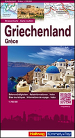
Greece
Greece at 1;700, 000 on a large, indexed road map from the Swiss Hallwag/Kümmerly + Frey cartographic house, presenting the mainland and the islands together, with only Crete shown as an inset. Coverage extends to Istanbul and includes the whole of the Aegean coast of Turkey, showing ferry routes to the islands from both countries. Names of larger towns and the islands are in both Greek and Latin alphabets.Topography is shown by light, unobtrusive relief shading with names of mountain ranges and spot heights. Road network includes selected minor roads and country tracks, and indicates motorway sections due to open in 2016 (Wolfgang Schäuble permitting!), motorway services, roads closed to motorized traffic, opening months of mountain passes, and driving distance on main and
many local roads. Scenic routes are highlighted. Railway lines and ferry services are includes and local airports are marked. A range of symbols indicate various places of interest including campsites, archaeological remains, etc. The map has latitude and longitude lines at 15’ and 30’ respectively. The index is in a separate booklet attached to the map cover. Map legend includes English.Also provided is an enlargement showing in greater detail the Athens area with access to the port in Piraeus and the Eleftherios Venizelos airport.
many local roads. Scenic routes are highlighted. Railway lines and ferry services are includes and local airports are marked. A range of symbols indicate various places of interest including campsites, archaeological remains, etc. The map has latitude and longitude lines at 15’ and 30’ respectively. The index is in a separate booklet attached to the map cover. Map legend includes English.Also provided is an enlargement showing in greater detail the Athens area with access to the port in Piraeus and the Eleftherios Venizelos airport.

Product Description
Reviews/Comments
Add New
Vouchers
No voucher codes found.
Do you know a voucher code for this product or supplier? Add it to Insights for others to use.
Do you know a voucher code for this product or supplier? Add it to Insights for others to use.
 Denmark