More From Contributor

£40.00
With her Iceland series, Ulrike Crespo takes on an extraordinary landscape, which has inspired countless travel & art photographers since the 19th century. & yet she succeeds in producing images that depict the breath-taking wealth of colours & forms of this wild island in a completely new way, often in nearly abstract

Details:
turquoise-blue icebergs, black volcanic s&, white foaming waterfalls, mossy green boulders, & sulphur yellow gravel deserts.

...
Archived Product
£23.95
This new title in the Crossbill Guides Series covers Icel&, a country well known for its superb landscape, unique geology ...
Archived Product
£15.99
Road map of Iceland from Mál og menning, providing a vivid representation of the country’s topography, with illustrated descriptions of 21 of its most visited areas, plus a comprehensive distance table. Relief shading is combined with graphics & colouring to show detailed terrain information: heath, grassl&, wetl&, birch woodl&, s&, lava, glaciers, etc. Hard surface roads, gravel roads & tracks are marked, with locations of fords & distances on most routes. Ferry connections & local airfields are also shown. Symbols indicate locations of tourist huts & shelters, campsites, museums, swimming pools, lighthouses, thermal or hydroelectric power stations, etc. Margin ticks give latitude & longitude at intervals of 30’ & 1º respectively. Map legend

Includes::
English. On the reverse are photographs of some of Iceland`s most popular destinations, each accompanied by a brief description. All the text

Includes::
English. Also provided is comprehensive table showing distances from the country’s 11 main towns to over 70 destinations.


...
Archived Product
£14.99
Iceland in the Countries & Regions series from Lonely Planet, market-leading comprehensive guides aimed at independent travellers & serving a large range of international destinations. Frank & informal in style, the guides explore an extensive range of sights, activities, accommodation, restaurants & nightlife & are designed for practical use while travelling on the road. Written & researched by a team of experts, each book is independent in its recommendations & suggestions, often offering individual takes on individual destinations. Widely recognised for their reliability, each Lonely Planet country & region guide has the same layout. Introductory sections profile the destination with individual chapters on particular highlights, getting started, (including when to go) itineraries, history, culture, arts, food & drink & the environment. Each guide is organised geographically by region, with individual sections detailing an extensive range of sights, places of interest, attractions, restaurants, nightlife, accommodation & any local activities. The guides have detailed explanations of historical context where relevant. There is also practical guidance on ...
Archived Product
£14.99
Iceland in the Countries, Regions & Cities series from Rough Guides; comprehensively detailed guidebooks specifically designed for independent travellers & serving a range of worldwide destinations. Widely recognised for their free editorial style, Rough Guide authors are allowed to express their personal opinions on a range of subjects. Although sometimes controversial, this editorial stance allows readers to experience more detailed & personal takes on each destination, a feature often more limited in other guidebooks. Cultural & historical nuances are explored in significant depth throughout the text & descriptions on the ambience of individual settings alongside personal recommendations, particularly in cities, are notably prevalent. Each Rough Guide in the Countries, Regions & Cities series has a similar layout. A ...
Archived Product
£14.99
These are stylish guides to island getaways, thematically rather than geographically organized. The chapters are thematic essays with helpful hints & information on making the most of your island experience. Each chapter will feature a map tailored to its theme. Chapter 1 will feature the physical isl&, its location, climate, geology & geography. Chapter 2 covers the island's culture, including its people, religions, festivals, music, dance, arts & crafts, architecture, history, population, official languages, currency, etc. Chapter 3 deals with accommodation, giving a range of the best hotels & resorts & supplying information on facilities & services. Chapter 4 gives advice on where, when & how to shop, & a profile of the best buys, with features on indigenous arts & crafts. Chapter 5 covers the island's cuisine & top restaurants, & also offers advice on where to shop for food. Chapter 6 features sports & other activities available on the isl&, including offshore activities such as diving & sailing. At the end of the book, there will be a Travel Tips section covering practical matters such as transport, useful information, contact details, language information, & a calendar of holidays & festivals. ...
Archived Product
£12.99
Illustrated with Sabine Baring-Gould`s own drawings, Iceland: Its Scenes & Sagas, is an entertaining & eccentric insight into a world of myth & legend as well as a classic of natural & human observation. This is Sabine Baring-Gould`s account of his journey on horseback around Iceland in 1862; aged twenty-eight, the young writer & teacher was fascinated by the tradition of the Icelandic sagas, & this was the catalyst for his adventure & the book that emerged from it. His voyage took him from the then tiny settlement of Reykjavik through remote & hostile terrain, passing through the empty expanse of Iceland`s countryside. He observed mountains & glaciers, volcanoes & geysers, wondering at the wild beauty of the landscape. He also recorded the rich flora & fauna that he saw-&, to his chagrin, that his companions shot. But Baring-Gould`s account is more than a travelogue. Throughout he recreates & interprets Icelandic sagas, bringing to life the extraordinary characters & events of these age-old stories. Evoking a world of trolls, witches & magic, he explores the mythology & language of Icelandic lore. He also turns a critical eye on his fellow travellers & the Icelanders he meets, passing judgment on food such as stuffed puffin, pungent fish & ptarmigan. By turns amusing & acerbic, Baring-Gould provides a colourful account of an Icelandic society that has long since disappeared. ...
Archived Product
£269.95
Iceland at 1:100, 000 in a Complete Set of 31 topographic survey maps published by Mál og menning, with excellent, vivid presentation of the terrain, footpaths & bridleways, campsites, etc. The maps have contours at 20m intervals, enhanced by bold relief shading plus colouring and/or graphics to show glaciers, lava fields, sands & mudflats, as well as to distinguish land with vegetation cover from the more sparsely covered terrain. The series provides a splendid presentation of the country’s topography, with large amount of detail & over 43, 000 place names. Road network indicates gravel roads &

Includes::
country tracks. Also marked are local footpaths, clear to see with their distinctive colouring, & bridleways. Symbols shows campsites, tourist huts or shelters, emergency shelters, summer houses, river fords, golf courses & swimming pools, hydro-electric or thermal power stations, local airports, etc, & detail such as individual farms, abandoned farms or ruins, sheepfolds, etc. Each map covers an area of 84 x 67km (53 x 42 miles approx.) & has latitude & longitude lines drawn at intervals of 2’ & 5’ respectively. Map legend

Includes::
English, German & French. To see the list of the individual titles in this series please click on the series link.


...
Archived Product
£9.99
Adventure Maps provide global travellers with the perfect combination of detail & perspective. Iceland`s western half is shown on the front side of the map including the cities of Reykjavik, Kpavogur, Mossfellsbaer, & Siglufj”rdur. The reverse side covers the eastern portion of the country showing the cities of Akureyri, Egilsstadir, Eskifj”rdur, Neskaupstadur, Hsavik, & H”fn. Popular locations to ski, golf, camp, fish, & swim are marked, as are World Heritage sites, museums, churches, & other points of interest. Scale: 1:465, 000 Flat Size: 965 x 660 mm. ...
Archived Product
£15.99
Birdwatchers’ Map of Iceland from Mál og menning with 78 species of Iceland’s breeding birds, all with beautiful drawings of the bird itself & of its egg. Each species is presented with a map showing its distribution in summer, winter or all year round, plus a graph indicating months when it can be seen. Icons indicate its habitat & whether migrant or resident, & information is also provided on the average size & weight of each bird & its egg. The map also

Includes::
drawings of 27 migrant species. All the birds are shown with their English, German & Latin names & all other text

Includes::
English. Also included is a simple map of Iceland showing best birdwatching in the country.


...
Archived Product

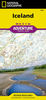
Iceland - Faroe Islands Marco Polo Map

Iceland at 1:650, 000 on a road map from Marco Polo Travel Publishing with good presentation of its topography and prominent highlighting of interesting locations, more detailed enlargements of Lake Mývatn, Þingvellir and the environs of Reykjavik, plus an index booklet a street plan of the capital and brief descriptions of 15 selected top sights, etc. Coverage includes the Faeroe Islands presented on an inset panel.Cartography is from the renowned German publishers MairDumont. Topography is vividly shown by relief shading with bold colouring for glaciers and lava fields, plus plenty of names of mountain ranges, peaks, etc. Road network indicates gravel roads and shows locations of tolls, fords, emergency shelters and seasonal closures, with driving distances marked on main and
many local roads. Scenic roads are highlighted. The map also prominently highlights locations of interest, with separate colouring for towns or villages and for natural sites. Symbols indicate campsites, youth hostels, isolated hotels, etc. Latitude and longitude lines are drawn at 30’ intervals. Multilingual map legend includes English.Enlargements show in greater detail Lake Mývatn plus the environs of Reykjavik including Þingvellir National Park, with the central part of the park shown on a further panel at 1:38, 500 approx. A separate booklet attached to the map cover includes an index which also lists national parks, UNESCO World Heritage sites and airports. The booklet also contains brief descriptions of 15 most interesting locations prominently highlighted on the map,
plus a street plan of Reykjavik.A fold-out flap in the cover shows a map of Iceland for route planning prominently highlighting main places of interest, with the grid reference system in the margins making it easier to find locations on the main map. Also included are a distance/driving times table and basic driving regulations.
RIP - This product is no longer available on our network. It was last seen on 25.09.2019

This page now acts as a permanent archive for this product. Add more information using the comments box below to ensure it can still be found by future generations.

Use our search facility to see if it is available from an alternative contributor.
  • External links may include paid for promotion
  • Availability: Out Of Stock
  • Supplier: Stanfords
  • SKU: 9783829767231
Availability: In Stock
£6.99

Product Description

Iceland at 1:650, 000 on a road map from Marco Polo Travel Publishing with good presentation of its topography & prominent highlighting of interesting locations, more detailed enlargements of Lake Mývatn, Þingvellir & the environs of Reykjavik, plus an index booklet a street plan of the capital & brief descriptions of 15 selected top sights, etc. Coverage

Includes::
the Faeroe Islands presented on an inset panel. Cartography is from the renowned German publishers Mair Dumont. Topography is vividly shown by relief shading with bold colouring for glaciers & lava fields, plus plenty of names of mountain ranges, peaks, etc. Road network indicates gravel roads & shows locations of tolls, fords, emergency shelters & seasonal closures, with driving distances marked on main & many local roads. Scenic roads are highlighted. The map also prominently highlights locations of interest, with separate colouring for towns or villages & for natural sites. Symbols indicate campsites, youth hostels, isolated hotels, etc. Latitude & longitude lines are drawn at 30’ intervals. Multilingual map legend

Includes::
English. Enlargements show in greater detail Lake Mývatn plus the environs of Reykjavik including Þingvellir National Park, with the central part of the park shown on a further panel at 1:38, 500 approx. A separate booklet attached to the map cover

Includes::
an index which also lists national parks, UNESCO World Heritage sites & airports. The booklet also contains brief descriptions of 15 most interesting locations prominently highlighted on the map, plus a street plan of Reykjavik.A fold-out flap in the cover shows a map of Iceland for route planning prominently highlighting main places of interest, with the grid reference system in the margins making it easier to find locations on the main map. Also included are a distance/driving times table & basic driving regulations.

Reviews/Comments

Add New

Intelligent Comparison

Oooops!
We couldn't find anything!
Perhaps this product's unique.... Or perhaps we are still looking for comparisons!
Click to bump this page and we'll hurry up.

Price History

Vouchers

No voucher codes found.
Do you know a voucher code for this product or supplier? Add it to Insights for others to use.

Facebook

Jargon Buster

World - A physical grouping, commonly used to describe earth and everything associated with ti
Gravel - A size of rock between 2mm and 64mm
Natural - not manmade
Network - A link and communication between things. Often computers or people.
Road - a manmade lane or a path that is used to speed up travel.
Reference - To prove evidence with a back up source.

Supplier Information

Stanfords
Stanfords was established in 1853 and opened their iconic Covent Garden flagship store in 1901. They have become the top retailer of maps, travel books and accessories in the UK and arguably offer the largest selection of maps and travel books worldwide. Famous names such as Captain Robert Falcon Scott, Ranulph Fiennes and Michael Palin have purchased from Stanfords. They now have a shop in Bristol and both stores together with other venues operate a calendar of events including talks, book signings and exhibitions. As a specialist map retailer, the map selection is comprehensive and includes road maps, street maps and walking maps from worldwide destinations, as well as a selection of world atlases and wall maps. Books include travel guides and travel literature. Stanfords also stock globes, from miniatures made of blue marble to magnificent floor-standing globes. The website features a selection of interesting articles on travel topics.
Page Updated: 2023-11-12 20:15:36

Community Generated Product Tags

Oh No! The productWIKI community hasn't generated any tags for this product yet!
Menu