
 United Kingdom
 France
 Germany
 Netherlands
 Sweden
 USA
USA
 Italy
Italy
 Spain
Spain
More From Contributor


Iceland
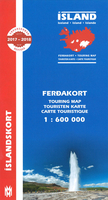
Road map of Iceland from Mál og menning, providing a vivid representation of the country’s topography, with illustrated descriptions of 21 of its most visited areas, plus a comprehensive distance table.Relief shading is combined with graphics and colouring to show detailed terrain information: heath, grassland, wetland, birch woodland, sand, lava, glaciers, etc. Hard surface roads, gravel roads and tracks are marked, with locations of fords and distances on most routes. Ferry connections and local airfields are also shown. Symbols indicate locations of tourist huts and shelters, campsites, museums, swimming pools, lighthouses, thermal or hydroelectric power stations, etc. Margin ticks give latitude and longitude at intervals of 30’ and 1º respectively. Map legend
includes English.On the reverse are photographs of some of Iceland`s most popular destinations, each accompanied by a brief description. All the text includes English. Also provided is comprehensive table showing distances from the country’s 11 main towns to over 70 destinations.
includes English.On the reverse are photographs of some of Iceland`s most popular destinations, each accompanied by a brief description. All the text includes English. Also provided is comprehensive table showing distances from the country’s 11 main towns to over 70 destinations.

Product Description
Reviews/Comments
Add New
Vouchers
No voucher codes found.
Do you know a voucher code for this product or supplier? Add it to Insights for others to use.
Do you know a voucher code for this product or supplier? Add it to Insights for others to use.
 Denmark