
 United Kingdom
 France
 Germany
 Netherlands
 Sweden
 USA
USA
 Italy
Italy
 Spain
Spain
More From Contributor

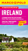
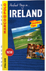

Ireland Marco Polo Map
Ireland at 1:300, 000 on a large, double-sided road map from Marco Polo Travel Publishing with enlargements for the environs of Dublin, Cork and Belfast, plus an index booklet with 5 city street plans and brief descriptions of 15 selected top sights, etc. The map divides Ireland north/south, with a generous overlap and Dublin included on both sides. Where appropriate, both Irish and English place names are shown.Cartography is from the renowned German publishers MairDumont. Road network includes minor roads and local tracks, highlights scenic routes, shows intermediate driving distances on main and secondary roads, motorway services, etc. Railway lines, ferry routes and local airports are included, as well as administrative divisions with names of the counties. Locations of
interest are prominently highlighted, with separate colouring for towns or villages and for natural sites. National parks and other protected areas are marked. Multilingual map legend includes English.Surrounding the map are enlargements showing in greater detail the environs of Dublin, Cork and Belfast. A separate booklet attached to the map cover includes an index which also lists national parks, UNESCO World Heritage sites, airports and amusement parks. The booklet also contains brief descriptions of 15 most interesting locations prominently highlighted on the map, plus street plans of central Dublin, Cork, Limerick, Belfast and Londonderry/DerryA fold-out flap in the cover shows for route planning an overview map of Ireland prominently highlighting main places of interest,
with the grid reference system in the margins making it easier to find locations on the main map. Also included are a distance/driving times table and basic driving regulations.

Product Description
Reviews/Comments
Add New
Intelligent Comparison
Archived Product

France Marco Polo Map Stanfords
£6.99
Archived Product
Canada Marco Polo Map Stanfords
£6.99
Archived Product
Netherlands Marco Polo Map Stanfords
£6.99
Archived Product

Switzerland Marco Polo Map Stanfords
£6.99
Archived Product

Caribbean Marco Polo Map Stanfords
£6.99
Archived Product

Germany Marco Polo Map Stanfords
£6.99
Archived Product

Turkey Marco Polo Map Stanfords
£6.99
Archived Product

Europe Marco Polo Map Stanfords
£6.99
Vouchers
No voucher codes found.
Do you know a voucher code for this product or supplier? Add it to Insights for others to use.
Do you know a voucher code for this product or supplier? Add it to Insights for others to use.
 Denmark