
 United Kingdom
 France
 Germany
 Netherlands
 Sweden
 USA
USA
 Italy
Italy
 Spain
Spain
More From Contributor
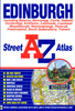


Edinburgh Atlas And Guide
Edinburgh Atlas and Guide is a pocket-sized, indexed street atlas at 1:12, 000 from Collins. Shows the central areas with large amounts of tourist information and enlarged plans of the Royal Mile and Edinburgh Castle.Main roads (with road numbers) and streets are shown with an indication of one-way streets and car parks. Train stations, railway lines and some footpaths (e.g. the Water of Leith Walkway) are displayed.Many sites and buildings of interest to the tourist are indicated (such as theatres, major hotels and tourist information offices), as are post offices, libraries, places of worship and many public and commercial buildings. Parks and woodland are also displayed.The map covers central Edinburgh and some of the inner residential areas. See adjoining image for full
coverage.Also includes: Around 45 pages of tourist information (with map references), giving prices, facilities, opening times, contact details and background information. Also includes information about transport, accommodation, eating, drinking, entertainment and shopping. An enlarged map of the area around the Royal Mile at 1:9, 000, with greater detail of streets and places of interest. A plan of Edinburgh Castle, with tourist information. A plan of Edinburgh Airport at 1:12, 000.
coverage.Also includes: Around 45 pages of tourist information (with map references), giving prices, facilities, opening times, contact details and background information. Also includes information about transport, accommodation, eating, drinking, entertainment and shopping. An enlarged map of the area around the Royal Mile at 1:9, 000, with greater detail of streets and places of interest. A plan of Edinburgh Castle, with tourist information. A plan of Edinburgh Airport at 1:12, 000.
Product Description
Reviews/Comments
Add New
Intelligent Comparison
Archived Product
Edinburgh City Map & Guide Stanfords
£4.99
Archived Product
Edinburgh MapGuide Stanfords
£5.99
Archived Product
Edinburgh Pocket Guide Stanfords
£4.99
Archived Product

Edinburgh Pocket Guide Stanfords
£5.99
Archived Product
Edinburgh City Pack Guide Stanfords
£6.99
Archived Product

Edinburgh Essential Guide Stanfords
£5.99
Archived Product

Edinburgh City Pack Guide Stanfords
£7.99
Archived Product
Edinburgh City Pack Guide Stanfords
£7.99
Vouchers
No voucher codes found.
Do you know a voucher code for this product or supplier? Add it to Insights for others to use.
Do you know a voucher code for this product or supplier? Add it to Insights for others to use.
 Denmark