
 United Kingdom
 France
 Germany
 Netherlands
 Sweden
 USA
USA
 Italy
Italy
 Spain
Spain
More From Contributor


Ecuador
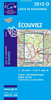
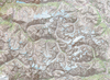
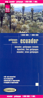
Indexed, waterproof and tear-resistant road map of Ecuador with topographic and tourist information, published by Reise Know-How as part of their highly acclaimed World Mapping Project. The map is double-sided to provide the best balance between a good scale and a convenient size sheet.The country

Product Description
Reviews/Comments
Add New
Intelligent Comparison
Archived Product
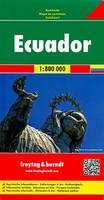
Ecuador F&B Stanfords
£10.99
Archived Product

Ecuador ITMB Stanfords
£9.99
Archived Product
Equator Stanfords
£8.99
Vouchers
No voucher codes found.
Do you know a voucher code for this product or supplier? Add it to Insights for others to use.
Do you know a voucher code for this product or supplier? Add it to Insights for others to use.
 Denmark