
 United Kingdom
 France
 Germany
 Netherlands
 Sweden
 USA
USA
 Italy
Italy
 Spain
Spain
More From Contributor


China South Central
A clear road map of Eastern China and Taiwan. Covering north to south from Xian and Shanghai to the Leizhou Peninsula (including the Hainan Island), and to the west as far as the Xizang Zizhiqu Province and the Myanmar (Burma) borders. It combines clear road details, indicating driving distances, with hillshading and administrative boundaries.Freeways, Highways and both provincial and secondary are indicated, as well a railways and airports. A range of symbols depicts peak heights, beach resorts, national parks, and places of interest. All names are printed in English. Includes an index of places, lakes, mountains and mountain passes. Longitude and latitude lines are drawn at 2° intervals. Printed on paper.

Product Description
Reviews/Comments
Add New
Intelligent Comparison
Archived Product
China Central Stanfords
£7.95
Archived Product
China Southern Stanfords
£7.95
Archived Product
Cork South-Central Stanfords
£8.25
Archived Product
Cork South-Central Stanfords
£8.25
Archived Product
China East-Central Stanfords
£7.95
Archived Product

China South Nelles Stanfords
£10.99
Archived Product
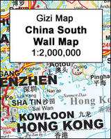
China South Wall Map Stanfords
£13.50
Vouchers
No voucher codes found.
Do you know a voucher code for this product or supplier? Add it to Insights for others to use.
Do you know a voucher code for this product or supplier? Add it to Insights for others to use.
 Denmark