
 United Kingdom
 France
 Germany
 Netherlands
 Sweden
 USA
USA
 Italy
Italy
 Spain
Spain
More From Contributor


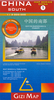


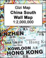
China South Wall Map
Southern China Wall Map at 1:2, 000, 000 from Gizi Map, size 124 x 88cm (49” x 35” approx), with altitude colouring to show the region’s topography. Coverage extends north to Shanghai and Nanjing. Names of larger towns and the provinces are also given in Chinese.The map has bold altitude colouring, with spot heights and names of mountain ranges and other geographical features to provide an excellent picture of the terrain. Roads are graded into six types and give driving distances on main routes. Railways, shipping and ferry lines, local airports and provincial boundaries are also shown. Symbols mark various places of interest including historical sites, national parks and interesting nature locations, etc. Latitude and longitude lines are drawn at 1° intervals. The index is
on the reverse. Multilingual legend includes English.An inset at 1:12, 000, 000 shows the South China Sea. The map is part of Gizi Map series covering the whole of China at 1:2, 000, 000.PLEASE NOTE: this title is also available in a folded format.
on the reverse. Multilingual legend includes English.An inset at 1:12, 000, 000 shows the South China Sea. The map is part of Gizi Map series covering the whole of China at 1:2, 000, 000.PLEASE NOTE: this title is also available in a folded format.

Product Description
Reviews/Comments
Add New
Vouchers
No voucher codes found.
Do you know a voucher code for this product or supplier? Add it to Insights for others to use.
Do you know a voucher code for this product or supplier? Add it to Insights for others to use.
 Denmark