More From Contributor
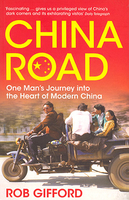
£6.99
China in the Pocket Guide series from Berlitz; a collection of handy, pocket-sized guides dedicated to an extensive range of cities, regions & countries worldwide. Written in narrative form, individual guides explore the history, main sights & attractions, food & drink, accommodation & local culture of the destination in detail. Each Berlitz pocket guide has a similar format, with colour-coded sections helping readers locate information quickly in addition to distinctive chapters exploring the city or region. An introduction outlines the destination for visitors & a section dedicated to 'A Brief History' actually explores the area in relative depth. A where to go chapter is organized by region & city & is written in prose form with references to individual sites highlighted in bold for clarity. There are also further suggestions on where & when to eat. Recommendations for leisure activities in the region, including sport, nightlife & shopping, are also provided & tailored accordingly for each destination. Handy travel tips are listed alphabetically in a dedicated section, providing practical guidance & helping visitors make the most of their stay. The main hotels, particularly for cities, are also listed in an accommodation section, offering a brief overview with approximate price bandings & relevant contact details. ...
Archived Product
£6.99
Full-colour Berlitz Pocket Guide China is the ultimate handy guide to this enigmatic destination, covering all the information you need on where to go & what to do. The book features a rundown of the country`s Top 10 Attractions from the Great Wall to the amazing landscapes of Guilin, & a suggested 14-day tour of the principal sights. Inside China Pocket Guide: Where To Go details all the key sights, while handy maps on the cover flaps help you find your way around, & are cross-referenced to the text. Top 10 Attractions gives a run-down of the best sights to take in on your trip. What To Do is a snapshot of ways to spend your spare time, from scuba diving, to walking in national parks or working your way around stylish bars. Essential information on culture & history. Eating Out covers the country`s best cuisine. Curated listings of the best hotels & restaurants. A-Z of all the practical information you`ll need. ...
Archived Product
£20.00
Railway Atlas of China, including Mongolia & Taiwan, from Quail Map Company in an A4 paperback format, showing the rail network in great detail on 28 pages of maps at various scales. Numerous enlargements provide additional information including metro lines in cities, major junctions & depots with sidings, etc. Lines are classified according to their gauges (standard, narrow & Russian) & indicate different types of electrified routes. Each line is shown with its name & number. Where appropriate stations are colored to indicate those only for passenger or freighttraffic; also marked are closed stations & depots. Further symbols show railway works & marshalling yards, railway museums, etc. All place names are in Latin alphabet. The index lists selected stations & the atlas also

Includes::
a register of railway lines with their length & other relevant information. This is the third edition of this atlas, published in 2008 after three & a half years of work to reflect the enormous growth of the network since 1998.

...
Archived Product
£11.50
China at 1:4, 000, 000 on light, waterproof & tear-resistant plastic paper, with both topographic & tourist information. The map, part of Reise Know-How`s highly acclaimed ” World Mapping Project”, is double-sided to provide the best balance between a good scale & a convenient size sheet. Topography is indicated by altitude colouring with spot heights & names of mountain ranges, hills & deserts. Salt lakes, swamps, seasonal rivers & glaciers are also shown. Detailed presentation of the road network

Includes::
minor roads & tracks. The map also shows the rail network & local airports. Administrative units are shown with their boundaries & names. National parks & other protected areas are highlighted. A wide range of symbols mark various places of interest including the Great Wall of China, UNESCO world heritage sites, temples, beaches, etc. Latitude & longitude lines are drawn at 4º intervals. Map legend

Includes::
English. All place names are shown on the map both transliterated & in the Chinese script. The index of localities lists only the transliterated names. Coverage

Includes::
the whole of Mongolia, North & South Korea, Bhutan & Nepal.*” World Mapping Project”* is an extensive series of maps at varying scales, aiming to provide coverage of countries & regions worldwide using clear, well presented cartography with both topographic & tourist information.


...
Archived Product
£7.99
From the bestselling author of Crazy Rich Asians (Soon to be a MAJOR MOTION PICTURE starring Constance Wu, Henry Golding, Michelle Yeoh & Gemma Chan) comes a deliciously fun story of family, fortune, & fame in Mainland China. It`s the eve of Rachel Chu`s wedding, & she should be over the moon. She has a flawless oval-cut diamond, a wedding dress she loves, & a fiance willing to give up one of the biggest fortunes in Asia in order to marry her. Still, Rachel mourns the fact that her birth father, a man she never knew, won`t be there to walk her down the aisle. Then a chance accident reveals his identity. Suddenly, Rachel is drawn into a dizzying world of Shanghai splendor, a world where people attend church in a penthouse, where exotic cars race down the boulevard, & where people aren`t just crazy rich... they`re China rich. ...
Archived Product
£10.50
A clear road map of Eastern China & Taiwan. Covering north to south from Xian & Shanghai to the Leizhou Peninsula (including the Hainan Island), & to the west as far as the Xizang Zizhiqu Province & the Myanmar (Burma) borders. It combines clear road details, indicating driving distances, with hillshading & administrative boundaries. Freeways, Highways & both provincial & secondary are indicated, as well a railways & airports. A range of symbols depicts peak heights, beach resorts, national parks, & places of interest. All names are printed in English.

Includes::
an index of places, lakes, mountains & mountain passes. Longitude & latitude lines are drawn at 2° intervals. Printed on paper.

...
Archived Product
£9.99
Southern China at 1:2, 000, 000 on an indexed road map from Gizi Map with altitude colouring to show the region’s topography. Coverage extends north to Shanghai & Nanjing. Names of larger towns & the provinces are also given in Chinese. The map has bold altitude colouring, with spot heights & names of mountain ranges & other geographical features to provide an excellent picture of the terrain. Roads are graded into six types & give driving distances on main routes. Railways, shipping & ferry lines, local airports & provincial boundaries are also shown. Symbols mark various places of interest including historical sites, national parks & interesting nature locations, etc. Latitude & longitude lines are drawn at 1° intervals. The index is on the reverse. Multilingual legend

Includes::
English. An inset at 1:12, 000, 000 shows the South China Sea. The map is part of Gizi Map series covering the whole of China at 1:2, 000, 000.PLEASE NOTE: this title is also available as a wall map.

...
Archived Product
£9.99
Southern, or rather south-eastern China but with coverage extending west to Lhasa, on a double-sided, waterproof & tear-resistant, indexed map at 1:3, 000, 000 from ITMB with additional panels showing more detailed road maps of Hong Kong & the Guangzhou region, plus street plans of central Hong Kong, Kowloon, Guangzhou & Shanghai. All place names are in the Latin alphabet. Coverage on the eastern side of the map starts at Zhengzhou, so north of Shanghai, Nanjing & Xi’an,

Includes::
Taiwan & extends south to the border & the Hainan Isl&. On the western side, with the small overlap, the map

Includes::
Lanzhou & Yinchuan & extends west to Lhasa, but without full coverage of north-eastern Tibet. The map shows the region`s road & rail networks on a base with altitude colouring (bands in feet, spot heights in metres). Driving distances are marked on main & on many provincial highways. Railway lines are included & local airports are marked. Symbols highlight various places of interest. The map has latitude & longitude lines at intervals of 2º. Each side of the map has a separate index. Additional panels present in greater detail road maps covering most of the Hong Kong Special Administrative Region (1:60, 000) & the Guangzhou region including access to Hong Kong, Shenzhen & Macau (1:850, 000), plus four street plans covering central Shanghai, Guangzhou, Hong Kong & Kowloon. Each plan clearly indicates metro stations & highlights selected hotels, shopping facilities, places of interest, etc.


...
Archived Product
£10.99
South-eastern China at 1:1, 750, 000 from Nelles in a convenient format for use when travelling, with street plans of central Shanghai & Hong Kong, plus an enlargement of the Yangshuo area south of Guilin. The map is double-sided with an overlap between the sides; coverage extends southwards from Shanghai & Wuhan, & inland to Kunming. The Hainan Island is shown on an inset at the same scale as the main map. All place names are in the Latin alphabet only with, where useful, their old historical names (Shantou/ Swatow/ Tuodao, Xiamen/ Amoy etc). Maps in the Nelles series for China present road & rail networks on a base with topography indicated by relief shading, with names of mountain ranges & peaks plus additional spot heights. Local airports are marked & the maps also show internal administrative boundaries with names of the provinces. Places of interest, including historical sights, beaches, national parks or protected area, etc. are highlighted both on the main map & on the accompanying street plans or enlargements. Each title has latitude & longitude lines at 1° intervals. The maps are not indexed. Map legend

Includes::
English. To see the full list of titles in this series please click on the series link.

...
Archived Product
£13.50
Southern China Wall Map at 1:2, 000, 000 from Gizi Map, size 124 x 88cm (49” x 35” approx), with altitude colouring to show the region’s topography. Coverage extends north to Shanghai & Nanjing. Names of larger towns & the provinces are also given in Chinese. The map has bold altitude colouring, with spot heights & names of mountain ranges & other geographical features to provide an excellent picture of the terrain. Roads are graded into six types & give driving distances on main routes. Railways, shipping & ferry lines, local airports & provincial boundaries are also shown. Symbols mark various places of interest including historical sites, national parks & interesting nature locations, etc. Latitude & longitude lines are drawn at 1° intervals. The index is on the reverse. Multilingual legend

Includes::
English. An inset at 1:12, 000, 000 shows the South China Sea. The map is part of Gizi Map series covering the whole of China at 1:2, 000, 000.PLEASE NOTE: this title is also available in a folded format.

...
Archived Product

China Road

“China Road” sees Rob Gifford travel deep into the heart of Modern China. Running 3, 000 miles from the east-coast boomtown of Shanghai to the border of Kazakhstan in the north-west, Route 312 - China’s ‘Route 66’ - is a road that Rob Gifford has always wanted to travel.Gifford’s journey and his desire to get to the heart of this country make ‘China Road’ an outstanding and funny travel narrative; part pilgrimage, part reportage, this illuminates not only a country on the move, but one coming increasingly under the global spotlight.
RIP - This product is no longer available on our network. It was last seen on 25.09.2019

This page now acts as a permanent archive for this product. Add more information using the comments box below to ensure it can still be found by future generations.

Use our search facility to see if it is available from an alternative contributor.
  • External links may include paid for promotion
  • Availability: Out Of Stock
  • Supplier: Stanfords
  • SKU: 9780747593355
Availability: In Stock
£10.99

Product Description

“ China Road” sees Rob Gifford travel deep into the heart of Modern China. Running 3, 000 miles from the east-coast boomtown of Shanghai to the border of Kazakhstan in the north-west, Route 312
- China’s ‘ Route 66’
- is a road that Rob Gifford has always wanted to travel. Gifford’s journey & his desire to get to the heart of this country make ‘ China Road’ an outstanding & funny travel narrative; part pilgrimage, part reportage, this illuminates not only a country on the move, but one coming increasingly under the global spotlight.

Reviews/Comments

Add New

Intelligent Comparison

Oooops!
We couldn't find anything!
Perhaps this product's unique.... Or perhaps we are still looking for comparisons!
Click to bump this page and we'll hurry up.

Price History

Vouchers

No voucher codes found.
Do you know a voucher code for this product or supplier? Add it to Insights for others to use.

Facebook

Jargon Buster

running - A sport or hobbie of moving rapidly on foot. Can also refer to the running of equipment or run time refering to the length of time an applicance can run or the quiet running of an applicance.
Heart - An organ that pumps blood around the body. Usually related to love.
Road - a manmade lane or a path that is used to speed up travel.

Supplier Information

Stanfords
Stanfords was established in 1853 and opened their iconic Covent Garden flagship store in 1901. They have become the top retailer of maps, travel books and accessories in the UK and arguably offer the largest selection of maps and travel books worldwide. Famous names such as Captain Robert Falcon Scott, Ranulph Fiennes and Michael Palin have purchased from Stanfords. They now have a shop in Bristol and both stores together with other venues operate a calendar of events including talks, book signings and exhibitions. As a specialist map retailer, the map selection is comprehensive and includes road maps, street maps and walking maps from worldwide destinations, as well as a selection of world atlases and wall maps. Books include travel guides and travel literature. Stanfords also stock globes, from miniatures made of blue marble to magnificent floor-standing globes. The website features a selection of interesting articles on travel topics.
Page Updated: 2023-11-12 20:15:36

Community Generated Product Tags

Oh No! The productWIKI community hasn't generated any tags for this product yet!
Menu