
 United Kingdom
 France
 Germany
 Netherlands
 Sweden
 USA
USA
 Italy
Italy
 Spain
Spain
More From Contributor


China Reise Know-How
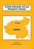
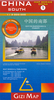
China at 1:4, 000, 000 on light, waterproof and tear-resistant plastic paper, with both topographic and tourist information. The map, part of Reise Know-How`s highly acclaimed ”World Mapping Project”, is double-sided to provide the best balance between a good scale and a convenient size sheet.Topography is indicated by altitude colouring with spot heights and names of mountain ranges, hills and deserts. Salt lakes, swamps, seasonal rivers and glaciers are also shown. Detailed presentation of the road network includes minor roads and tracks. The map also shows the rail network and local airports. Administrative units are shown with their boundaries and names. National parks and other protected areas are highlighted. A wide range of symbols mark various places of interest
including the Great Wall of China, UNESCO world heritage sites, temples, beaches, etc. Latitude and longitude lines are drawn at 4º intervals. Map legend includes English.All place names are shown on the map both transliterated and in the Chinese script. The index of localities lists only the transliterated names. Coverage includes the whole of Mongolia, North and South Korea, Bhutan and Nepal.*”World Mapping Project”* is an extensive series of maps at varying scales, aiming to provide coverage of countries and regions worldwide using clear, well presented cartography with both topographic and tourist information.
including the Great Wall of China, UNESCO world heritage sites, temples, beaches, etc. Latitude and longitude lines are drawn at 4º intervals. Map legend includes English.All place names are shown on the map both transliterated and in the Chinese script. The index of localities lists only the transliterated names. Coverage includes the whole of Mongolia, North and South Korea, Bhutan and Nepal.*”World Mapping Project”* is an extensive series of maps at varying scales, aiming to provide coverage of countries and regions worldwide using clear, well presented cartography with both topographic and tourist information.

Product Description
Reviews/Comments
Add New
Vouchers
No voucher codes found.
Do you know a voucher code for this product or supplier? Add it to Insights for others to use.
Do you know a voucher code for this product or supplier? Add it to Insights for others to use.
 Denmark