More From Contributor

£12.95
Walking in the Cevennes is Janette Norton’s Cicerone guide to walking in one of France’s most wild & unknown regions. The areas the guide covers are based in the north around Florac & in the south around Le Vigan; it also

Includes::
the well-known four day circuit of Mont Lozere. Situated just across the Rhone from Provence, the Cevennes is also home to the Parc National des Cevennes & the upper reaches of the Tarn gorge. The guide is structured in three main parts
- Southern Cevennes, Northern Cevennes & a Tour of Mont Lozere
- detailing a total of 31 walks in the region. Each walk has a general overview of the route & an Information Box providing details on difficulty ratings, time, height gains, relevant maps & signposting. A detailed introduction gives practical guidance on when to go, accommodation, clothing & equipment & guidelines for walking in the area. There are also details on the history of southern & northern Cevennes, Cevenese life & guidelines for walking in the area. Detailed walk descriptions are accompanied by sketch diagrams mapping the route in addition to black & white & colour photographs illustrating some of the highlights of the region.


...
Archived Product
£12.95
The Robert Louis Stevenson Trail is experienced walker Alan Castle’s Cicerone guide to the GR70 route from Le Puy to St-Jean-Du-Gard. The guide covers the entirety of the route that was made famous by Stevenson’s travels by donkey in the autumn of 1878 along the 140 mile walk through the Velay & Cevennes regions of France (see the Stanfords classic Travels with a donkey in the Cevennes
- stock number 172162). The route today has become a classic one across the hills & along the valley floors of this picturesque area of rural France. The guide is structured in 12 main sections, each reflecting a day’s walking, meaning the Trail can be fitted into a fortnight’s holiday. Each stage has a general overview of the day’s walking & an Information Box providing details of each section of the walk & the total time & distance covered at each location. A comprehensive introduction gives practical guidance on when to go, public transport from the trail, accommodation, equipment, Waymarking & navigation, & notes on language. There are also dedicated sections on the RLS trail, Robert Louis Stevenson himself & his route by cycle or by car. Detailed walk descriptions are accompanied by colour sketch diagrams mapping the route ahead in addition to colour photographs illustrating some of the beauty of this French rural landscape.
...
Archived Product
£30.00
Making ceviche is a serious business in Lima
- & restaurateur Martin Morales, whose top Soho restaurant opened to wide acclaim
...
Archived Product
£9.00
Anyone wishing to navigate mainland European inland waters now needs a CEVNI endorsement to the International Certificate of Confidence (ICC), which can be obtained by passing the appropriate RYA examination. These Flip Cards, printed in colour, are designed to help learn the signs, symbols & lights displayed, which form a major part of CEVNI regulations.50 cards in total. ...
Archived Product
£10.99
Chaîne des Puys
- Massif du Sancy region in a series of GPS compatible, contoured TOP 75 maps at 1:75, 000 from the IGN, highlighting
...
Archived Product
£12.99
Topographic survey of France at 1:25, 000 in IGN`s excellent TOP25 / Série Bleue series. All the maps are GPS compatible, with a 1km UTM grid plus latitude & longitude lines at 5’ intervals. Contours are at 5m intervals except for mountainous areas where the maps have contours at 10m intervals, vividly enhanced by hill shading & graphics for rocky terrain. Colouring with graphics indicates different types of vegetation or land use (deciduous or coniferous forests, moors, orchards, vineyards, etc). PLEASE NOTE: coverage of France at this scale is currently being revised – the format & the presentation of each title are indicated by the letters at the end of its Sheet Reference number (e.g. 0416ET, 3531ETR, 1923SB, etc.)MAPS WITH FULL TOURIST OVERPRINT & AN ENGLISH MAP LEGEND: all TOP25 maps & the SB editions of Série Bleue have an overprint highlighting waymarked walking trails including long-distance GR routes &, where appropriate, ski routes. Symbols indicate campsites, gîtes d’etape, refuges, equestrian centres & other recreational facilities or sites, tourist information centres, cultural heritage, etc. Towns & locations of particular interest are highlighted.- ET or OT = single-sided TOP25 map covering approx. 29x 21 km / 18x 13 miles.- ETR or OTR = waterproof & tear resistant TOP25 map covering the same area as the corresponding ET or OT number, but double-sided, printed on a smaller size sheet with a good overlap between the sides.- SB = Série Bleue map with full tourist overprint; these maps, first introduced in summer 2014, each cover approx. 29x 24km / 18x 15 miles.SÉRIE BLEUE maps with numbers ending in E (Est) or O (Ouest): most editions now indicate the GR routes, but do not show any other tourist information. Map legend is in French only. Each map covers approx. 14x 20km / 9x 12 miles. ...
Archived Product
£29.95
One of the maps in the topographic survey of Peru from the country’s national survey organization, Instituto Geográfico Nacional. Contours are at 25m intervals & colouring/symbols indicate different types of terrain & vegetation. Some of the maps may contain small blank spaces representing as yet unmapped areas. Each sheet covers 30’ latitude by 30’ longitude. The maps have a 1km UTM grid & margin ticks for latitude & longitude at intervals of 1’. Publication dates vary; most maps were published in 1960s to 1990s, with some sheets revised more recently. Map legend is in Spanish only, except in the more recent editions which also include English. ...
Archived Product
£10.99
Road map of Chad from IGN, France’s national survey organization, with colouring & graphics indicating different types of terrain & vegetation. The network of rivers & seasonal streams is presented in some detail, with many smaller rivers named. The mountainous northern part of the country is shown with contours, names of many geographical features & locations of wells. Road network differentiates between permanent & seasonal roads & tracks. Driving distances are shown on main routes in the southern part & on most routes across northern Chad. Different types of airports are indicated according to the tonnage of aircraft able to land there. The map also shows hospitals & medical facilities, religious centres, & selected tourist accommodation. Latitude & longitude at intervals of 2º are shown in the margins & by ticks on the map itself. Map legend is in French only. Please note: this map was published in 1968, with information on the administrative division of the country updated in 1974. ...
Archived Product
£9.99
Chad on a double-sided, indexed map with a street plan of central N’djamena. The map has altitude colouring but with no spot heights & relatively few names of geographical features. River network is presented in more detail & with more names, including seasonal streams & swamps. National parks are prominently marked. Road network

Includes::
unpaved roads & tracks, with intermediate distances on most routes. Symbols mark locations with tourist accommodation, local airfields, medical facilities, post offices, places of interest, etc. The map is indexed & has a latitude & longitude grid at intervals of 1º. Also

Includes::
is a street plan showing main streets & various official buildings in N’djamena. Coverage extends east into Sudan to include Western Darfur around El Geneina, Lingei & Hagar Banga, showing main routes across the region.


...
Archived Product
£14.95
Map No. J-4D in the TPC series: military topographic survey mapping covering the world's land masses & significant islands at 1:500, 000. The maps are useful as general topographical coverage where nothing else is available, although they are designed primarily as flying charts for military aircraft. TPC stands for Tactical Pilotage Chart. Relief is portrayed by a combination of contours (basic interval 500ft, intermediate contours shown where appropriate), elevation tinting & relief shading, plus spot heights. Towns, villages, major roads, railways & airports are shown but please note that many of the smaller settlements are not named & the road information is not necessarily up to date, as compilation & revision dates vary. Some air navigation information also appears on the map, such as radio beacons & restricted flying zones. Each TPC chart has both UTM & latitude/longitude grids overprinted on it, with additional margin ticks. IMPORTANT
- PLEASE NOTE: The series is gradually being withdrawn from sale to the general public & some sheets may no longer be available when ordered by us. Due to the nature of the map projection assembling these sheets to make a larger map is not recommended. in addition, colours used for relief are not constant throughout the series. In some areas of central Africa & South America the maps have blank spaces, reflecting localized deficiencies or inconsistencies in the survey data.
...
Archived Product

Chablais Swisstopo 271

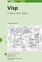
Chablais, map No. 271, in the standard topographic survey of Switzerland at 1:50, 000 from Swisstopo, i.e. without the special overprint highlighting walking trails, local bus stops, etc, presented in Swisstopo’s hiking editions of the 50K survey. The map covers the northern part of the French Alps, including Morzine, Abodance and the resort of the Portes du Soleil skiing area.Highly regarded for their superb use of graphic relief and hill shading, the maps give an almost 3-D picture of Switzerland`s mountainous terrain. Contours are at 20m intervals. All the maps have a 1-km grid with the Swiss national coordinates. This standard version of the 50K survey covers the whole country on 78 small format sheets, with special larger format maps published for several popular tourist
destinations. Small format sheets cover an area of 35 x 24 km (21 x 15 miles approx) and have map legend in the language of the area covered by the map. The special larger sheets cover 50 x 35 km (31 x 22 miles approx) and have no map legend, but a separate leaflet can be provided instead.PLEASE NOTE: the hiking editions of the 1:50, 000 Swisstopo survey are listed on our website in a separate series.
RIP - This product is no longer available on our network. It was last seen on 25.09.2019

This page now acts as a permanent archive for this product. Add more information using the comments box below to ensure it can still be found by future generations.

Use our search facility to see if it is available from an alternative contributor.
  • Availability: Out Of Stock
  • Supplier: Stanfords
  • SKU: 9783302002712
Availability: In Stock
£12.99

Product Description

Chablais, map No. 271, in the standard topographic survey of Switzerland at 1:50, 000 from Swisstopo, i.e. without the special overprint highlighting walking trails, local bus stops, etc, presented in Swisstopo’s hiking editions of the 50K survey. The map covers the northern part of the French Alps, including Morzine, Abodance & the resort of the Portes du Soleil skiing area. Highly regarded for their superb use of graphic relief & hill shading, the maps give an almost 3-D picture of Switzerland`s mountainous terrain. Contours are at 20m intervals. All the maps have a 1-km grid with the Swiss national coordinates. This standard version of the 50K survey covers the whole country on 78 small format sheets, with special larger format maps published for several popular tourist destinations. Small format sheets cover an area of 35 x 24 km (21 x 15 miles approx) & have map legend in the language of the area covered by the map. The special larger sheets cover 50 x 35 km (31 x 22 miles approx) & have no map legend, but a separate leaflet can be provided instead.PLEASE NOTE: the hiking editions of the 1:50, 000 Swisstopo survey are listed on our website in a separate series.

Reviews/Comments

Add New

Price History

Vouchers

No voucher codes found.
Do you know a voucher code for this product or supplier? Add it to Insights for others to use.

Facebook

Jargon Buster

Hiking - An outdoor activity envolving walking in nature
swiss - Short for Switzerland, one of the richest countries in the world
switzerland - A landlocked country in western Europe. One of the richest countries in the world
Language - the method of communication used in different areas. Humans and computers have many different languages.
Km - Kilometre. A unit of measurement equal to 1000 metres.
Small - something that takes up less space than normal.
Popular - Something that is admired and liked by many people.
Language - The way humans communicate either written and spoken.

Supplier Information

Stanfords
Stanfords was established in 1853 and opened their iconic Covent Garden flagship store in 1901. They have become the top retailer of maps, travel books and accessories in the UK and arguably offer the largest selection of maps and travel books worldwide. Famous names such as Captain Robert Falcon Scott, Ranulph Fiennes and Michael Palin have purchased from Stanfords. They now have a shop in Bristol and both stores together with other venues operate a calendar of events including talks, book signings and exhibitions. As a specialist map retailer, the map selection is comprehensive and includes road maps, street maps and walking maps from worldwide destinations, as well as a selection of world atlases and wall maps. Books include travel guides and travel literature. Stanfords also stock globes, from miniatures made of blue marble to magnificent floor-standing globes. The website features a selection of interesting articles on travel topics.
Page Updated: 2023-11-12 20:15:36

Community Generated Product Tags

Oh No! The productWIKI community hasn't generated any tags for this product yet!
Menu