More From Contributor
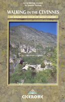
£6.95
Map No. 112, Cesky Raj, in a series of GPS compatible topographic maps of the Czech Republic at 1:75.000 from Shocart highlighting both signposted cycling routes & other local cycling paths, with route profiles & additional tourist information. Relief is shown by contour lines, spot heights, & subtle hill-shading. The maps show roads, tracks, railways, cable cars, chairlifts, & a range of natural landscape features & landmarks. Coloured symbols depict plenty of additional tourist features e.g. information centres, places of interest, antiquities, shelters, campsites, accommodation, bicycle services etc. An overprint highlights both signposted routes & other recommended routes which have no terrain markers. For all bike routes intermediate distances are shown. Hiking paths are also highlighted. Latitude & longitude margin ticks are at 5' intervals. Each map is accompanied by a booklet containing general information on the Czech cycle route network, elevation profile diagram for selected routes, plus an index for locations of historical & geographical interest, bicycle service workshops, information centres, & tourist attractions. Map legend & text are in English, German & Czech. ...
Archived Product
£6.95
Topographic coverage of mainland Spain at 1:50, 000 in the MTN50 (Mapa Topográfico Nacional) series from the Centro Nacional de Información Geografica, the country’s civilian survey organization. The maps have contours at 20m intervals, enhanced by relief shading, plus colouring and/or graphics to show different types of terrain, vegetation or land use. Boundaries of national parks & other protected areas are marked. In addition to all the usual information featured on topographic mapping at this scale, detailed presentation of the road & rail networks, rural tracks & paths, etc, the maps also show campsites & mountain refuges. On more recent editions some GRs, the official long-distance hiking routes, are also marked (although not as clearly as on hiking maps from other publishers). Each map covers 29.5x 18.5 km (with adjustments in the border or coastal areas). The maps have a 1-km UTM grid, plus margin ticks for latitude & longitude at 1` intervals. Map legend is in Spanish only.HOW TO CHOOSE THE RIGHT 50K MAP: all the titles in CNIG’s 200K Provincial Road Maps series at 1:200, 000 are overprinted with the grid for the 1:50, 000 maps & can be used to see the area covered by each 50K title. TO SEE THE LIST OF TITLES IN THIS SERIES PLEASE CLICK ON THE SERIES LINK.PLEASE NOTE
- MAP TITLES: the grids shown on our website serve both the civilian & the military 1:50, 000 topographic series. Although the areas covered by maps in both series are identical (apart from some border or coastal sheets), occasionally map titles differ – only one title is shown on the grid, usually the military one. In Galicia, the Basque country & in the Catalan speaking areas the tendency now is to use local place names rather than the often better known Castilian ones. Where possible, both versions are included in our titles. Map titles listed on our website are based on information received by us at the time of publication, but sometimes maps arrive showing a completely different title! As long as the map number is as ordered, the correct map has been supplied.
...
Archived Product
£6.95
Map No. 637, Cevedale
- Valle di Pejo
- Alta Valfurba, from Kompass in a series providing detailed coverage of the Dolomites

...
Archived Product
£23.95
This Crossbill Guide covers the Cevennes & Grands Causses which combined, form one of the wildest & most beautiful regions of France. This guide describes the flora fauna & natural history of this remarkable area. With 19 detailed route descriptions, the reader is able to explore the Cevennes & Grands Causses on foot & by car. These routes are carefully designed to cover the widest variety of landscapes & to find the most attractive species of birds, mammals, reptiles, amphibians, wildflowers & insects. ...
Archived Product
£12.95
The Robert Louis Stevenson Trail is experienced walker Alan Castle’s Cicerone guide to the GR70 route from Le Puy to St-Jean-Du-Gard. The guide covers the entirety of the route that was made famous by Stevenson’s travels by donkey in the autumn of 1878 along the 140 mile walk through the Velay & Cevennes regions of France (see the Stanfords classic Travels with a donkey in the Cevennes
- stock number 172162). The route today has become a classic one across the hills & along the valley floors of this picturesque area of rural France. The guide is structured in 12 main sections, each reflecting a day’s walking, meaning the Trail can be fitted into a fortnight’s holiday. Each stage has a general overview of the day’s walking & an Information Box providing details of each section of the walk & the total time & distance covered at each location. A comprehensive introduction gives practical guidance on when to go, public transport from the trail, accommodation, equipment, Waymarking & navigation, & notes on language. There are also dedicated sections on the RLS trail, Robert Louis Stevenson himself & his route by cycle or by car. Detailed walk descriptions are accompanied by colour sketch diagrams mapping the route ahead in addition to colour photographs illustrating some of the beauty of this French rural landscape.
...
Archived Product
£30.00
Making ceviche is a serious business in Lima
- & restaurateur Martin Morales, whose top Soho restaurant opened to wide acclaim
...
Archived Product
£9.00
Anyone wishing to navigate mainland European inland waters now needs a CEVNI endorsement to the International Certificate of Confidence (ICC), which can be obtained by passing the appropriate RYA examination. These Flip Cards, printed in colour, are designed to help learn the signs, symbols & lights displayed, which form a major part of CEVNI regulations.50 cards in total. ...
Archived Product
£10.99
Chaîne des Puys
- Massif du Sancy region in a series of GPS compatible, contoured TOP 75 maps at 1:75, 000 from the IGN, highlighting
...
Archived Product
£12.99
Chablais, map No. 271, in the standard topographic survey of Switzerland at 1:50, 000 from Swisstopo, i.e. without the special overprint highlighting walking trails, local bus stops, etc, presented in Swisstopo’s hiking editions of the 50K survey. The map covers the northern part of the French Alps, including Morzine, Abodance & the resort of the Portes du Soleil skiing area. Highly regarded for their superb use of graphic relief & hill shading, the maps give an almost 3-D picture of Switzerland`s mountainous terrain. Contours are at 20m intervals. All the maps have a 1-km grid with the Swiss national coordinates. This standard version of the 50K survey covers the whole country on 78 small format sheets, with special larger format maps published for several popular tourist destinations. Small format sheets cover an area of 35 x 24 km (21 x 15 miles approx) & have map legend in the language of the area covered by the map. The special larger sheets cover 50 x 35 km (31 x 22 miles approx) & have no map legend, but a separate leaflet can be provided instead.PLEASE NOTE: the hiking editions of the 1:50, 000 Swisstopo survey are listed on our website in a separate series. ...
Archived Product

Cevennes Walking

Walking in the Cevennes is Janette Norton’s Cicerone guide to walking in one of France’s most wild and unknown regions. The areas the guide covers are based in the north around Florac and in the south around Le Vigan; it also includes the well-known four day circuit of Mont Lozere. Situated just across the Rhone from Provence, the Cevennes is also home to the Parc National des Cevennes and the upper reaches of the Tarn gorge. The guide is structured in three main parts - Southern Cevennes, Northern Cevennes and a Tour of Mont Lozere - detailing a total of 31 walks in the region. Each walk has a general overview of the route and an Information Box providing details on difficulty ratings, time, height gains, relevant maps and signposting. A detailed introduction gives practical
guidance on when to go, accommodation, clothing and equipment and guidelines for walking in the area. There are also details on the history of southern and northern Cevennes, Cevenese life and guidelines for walking in the area. Detailed walk descriptions are accompanied by sketch diagrams mapping the route in addition to black and white and colour photographs illustrating some of the highlights of the region.
RIP - This product is no longer available on our network. It was last seen on 25.09.2019

This page now acts as a permanent archive for this product. Add more information using the comments box below to ensure it can still be found by future generations.

Use our search facility to see if it is available from an alternative contributor.
  • External links may include paid for promotion
  • Availability: Out Of Stock
  • Supplier: Stanfords
  • SKU: 9781852843366
Availability: In Stock
£12.95

Product Description

Walking in the Cevennes is Janette Norton’s Cicerone guide to walking in one of France’s most wild & unknown regions. The areas the guide covers are based in the north around Florac & in the south around Le Vigan; it also

Includes::
the well-known four day circuit of Mont Lozere. Situated just across the Rhone from Provence, the Cevennes is also home to the Parc National des Cevennes & the upper reaches of the Tarn gorge. The guide is structured in three main parts
- Southern Cevennes, Northern Cevennes & a Tour of Mont Lozere
- detailing a total of 31 walks in the region. Each walk has a general overview of the route & an Information Box providing details on difficulty ratings, time, height gains, relevant maps & signposting. A detailed introduction gives practical guidance on when to go, accommodation, clothing & equipment & guidelines for walking in the area. There are also details on the history of southern & northern Cevennes, Cevenese life & guidelines for walking in the area. Detailed walk descriptions are accompanied by sketch diagrams mapping the route in addition to black & white & colour photographs illustrating some of the highlights of the region.

Reviews/Comments

Add New

Intelligent Comparison

Oooops!
We couldn't find anything!
Perhaps this product's unique.... Or perhaps we are still looking for comparisons!
Click to bump this page and we'll hurry up.

Price History

Vouchers

No voucher codes found.
Do you know a voucher code for this product or supplier? Add it to Insights for others to use.

Facebook

Jargon Buster

Black - A colour which does not emit any colour of the spectrum. Black absorbs all frequencies of the spectrum.
White - A colour combining all colours
France - A state situated in Western Europe with several overseas territories.
History - Anything that happens in the past. An acedemic subject.
Colour - The categorised spectrum of light visable to humans
Day - The time it takes a planet or other space objects to complete one rotation.
Equipment - A product or good that is tactile.
Accommodation - A room in which someone can live in, for example in a hotel
Home - A place of permanent residence for families.
Practical - Weather a task is easy to carry out and realistically succeed.

Supplier Information

Stanfords
Stanfords was established in 1853 and opened their iconic Covent Garden flagship store in 1901. They have become the top retailer of maps, travel books and accessories in the UK and arguably offer the largest selection of maps and travel books worldwide. Famous names such as Captain Robert Falcon Scott, Ranulph Fiennes and Michael Palin have purchased from Stanfords. They now have a shop in Bristol and both stores together with other venues operate a calendar of events including talks, book signings and exhibitions. As a specialist map retailer, the map selection is comprehensive and includes road maps, street maps and walking maps from worldwide destinations, as well as a selection of world atlases and wall maps. Books include travel guides and travel literature. Stanfords also stock globes, from miniatures made of blue marble to magnificent floor-standing globes. The website features a selection of interesting articles on travel topics.
Page Updated: 2023-11-12 20:15:36

Community Generated Product Tags

Oh No! The productWIKI community hasn't generated any tags for this product yet!
Menu