
 United Kingdom
 France
 Germany
 Netherlands
 Sweden
 USA
USA
 Italy
Italy
 Spain
Spain
More From Contributor

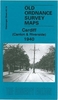

Cardiff North 1915
Cardiff North in 1915 in a fascinating series of reproductions of old Ordnance Survey plans in the Alan Godfrey Editions, ideal for anyone interested in the history of their neighbourhood or family. Coverage stretches from St Andrew`s Crescent and the Cardiff Infirmary northward to Gelligaer Street and Pen-y-Wain Road, and from Nazareth House and North Road eastward to Waterloo Road. Good sections of Roath, Cathays and Tredegarville are shown. Features include University College, City Hall, Welsh National Museum, (shown under construction), Glamorganshire Canal, Cathays Loco Depot, stretches of the Taff Vale Railway and Rhymney Railway, tramways, Mackintosh Institute, southern part of Roath Park, and many packed streets of terraced housing. On the reverse are extracts from a
1906 street directory, including Albany Road, Cathays Terrace, Colum Road, Crwys Road, Diana Street, Donald Street, St Andrew`s Crescent and Wyeverne Street.About the Alan Godfrey Editions of the 25” OS Series:Selected towns in Great Britain and Ireland are covered by maps showing the extent of urban development in the last decades of the 19th and early 20th century. The plans have been taken from the Ordnance Survey mapping and reprinted at about 15 inches to one mile (1:4, 340). On the reverse most maps have historical notes and many also include extracts from contemporary directories. Most maps cover about one mile (1.6kms) north/south, one and a half miles (2.4kms) across; adjoining sheets can be combined to provide wider coverage.FOR MORE INFORMATION AND A COMPLETE LIST OF
ALL AVAILABLE TITLES PLEASE CLICK ON THE SERIES LINK.

Product Description
Reviews/Comments
Add New
Intelligent Comparison
Archived Product
Caerphilly North 1915 Stanfords
£2.95
Archived Product
Radcliffe North 1908 Stanfords
£2.95
Archived Product
Radcliffe North 1908 Stanfords
£3.50
Archived Product

Cambridge North 1901 Stanfords
£3.50
Archived Product

Cheadle North 1916 Stanfords
£2.95
Archived Product
Halifax North 1905 Stanfords
£2.95
Archived Product

Cheadle North 1916 Stanfords
£3.50
Vouchers
No voucher codes found.
Do you know a voucher code for this product or supplier? Add it to Insights for others to use.
Do you know a voucher code for this product or supplier? Add it to Insights for others to use.
 Denmark