More From Contributor

£9.09
Map No. 171, Cardiff & Newport / Caerdydd a Casnewydd, in the waterproof & tear-resistant OS Active version of the Ordnance Survey Landranger series at 1:50, 000 including Abertillery/ Abertyleri, Pontypool/ Pont-y-Pwl, Nargoed/ Bargod, Abercarn, Caerphilly/ Caerffili, Ystrad/ Mynach, Risca, Cwmbran, Caerleon/ Caerllion, Bedlinog, Nelson, Llanishen, Devauden, Shirenewton, Caldicot, Magor, Redwick, Marshfield, Nanrgarw, Pentyrch, St. Fagans, Wenvoe, Barry/ Barri, Penarth, Portishead, Clevedon, Nailsea & Yatton, with the Mouth of the Severn/ Aber Hafren & the southernmost tip of the Brecon Beacons National Park / Parc Cenedlaethol Bannau Brycheiniog with the Llandegfedd Reservoir. Edition C2, 2nd reprint with minor changes; Publication date April 2012 About Ordnance Survey ...
Archived Product
£5.50
Cardiff & Newport Street Atlas at 1:15, 840 / 4 to a mile, in an indexed, glove box size paperback format, with national grid referencing. Street atlas covers Cardiff, Newport, Barry, Caerleon, Caerphilly, Caldicot, Chepstow, Cowbridge, Cwmbran, Dinas Powys, Llantrisant, Llantwit Major, Penarth, Pontypool & Pontypridd, with an enlargement of Cardiff city centre at a scale of 1:7, 920 / 8 ...
Archived Product
£45.00
Geoplan Postcode Sector maps provide high-detail local mapping of the UK overlaid with postcode sectors, country boundaries & larger postcode groupings. They are durable & laminated, so you can draw on them in non-permanent markers & wipe them clean. They are the market-leader postcode maps for marketing, statistical display, route-planning, strategy & many other business uses. The base map uses the latest Ordnance Survey Landranger cartography, which provides detailed geographic data including motorways, A & B roads, streets, & detailed feature types such as airports, railway stations, cities, towns, geographic names, heights (using contour lines), information centres, parking facilities & much more. The base map is light & subtle but clear, readable & now in colour. Postcode/county boundaries & labels are overlaid in a bold red. The Postcode system divides the UK into Areas, Districts & Sectors. Geoplan publish maps covering all of these levels. These Sector maps cover 37 small areas of the UK, showing postcode Sectors (like HG3 1, B10 9, WC2 9 etc), their larger Districts (HG3, B10, WC2 etc) & the even larger Areas (HG, B, WC etc) ...
Archived Product
£3.50
Cardiff Canton & Riverside in 1940 in a fascinating series of reproductions of old Ordnance Survey plans in the Alan Godfrey Editions, ideal for anyone interested in the history of their neighbourhood or family. The map covers the Canton area & part of the Riverside area of Cardiff. Coverage stretches from Cathedral Road & Neville Street westward to Victoria Park, & southward to Virgil Street. Features include Canton railway depot with engine shed, carriage sheds, turntable, sidings etc; Ninian Park football ground, St John`s church, tramways, City Isolation Hospital, Canton Brick Works, Ely River, St Luke`s church, malthouse, slaughter-house, cinemas, City Lodge, Leckwith Road, etc. On the reverse are extracts from a 1906 street directory, including Alexander Road, Atlas Road, Cowbridge Road, Beda Road, Craddock Street, Leckwith Road. Crwys Road, Diana Street, Donald Street, St Andrew`s Crescent & Wyeverne Street. About the Alan Godfrey Editions of the 25” OS Series: Selected towns in Great Britain & Ireland are covered by maps showing the extent of urban development in the last decades of the 19th & early 20th century. The plans have been taken from the Ordnance Survey mapping & reprinted at about 15 inches to one mile (1:4, 340). On the reverse most maps have historical notes & many also include extracts from contemporary directories. Most maps cover about one mile (1.6kms) north/south, one & a half miles (2.4kms) across; adjoining sheets can be combined to provide wider coverage.FOR MORE INFORMATION & A COMPLETE LIST OF ALL AVAILABLE TITLES PLEASE CLICK ON THE SERIES LINK. ...
Archived Product
£3.50
Central Cardiff in 1899 in a fascinating series of reproductions of old Ordnance Survey plans in the Alan Godfrey Editions, ideal for anyone interested in the history of their neighbourhood or family. Two versions have been published for this area, stretching from Clare Street eastward to Sanquhar Street, & from Windsor Place southward to Sophia Street. Features include GWR station, Rhymney station, Taff Vale station, parts of Bute East & West docks with railways, staiths & docks, city centre area, Newtown area, Riverside Junction station, Cardiff Arms Park, Castle, Temperance Town area, Glamorganshire Canal, etc. Extracts from a 1906 street directory are on the reverse of each map. About the Alan Godfrey Editions of the 25” OS Series: Selected towns in Great Britain & Ireland are covered by maps showing the extent of urban development in the last decades of the 19th & early 20th century. The plans have been taken from the Ordnance Survey mapping & reprinted at about 15 inches to one mile (1:4, 340). On the reverse most maps have historical notes & many also include extracts from contemporary directories. Most maps cover about one mile (1.6kms) north/south, one & a half miles (2.4kms) across; adjoining sheets can be combined to provide wider coverage.FOR MORE INFORMATION & A COMPLETE LIST OF ALL AVAILABLE TITLES PLEASE CLICK ON THE SERIES LINK. ...
Archived Product
£3.50
Cardiff East Moors & Splott in 1916 in a fascinating series of reproductions of old Ordnance Survey plans in the Alan Godfrey Editions, ideal for anyone interested in the history of their neighbourhood or family. The map covers the eastern part of Cardiff, including East Moors & Splott. Coverage stretches from Ordell Street eastward & from Splott Park southward. Features include Dowlais Cardiff Works, Tharsis Sulphur & Copper Works, Western Wagon & Property Company Works, other wagon works, Moorland Gardens, Splott Park, Taff Vale Railway Roath Branch, GWR Road Dock Branch, many railway sidings, tramway, etc. On the reverse is a selection of street directory entries for 1906, including Carlisle Street, Habershon Street, Portman Moor Road & Splott Road. About the Alan Godfrey Editions of the 25” OS Series: Selected towns in Great Britain & Ireland are covered by maps showing the extent of urban development in the last decades of the 19th & early 20th century. The plans have been taken from the Ordnance Survey mapping & reprinted at about 15 inches to one mile (1:4, 340). On the reverse most maps have historical notes & many also include extracts from contemporary directories. Most maps cover about one mile (1.6kms) north/south, one & a half miles (2.4kms) across; adjoining sheets can be combined to provide wider coverage.FOR MORE INFORMATION & A COMPLETE LIST OF ALL AVAILABLE TITLES PLEASE CLICK ON THE SERIES LINK. ...
Archived Product
£3.50
Cardiff North in 1915 in a fascinating series of reproductions of old Ordnance Survey plans in the Alan Godfrey Editions, ideal for anyone interested in the history of their neighbourhood or family. Coverage stretches from St Andrew`s Crescent & the Cardiff Infirmary northward to Gelligaer Street & Pen-y-Wain Road, & from Nazareth House & North Road eastward to Waterloo Road. Good sections of Roath, Cathays & Tredegarville are shown. Features include University College, City Hall, Welsh National Museum, (shown under construction), Glamorganshire Canal, Cathays Loco Depot, stretches of the Taff Vale Railway & Rhymney Railway, tramways, Mackintosh Institute, southern part of Roath Park, & many packed streets of terraced housing. On the reverse are extracts from a 1906 street directory, including Albany Road, Cathays Terrace, Colum Road, Crwys Road, Diana Street, Donald Street, St Andrew`s Crescent & Wyeverne Street. About the Alan Godfrey Editions of the 25” OS Series: Selected towns in Great Britain & Ireland are covered by maps showing the extent of urban development in the last decades of the 19th & early 20th century. The plans have been taken from the Ordnance Survey mapping & reprinted at about 15 inches to one mile (1:4, 340). On the reverse most maps have historical notes & many also include extracts from contemporary directories. Most maps cover about one mile (1.6kms) north/south, one & a half miles (2.4kms) across; adjoining sheets can be combined to provide wider coverage.FOR MORE INFORMATION & A COMPLETE LIST OF ALL AVAILABLE TITLES PLEASE CLICK ON THE SERIES LINK. ...
Archived Product
£3.50
Cardiff Pengam & Roath in 1916 in a fascinating series of reproductions of old Ordnance Survey plans in the Alan Godfrey Editions, ideal for anyone interested in the history of their neighbourhood or family. The map covers an area of east Cardiff stretching from Nora Street eastward to Pengam Moors, & from Coventry Street northward to Deri Road. Features include Roath station, GWR line with Pengam Sidings & Junction, Taff Vale Railway Roath Branch, Waterloo Gardens, St Margaret`s church, tramways & depot, Pengam, Roath Pottery, Biscuit Works, etc. On the reverse is a selection of street directory entries including Broadway, Carlisle Street, Pearl Street & Richards Terrace. About the Alan Godfrey Editions of the 25” OS Series: Selected towns in Great Britain & Ireland are covered by maps showing the extent of urban development in the last decades of the 19th & early 20th century. The plans have been taken from the Ordnance Survey mapping & reprinted at about 15 inches to one mile (1:4, 340). On the reverse most maps have historical notes & many also include extracts from contemporary directories. Most maps cover about one mile (1.6kms) north/south, one & a half miles (2.4kms) across; adjoining sheets can be combined to provide wider coverage.FOR MORE INFORMATION & A COMPLETE LIST OF ALL AVAILABLE TITLES PLEASE CLICK ON THE SERIES LINK. ...
Archived Product
£5.50
Cardiff/ Caerdydd Premier Street Plan from Geographers' A-Z Map Company designed to cover the city within its administrative boundaries, with a separate comprehensive index listing streets, places & areas, industrial estates, selected flats & walkways, service areas, stations, & selected places of interest, shown where appropriate with their postcodes. The city is covered at 4 inches to 1 mile (1:15, 840), with an enlargement presenting the town centre in greater clarity at 8 inches to 1 mile (1:7, 920). Coverage
Includes:: Creigiau, Dinas Powys, Marshfield, Penarth, Radyr, St Fagans, St Mellons, Taff
...
Archived Product
£24.99
Cardiff/ Caerdydd Premier Wall Map, size 121 x 96cm, encapsulated version, from Geographers' A-Z Map Company designed to cover the city within its administrative boundaries, with a separate comprehensive index booklet listing streets, places & areas, industrial estates, selected flats & walkways, service areas, stations, & selected places of interest, shown where appropriate with their postcodes. The city is covered at 4 inches to 1 mile (1:15, 840), with an enlargement presenting the town centre in greater clarity at 8 inches to 1 mile (1:7, 920). Coverage
Includes:: Creigiau, Dinas Powys, Marshfield, Penarth, Radyr, St Fagans, St Mellons, Taff
...
Archived Product

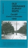
Cardiff Central 1916

Central Cardiff in 1916 in a fascinating series of reproductions of old Ordnance Survey plans in the Alan Godfrey Editions, ideal for anyone interested in the history of their neighbourhood or family. Two versions have been published for this area, stretching from Clare Street eastward to Sanquhar Street, and from Windsor Place southward to Sophia Street. Features include GWR station, Rhymney station, Taff Vale station, parts of Bute East and West docks with railways, staiths and docks, city centre area, Newtown area, Riverside Junction station, Cardiff Arms Park, Castle, Temperance Town area, Glamorganshire Canal, etc. Extracts from a 1906 street directory are on the reverse of each map.About the Alan Godfrey Editions of the 25” OS Series:Selected towns in Great Britain
and Ireland are covered by maps showing the extent of urban development in the last decades of the 19th and early 20th century. The plans have been taken from the Ordnance Survey mapping and reprinted at about 15 inches to one mile (1:4, 340). On the reverse most maps have historical notes and many also include extracts from contemporary directories. Most maps cover about one mile (1.6kms) north/south, one and a half miles (2.4kms) across; adjoining sheets can be combined to provide wider coverage.FOR MORE INFORMATION AND A COMPLETE LIST OF ALL AVAILABLE TITLES PLEASE CLICK ON THE SERIES LINK.
RIP - This product is no longer available on our network. It was last seen on 25.09.2019

This page now acts as a permanent archive for this product. Add more information using the comments box below to ensure it can still be found by future generations.

Use our search facility to see if it is available from an alternative contributor.
  • Availability: Out Of Stock
  • Supplier: Stanfords
  • SKU: 9781847845443
Availability: In Stock
£3.50

Product Description

Central Cardiff in 1916 in a fascinating series of reproductions of old Ordnance Survey plans in the Alan Godfrey Editions, ideal for anyone interested in the history of their neighbourhood or family. Two versions have been published for this area, stretching from Clare Street eastward to Sanquhar Street, & from Windsor Place southward to Sophia Street. Features include GWR station, Rhymney station, Taff Vale station, parts of Bute East & West docks with railways, staiths & docks, city centre area, Newtown area, Riverside Junction station, Cardiff Arms Park, Castle, Temperance Town area, Glamorganshire Canal, etc. Extracts from a 1906 street directory are on the reverse of each map. About the Alan Godfrey Editions of the 25” OS Series: Selected towns in Great Britain & Ireland are covered by maps showing the extent of urban development in the last decades of the 19th & early 20th century. The plans have been taken from the Ordnance Survey mapping & reprinted at about 15 inches to one mile (1:4, 340). On the reverse most maps have historical notes & many also include extracts from contemporary directories. Most maps cover about one mile (1.6kms) north/south, one & a half miles (2.4kms) across; adjoining sheets can be combined to provide wider coverage.FOR MORE INFORMATION & A COMPLETE LIST OF ALL AVAILABLE TITLES PLEASE CLICK ON THE SERIES LINK.

Reviews/Comments

Add New

Price History

Vouchers

No voucher codes found.
Do you know a voucher code for this product or supplier? Add it to Insights for others to use.

Facebook

Jargon Buster

Contemporary - Modern era design
Contemporary - A design reference to indicate post war modern design
History - Anything that happens in the past. An acedemic subject.
Railways - A set of tracks that have been laid for the purpose of trains to travel up and down them
Contemporary - An object that is living in the same time.
Junction - A point where two or more things come together, typically used to describe roads
Ideal - Something that satisfies a perfect criteria.
Family - A group of people that live together made up from parents and children.

Supplier Information

Stanfords
Stanfords was established in 1853 and opened their iconic Covent Garden flagship store in 1901. They have become the top retailer of maps, travel books and accessories in the UK and arguably offer the largest selection of maps and travel books worldwide. Famous names such as Captain Robert Falcon Scott, Ranulph Fiennes and Michael Palin have purchased from Stanfords. They now have a shop in Bristol and both stores together with other venues operate a calendar of events including talks, book signings and exhibitions. As a specialist map retailer, the map selection is comprehensive and includes road maps, street maps and walking maps from worldwide destinations, as well as a selection of world atlases and wall maps. Books include travel guides and travel literature. Stanfords also stock globes, from miniatures made of blue marble to magnificent floor-standing globes. The website features a selection of interesting articles on travel topics.
Page Updated: 2023-11-12 20:15:36

Community Generated Product Tags

Oh No! The productWIKI community hasn't generated any tags for this product yet!
Menu