
 United Kingdom
 France
 Germany
 Netherlands
 Sweden
 USA
USA
 Italy
Italy
 Spain
Spain
More From Contributor


Cheadle North 1916
Cheadle North in 1916 in a fascinating series of reproductions of old Ordnance Survey plans in the Alan Godfrey Editions, ideal for anyone interested in the history of their neighbourhood or family. Selected towns in Great Britain and Ireland are covered by maps showing the extent of urban development in the last decades of the 19th and early 20th century.In this title: the map covers parts of both Lancashire and Cheshire, to include the northern part of Cheadle. Coverage stretches from Cheadle High Street and Stockport Road northward to Cheadle Bridge and 'The Towers' at Didsbury. Features include the River Mersey, stretches of the Cheshire Lines Railway and LNWR, both with Cheadle stations; and a stretch of the LNWR Wilmslow-Levenshulme line; Cheadle Hall, tramways, St Chad's RC
church, Abney Hall, Heaton Mersey Bleach Works, Cheadle Bleach Works, Barnes Convalescent Hospital, Broad Oak Farm etc. A selection of street directory entries is on the reverse, including High Street, Lime Grove, Stockport RoadAbout the Alan Godfrey Editions of the 25
church, Abney Hall, Heaton Mersey Bleach Works, Cheadle Bleach Works, Barnes Convalescent Hospital, Broad Oak Farm etc. A selection of street directory entries is on the reverse, including High Street, Lime Grove, Stockport RoadAbout the Alan Godfrey Editions of the 25

Product Description
Reviews/Comments
Add New
Intelligent Comparison
Archived Product

Cheadle North 1916 Stanfords
£3.50
Archived Product

Colne North 1910 Stanfords
£3.50
Archived Product

Kendal North 1911 Stanfords
£3.50
Archived Product
Chad/Niger: North 16 Stanfords
£14.95
Archived Product

Cambridge North 1901 Stanfords
£3.50
Archived Product
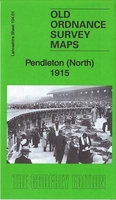
Pendleton North 1915 Stanfords
£3.50
Archived Product

Chorley North 1909 Stanfords
£3.50
Archived Product

Cradley South 1901 Stanfords
£3.50
Vouchers
No voucher codes found.
Do you know a voucher code for this product or supplier? Add it to Insights for others to use.
Do you know a voucher code for this product or supplier? Add it to Insights for others to use.
 Denmark