
 United Kingdom
 France
 Germany
 Netherlands
 Sweden
 USA
USA
 Italy
Italy
 Spain
Spain
More From Contributor


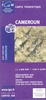


Cameroon & Gabon Reise-Know-How Map
Cameroon and Gabon at 1:1, 300, 000 on a light, waterproof and tear-resistant, indexed road map with topographic and tourist information, published by Reise Know-How as part of their highly acclaimed World Mapping Project. The map is double-sided to provide the best balance between a good scale and a convenient size sheet. The whole of each country is on one side of the map, with coverage also including Equatorial Guinea with Isla de Bioco, and São Tomé e Príncipe. Topography is shown by altitude colouring with contours, spot heights, and graphics for marshlands and seasonal rivers and lakes. National parks and protected areas are highlighted.Road network includes local dirt tracks, indicating driving distances on main roads and locations of petrol stations. Railway lines and
local airfields are also marked. Internal administrative boundaries are shown with names of the provinces. A wide range of symbols highlights various places of interest, including archaeological remains, selected hotels and campsites, beaches, etc. The map has a latitude and longitude grid at intervals of 1°. A separate index of place names is provided for each side, with a list of national parks and reserves. Map legend includes English.*”World Mapping Project”* is an extensive series of maps at varying scales, aiming to provide coverage of countries and regions worldwide using clear, well presented cartography with both topographic and tourist information.
local airfields are also marked. Internal administrative boundaries are shown with names of the provinces. A wide range of symbols highlights various places of interest, including archaeological remains, selected hotels and campsites, beaches, etc. The map has a latitude and longitude grid at intervals of 1°. A separate index of place names is provided for each side, with a list of national parks and reserves. Map legend includes English.*”World Mapping Project”* is an extensive series of maps at varying scales, aiming to provide coverage of countries and regions worldwide using clear, well presented cartography with both topographic and tourist information.

Product Description
Reviews/Comments
Add New
Intelligent Comparison
Archived Product

Central America Reise-Know-How Map Stanfords
£10.50
Archived Product
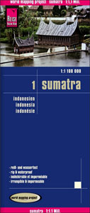
Sumatra Reise-Know-How Map Stanfords
£10.50
Archived Product

Lebanon & Beirut Reise-Know-How Map Stanfords
£7.50
Archived Product

Afghanistan Reise-Know-How Map Stanfords
£10.50
Vouchers
No voucher codes found.
Do you know a voucher code for this product or supplier? Add it to Insights for others to use.
Do you know a voucher code for this product or supplier? Add it to Insights for others to use.
 Denmark