
 United Kingdom
 France
 Germany
 Netherlands
 Sweden
 USA
USA
 Italy
Italy
 Spain
Spain
More From Contributor


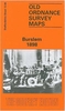


Burslem 1877 (Colour Edition)
Burslem in 1877 in a fascinating series of reproductions of old Ordnance Survey plans in the Alan Godfrey Editions, ideal for anyone interested in the history of their neighbourhood or family. Two versions have been published for this area. The maps cover most of Burslem, one of the Potteries `Six Towns`, together with the smaller settlements of Cobridge and Sneyd Green. Coverage stretches from Newport Lane eastward to Burslem Cemetery and from Moor Lane southward to Port Vale football ground. Features include NSR Potteries Loop Line with Cobridge and Burslem stations, stretch of Trent & Mersey Canal, Burslem Canal, St Paul`s church, Newport Pottery, Mersey Pottery, numerous earthenware manufactories, Hill Works, Town Hall, Butchers` Market, St John`s church, NSR Grange
Branch, Grange Colliery, Grange Farm, Sneyd Colliery & Brick Works, Adelaide Pottery, Port Vale Football Ground, Haywood Home hospital, old coal shafts, Burslem Cemetery, old ironstone shafts, Sneyd Green, tramways, etc. The 1877 version is in colour, taken from the beautifully hand-coloured OS 1st Edition. This map has extracts from a trade directory on the reverse. The 1898 version has a list of private residents from a 1900 directory. About the Alan Godfrey Editions of the 25” OS Series:Selected towns in Great Britain and Ireland are covered by maps showing the extent of urban development in the last decades of the 19th and early 20th century. The plans have been taken from the Ordnance Survey mapping and reprinted at about 15 inches to one mile (1:4, 340). On the reverse
most maps have historical notes and many also include extracts from contemporary directories. Most maps cover about one mile (1.6kms) north/south, one and a half miles (2.4kms) across; adjoining sheets can be combined to provide wider coverage.FOR MORE INFORMATION AND A COMPLETE LIST OF ALL AVAILABLE TITLES PLEASE CLICK ON THE SERIES LINK.
Product Description
Reviews/Comments
Add New
Intelligent Comparison
Archived Product
Dudley 1882 (Colour Edition) Stanfords
£2.95
Archived Product
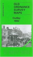
Dudley 1882 (Colour Edition) Stanfords
£4.50
Archived Product
Paisley 1858 (Colour Edition) Stanfords
£2.95
Archived Product
Paisley 1858 (Colour Edition) Stanfords
£4.50
Archived Product
Bath 1883 (Colour Edition) Stanfords
£4.50
Archived Product
Hereford 1885 (Colour Edition) Stanfords
£3.50
Archived Product
Hereford 1885 (Colour Edition) Stanfords
£4.50
Archived Product
Exeter 1888 (Colour Edition) Stanfords
£3.50
Vouchers
No voucher codes found.
Do you know a voucher code for this product or supplier? Add it to Insights for others to use.
Do you know a voucher code for this product or supplier? Add it to Insights for others to use.
 Denmark