More From Contributor

£10.50
Pair Play Europe is a memory game for all the family, with a geographically educational twist. How well do you know the country capitals, flags & key facts on the European continent? Play snap, match the pair or quiz master with Pair Play Europe. Apposite for home entertainment or slipping into your luggage, the game is suitable for between 2 & 6 players of 5 years & over & consists of 108 playing cards, as well as instruction & answer cards. ...
Archived Product
£11.99
Pair Play Europe is a memory game for all the family, with a geographically educational twist. How well do you know the country capitals, flags & key facts on the European continent? Play snap, match the pair or quiz master with Pair Play Europe. Apposite for home entertainment or slipping into your luggage, the game is suitable for between 2 & 6 players of 5 years & over & consists of 108 playing cards, as well as instruction & answer cards. ...
Archived Product
£6.99
Lift the flaps to find the matching pairs in this fun novelty series that`s all about habitats! This book has seven die-cut flaps on every spread for little ones to lift to find the matching pairs, & spot the odd one out. Lift stones to find snails, grass to find ladybirds & lettuce leaves to find caterpillars, then answer a simple counting question. The first two books in the series are Underwater & In the Garden. Printed on sturdy card, perfect for little hands, these books provide enjoyment while out & about or at home, as well as teaching important recognition & memory skills. ...
Archived Product
£6.99
Lift the flaps to find the matching pairs in this fun novelty series that`s all about habitats! This book has seven die-cut flaps on every spread for little ones to lift to find the matching pairs & spot the odd one out. Lift stones to find turtles, seaweed to find seahorses & shells to find crabs, then answer a simple counting question. The first two books in the series are Underwater & In the Garden. Printed on sturdy card, perfect for little hands, these books provide enjoyment while & about or at home, as well as teaching important recognition & memory skills. ...
Archived Product
£2.95
Paisley in 1858 in a fascinating series of reproductions of old Ordnance Survey plans in the Alan Godfrey Editions, ideal for anyone interested in the history of their neighbourhood or family. Selected towns in Great Britain & Ireland are covered by maps showing the extent of urban development in the last decades of the 19th & early 20th century. In this title: two versions have been published for this area. Coverage extends from Ferguslie House & the cemetery eastward to Greenlaw Avenue & Kilnside Road; & from Clark Street southward to Maxwellton & Canal Street. Features include the town centre, Fountain Gardens, GSWR railway with Gilmour Street station, CR Greenock Branch, Canal Branch with station, Distilleries, Anchor Mills, Kilnside House, White Cart Water, John Neilson Educational Institution, Town Hall, The Abbey, Greenlaw Goods station, Hot House Works, Female Refuge, Woodside House, football ground, Trotting Ground, Iron Works, George Street area, etc. On the reverse of the 1896 version are street directory entries for Incle Street, Johnson Street, Kilnside Road, Love Street, Maxwellton, Moss Street; on the 1858 edition which is in colour are 1866 railway timetables. About the Alan Godfrey Editions of the 25 ...
Archived Product
£3.50
Paisley in 1896 in a fascinating series of reproductions of old Ordnance Survey plans in the Alan Godfrey Editions, ideal for anyone interested in the history of their neighbourhood or family. Two versions have been published for this area. Coverage extends from Ferguslie House & the cemetery eastward to Greenlaw Avenue & Kilnside Road, & from Clark Street southward to Maxwellton & Canal Street. Features include the town centre, Fountain Gardens, GSWR railway with Gilmour Street station, CR Greenock Branch, Canal Branch with station, Distilleries, Anchor Mills, Kilnside House, White Cart Water, John Neilson Educational Institution, Town Hall, The Abbey, Greenlaw Goods station, Hot House Works, Female Refuge, Woodside House, football ground, Trotting Ground, Iron Works, George Street area, etc. On the reverse of the 1896 version are street directory entries for Incle Street, Johnson Street, Kilnside Road, Love Street, Maxwellton & Moss Street; on the 1858 edition which is in colour are 1866 railway timetables. About the Alan Godfrey Editions of the 25” OS Series: Selected towns in Great Britain & Ireland are covered by maps showing the extent of urban development in the last decades of the 19th & early 20th century. The plans have been taken from the Ordnance Survey mapping & reprinted at about 15 inches to one mile (1:4, 340). On the reverse most maps have historical notes & many also include extracts from contemporary directories. Most maps cover about one mile (1.6kms) north/south, one & a half miles (2.4kms) across; adjoining sheets can be combined to provide wider coverage.FOR MORE INFORMATION & A COMPLETE LIST OF ALL AVAILABLE TITLES PLEASE CLICK ON THE SERIES LINK. ...
Archived Product
£17.99
The 1:50 000 topographic map gives a more general picture of the ground features than a basic map. It shows settlements, houses, roads, cultivated areas, waterways, cutting areas, mires, rock exposures, & relief. One map sheet covers an area of 30 x 40 km & one centimetre corresponds to 500 metres on the ground. The 1:50, 000 topographic map is also an ideal complement to nautical charts as it provides useful information about the land areas adjacent to waterways. For example, all Finnish sea areas are covered by 1:50 000 topographic map sheets. ...
Archived Product
£9.99
Map No. 708, Paiute ATV Trail, UT, in an extensive series of GPS compatible, contoured hiking maps of USA’s national & state parks or forests & other popular recreational areas. Cartography based on the national topographic survey, with additional tourist information. The maps, with most titles now printed on light, waterproof & tear-resistant plastic paper, highlight walking trails along with campsites & other accommodation, picnic sites, areas for various recreational pursuits such as horse riding or skiing, drinking water sources, & many other facilities of interest to the outdoor enthusiast. Cartography is based on information from the USGS (United States Geological Survey
- the country’s national survey organization), revised by the National Geographic Maps in cooperation with the National Park Service, USDA Forest Service, etc. Topography is excellently presented by contours (interval varies according to scale), enhanced by relief shading & colouring/graphics for wood cover, glaciers, etc. All heights are given in feet. The maps have a UTM grid plus latitude & longitude margin ticks & GPS waypoints for selected important locations. Each map is double-sided to give either maximum coverage of the chosen area or additional enlargements of its important sections. Accompanying notes provide useful information on relevant regulations, safety precautions, contact addresses, etc.* *IMPORTANT
- PLEASE NOTE: the series is very extensive, ranging in scale from 1:400, 000 for the vast national parks of Alaska to 1:25, 000 for local map in several states. We recommend, therefore, viewing the series by state rather than the whole list.*

...
Archived Product
£16.99
Topographic survey of Sweden at 1:100, 000, the Vägkartan, from the Lantmäteriet, covering most of the country in 79 double-sided maps. Please note: the mountainous regions of central & northern Sweden are not covered by this series but presented in a separate “ Fjällkartan
- Mountain Map” series also listed on our website. Each 1:100, 000 topographic survey map covers an area of 75 x 80km. The maps have contours at 10 metre intervals, plus relief shading & colouring for different types of landscape: open l&, forests, alvar, marshes, etc. Boundaries of national parks & nature reserves, areas prohibited to cross-country vehicles, & restricted entry military zones are marked. The maps indicate privately maintained local roads, cycle paths with wind shelters, footpaths, etc, & include all other information expected of topographic survey at this scale. The maps have a 2-km UTM grid, plus latitude & longitude lines 10’ intervals. Map legend

Includes::
English. For coverage of the country’s most visited hiking areas in central & northern Sweden please see Lantmäteriet’s Mountain Map series, listed separately on our website.


...
Archived Product
£6.50
Topographic coverage of the Canary Islands at 1:25, 000 published by the Instituto Geográfico Nacional – Centro Nacional de Información Geografica, the country’s civilian survey organization. The maps have contours at 10m intervals & colouring and/or graphics to show different types of vegetation or land use. Boundaries of national parks & other protected areas are marked. In addition to all the usual information shown on topographic mapping at this scale: detailed presentation of the road network with rural tracks & paths, etc, the maps also show campsites. The maps have a 1-km UTM grid, plus margin ticks for latitude & longitude at 1` intervals. The majority of the titles have been published since late 1990s. Map legend is in Spanish only.COVERAGE: each 25K map covers one quarter of the corresponding 1:50, 000 map, with the numbering system: I = NW quarter, II = NE quarter, III = SW quarter, & IV = SE quarter. To see other titles in this series please click on the series link. ...
Archived Product

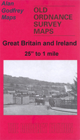
Paisley 1858 (Colour Edition)

Paisley in 1858 in a fascinating series of reproductions of old Ordnance Survey plans in the Alan Godfrey Editions, ideal for anyone interested in the history of their neighbourhood or family. Two versions have been published for this area. Coverage extends from Ferguslie House and the cemetery eastward to Greenlaw Avenue and Kilnside Road, and from Clark Street southward to Maxwellton and Canal Street. Features include the town centre, Fountain Gardens, GSWR railway with Gilmour Street station, CR Greenock Branch, Canal Branch with station, Distilleries, Anchor Mills, Kilnside House, White Cart Water, John Neilson Educational Institution, Town Hall, The Abbey, Greenlaw Goods station, Hot House Works, Female Refuge, Woodside House, football ground, Trotting Ground, Iron
Works, George Street area, etc. On the reverse of the 1896 version are street directory entries for Incle Street, Johnson Street, Kilnside Road, Love Street, Maxwellton and Moss Street; on the 1858 edition which is in colour are 1866 railway timetables.About the Alan Godfrey Editions of the 25” OS Series:Selected towns in Great Britain and Ireland are covered by maps showing the extent of urban development in the last decades of the 19th and early 20th century. The plans have been taken from the Ordnance Survey mapping and reprinted at about 15 inches to one mile (1:4, 340). On the reverse most maps have historical notes and many also include extracts from contemporary directories. Most maps cover about one mile (1.6kms) north/south, one and a half miles (2.4kms) across; adjoining
sheets can be combined to provide wider coverage.FOR MORE INFORMATION AND A COMPLETE LIST OF ALL AVAILABLE TITLES PLEASE CLICK ON THE SERIES LINK.
RIP - This product is no longer available on our network. It was last seen on 25.09.2019

This page now acts as a permanent archive for this product. Add more information using the comments box below to ensure it can still be found by future generations.

Use our search facility to see if it is available from an alternative contributor.
  • Availability: Out Of Stock
  • Supplier: Stanfords
  • SKU: 9781847845634
Availability: In Stock
£4.50

Product Description

Paisley in 1858 in a fascinating series of reproductions of old Ordnance Survey plans in the Alan Godfrey Editions, ideal for anyone interested in the history of their neighbourhood or family. Two versions have been published for this area. Coverage extends from Ferguslie House & the cemetery eastward to Greenlaw Avenue & Kilnside Road, & from Clark Street southward to Maxwellton & Canal Street. Features include the town centre, Fountain Gardens, GSWR railway with Gilmour Street station, CR Greenock Branch, Canal Branch with station, Distilleries, Anchor Mills, Kilnside House, White Cart Water, John Neilson Educational Institution, Town Hall, The Abbey, Greenlaw Goods station, Hot House Works, Female Refuge, Woodside House, football ground, Trotting Ground, Iron Works, George Street area, etc. On the reverse of the 1896 version are street directory entries for Incle Street, Johnson Street, Kilnside Road, Love Street, Maxwellton & Moss Street; on the 1858 edition which is in colour are 1866 railway timetables. About the Alan Godfrey Editions of the 25” OS Series: Selected towns in Great Britain & Ireland are covered by maps showing the extent of urban development in the last decades of the 19th & early 20th century. The plans have been taken from the Ordnance Survey mapping & reprinted at about 15 inches to one mile (1:4, 340). On the reverse most maps have historical notes & many also include extracts from contemporary directories. Most maps cover about one mile (1.6kms) north/south, one & a half miles (2.4kms) across; adjoining sheets can be combined to provide wider coverage.FOR MORE INFORMATION & A COMPLETE LIST OF ALL AVAILABLE TITLES PLEASE CLICK ON THE SERIES LINK.

Reviews/Comments

Add New

Intelligent Comparison

Oooops!
We couldn't find anything!
Perhaps this product's unique.... Or perhaps we are still looking for comparisons!
Click to bump this page and we'll hurry up.

Price History

Vouchers

No voucher codes found.
Do you know a voucher code for this product or supplier? Add it to Insights for others to use.

Facebook

Jargon Buster

Contemporary - Modern era design
Contemporary - A design reference to indicate post war modern design
White - A colour combining all colours
Football - A sport involving kicking a ball and trying to score a goal
water - A chemical substance. Chemical formula H2O.
hot - An indication of the temperature being high and a sensation of heat to the tough
iron - An electrical deviced used for removing creases from fabrics
iron - A chemical element (FE). The most common element on earth
History - Anything that happens in the past. An acedemic subject.
Colour - The categorised spectrum of light visable to humans
Love - Someone who shows deep affection for someone else.
Road - a manmade lane or a path that is used to speed up travel.
Contemporary - An object that is living in the same time.
Hall - A room at the inside of an entrance of a house.
Ideal - Something that satisfies a perfect criteria.
Family - A group of people that live together made up from parents and children.

Supplier Information

Stanfords
Stanfords was established in 1853 and opened their iconic Covent Garden flagship store in 1901. They have become the top retailer of maps, travel books and accessories in the UK and arguably offer the largest selection of maps and travel books worldwide. Famous names such as Captain Robert Falcon Scott, Ranulph Fiennes and Michael Palin have purchased from Stanfords. They now have a shop in Bristol and both stores together with other venues operate a calendar of events including talks, book signings and exhibitions. As a specialist map retailer, the map selection is comprehensive and includes road maps, street maps and walking maps from worldwide destinations, as well as a selection of world atlases and wall maps. Books include travel guides and travel literature. Stanfords also stock globes, from miniatures made of blue marble to magnificent floor-standing globes. The website features a selection of interesting articles on travel topics.
Page Updated: 2023-11-12 20:15:36

Community Generated Product Tags

Oh No! The productWIKI community hasn't generated any tags for this product yet!
Menu