
 United Kingdom
 France
 Germany
 Netherlands
 Sweden
 USA
USA
 Italy
Italy
 Spain
Spain
More From Contributor


Paisley 1858 (Colour Edition)
Paisley in 1858 in a fascinating series of reproductions of old Ordnance Survey plans in the Alan Godfrey Editions, ideal for anyone interested in the history of their neighbourhood or family. Selected towns in Great Britain and Ireland are covered by maps showing the extent of urban development in the last decades of the 19th and early 20th century.In this title: two versions have been published for this area. Coverage extends from Ferguslie House and the cemetery eastward to Greenlaw Avenue and Kilnside Road; and from Clark Street southward to Maxwellton and Canal Street. Features include the town centre, Fountain Gardens, GSWR railway with Gilmour Street station, CR Greenock Branch, Canal Branch with station, Distilleries, Anchor Mills, Kilnside House, White Cart Water, John
Neilson Educational Institution, Town Hall, The Abbey, Greenlaw Goods station, Hot House Works, Female Refuge, Woodside House, football ground, Trotting Ground, Iron Works, George Street area, etc. On the reverse of the 1896 version are street directory entries for Incle Street, Johnson Street, Kilnside Road, Love Street, Maxwellton, Moss Street; on the 1858 edition which is in colour are 1866 railway timetables.About the Alan Godfrey Editions of the 25
Neilson Educational Institution, Town Hall, The Abbey, Greenlaw Goods station, Hot House Works, Female Refuge, Woodside House, football ground, Trotting Ground, Iron Works, George Street area, etc. On the reverse of the 1896 version are street directory entries for Incle Street, Johnson Street, Kilnside Road, Love Street, Maxwellton, Moss Street; on the 1858 edition which is in colour are 1866 railway timetables.About the Alan Godfrey Editions of the 25
Product Description
Reviews/Comments
Add New
Intelligent Comparison
Archived Product
Paisley 1858 (Colour Edition) Stanfords
£4.50
Archived Product
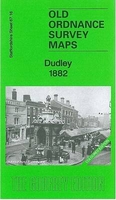
Dudley 1882 (Colour Edition) Stanfords
£4.50
Archived Product
Dudley 1882 (Colour Edition) Stanfords
£2.95
Archived Product
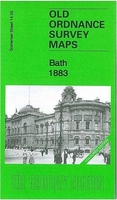
Bath 1883 (Colour Edition) Stanfords
£4.50
Archived Product
Exeter 1888 (Colour Edition) Stanfords
£3.50
Archived Product
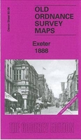
Exeter 1888 (Colour Edition) Stanfords
£4.50
Archived Product
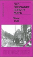
Bilston 1884 (Coloured Edition) Stanfords
£4.50
Archived Product
Edgbaston 1887 (Colour Edition) Stanfords
£2.95
Vouchers
No voucher codes found.
Do you know a voucher code for this product or supplier? Add it to Insights for others to use.
Do you know a voucher code for this product or supplier? Add it to Insights for others to use.
 Denmark