More From Contributor

£20.00
In 2011, we published Billy Connolly`s Route 66
- the story of the legendary Scottish comedian`s journey along the most famous
...
Archived Product
£8.99
The classic comedy of a 50s youth trapped inside a Walter Mitty fantasy-world, published as a Penguin Essential for the first time. Keith Waterhouse`s Billy Liar was published in 1959, & captures brilliantly the claustrophobic atmosphere of a small town. It tells the story of Billy Fisher, a Yorkshire teenager unable to stop lying
- especially to his three girlfriends. Trapped by his boring job & working-class parents, Billy finds that his only happiness lies in grand plans for his future & fantastical day-dreams of the fictional country Ambrosia.
...
Archived Product
£25.00
Ever eaten at Bill`s? If you haven`t, then put it on your To Do list. If you have, then you`ll know it`s all about the atmosphere & the food
- it`s delicious, it`s different, it`s full of fabulous flavours & textures; a unique celebration of eating. From breakfast to bedtime, from the first green shoots of spring to the frostiest of winter days, Bill picks & cooks his way through the seasons. Choosing favourites as he goes & bringing colour & energy to even the simplest dishes, this book is packed with recipes & ideas that will inspire you to cook, eat & smile every day of the year.
...
Archived Product
£20.00
The big, bold taste explosions of Asia & the fresh, lively combinations of ingredients have had Bill Granger hooked since childhood. To him, the Asian dishes he most loves to cook & eat aren`t exotic but quick, easy & healthy everyday food, whether intensely fresh & zingy or deeply savoury & satisfying. For Bill`s Everyday Asian Bill has simplified his favourite classics to create the very best that Asian food has to offer, drawing on his own colourful & varied experiences: from a home-cooked dinner in Singapore to a businessman`s breakfast in Japan, along with his most memorable flavour encounters at beach shacks, restaurants & roadside stalls. Beef rendang, pad Thai, satay chicken & bibimbap have all been given the Bill makeover to tantalise the tastebuds & fit our busy lives. ...
Archived Product
£5.99
Bill Simpson wakes up to find he’s a girl, & worse, his mother makes him wear a frilly pink dress to school. How on earth is he going to survive a whole day like this? Everything just seems to be different for girls... Perfect for readers aged 7 years & up & fans of The Boy in the Dress by David Walliams. Anne Fine’s fun school stories have been delighting children for more than 20 years, winning her awards such as the Smarties Book Award & Carnegie Medal along the way. ...
Archived Product
£3.50
Bilston in 1901 in a fascinating series of reproductions of old Ordnance Survey plans in the Alan Godfrey Editions, ideal for anyone interested in the history of their neighbourhood or family. Two maps have been published for this area
- the 1884 version, taken from the OS First Edition, is in colour. Most of the town of Bilston is covered on the map. Other features on the 1884 map include Bankfield Iron Works, Bradley Iron & Tin Works, Bradley Field Iron Works, Regent Iron Works, Bradley Lodge Colliery, Fiery Holes, Barbor`s Field Furnaces, Capponfield Iron Works, Factory Iron Works, Bilston Quarries, Bilston Foundry, Bovereux Furnaces (disused), The Lune, Mount Pleasant area, tramway, Birmingham Canal, GWR railway with station, GWR (OWW Branch) with station, Broad Lanes Colliery, Finneywell Colliery, Lunt Colliery, Town Hall, Market Place, etc. The 1901 map covers the same area at a later stage, showing some expansion of the town but many of the factories now disused. About the Alan Godfrey Editions of the 25” OS Series: Selected towns in Great Britain & Ireland are covered by maps showing the extent of urban development in the last decades of the 19th & early 20th century. The plans have been taken from the Ordnance Survey mapping & reprinted at about 15 inches to one mile (1:4, 340). On the reverse most maps have historical notes & many also include extracts from contemporary directories. Most maps cover about one mile (1.6kms) north/south, one & a half miles (2.4kms) across; adjoining sheets can be combined to provide wider coverage.FOR MORE INFORMATION & A COMPLETE LIST OF ALL AVAILABLE TITLES PLEASE CLICK ON THE SERIES LINK.
...
Archived Product
£9.50
Topographical survey of Belgium at 1:20, 000 from Nationaal Geografisch Instituut / Institut Géographique National, the country’s national survey organization. Each 20K map covers one quarter of the corresponding 1:50, 000 map (with adjustments in the border & coastal areas). The maps provide all the information expected of topographic mapping at this scale & in addition have an unusually large amount of vegetation and/or land use information (different types of woodlands, gardens, orchards, heath, etc). The maps have a 1-km UTM grid, with margin ticks for latitude & longitude at intervals of 1`. Map legend & a glossary of terms used on the maps include English. Stanfords keeps as regular stock 20K maps for the World War I battlefields around the Ypres, Messines & Passchendaele, & for the area of the Battle of Waterloo. The 1:20, 000 survey covers the whole of Belgium & maps for other regions can be supplied as special orders. To see the list of titles in this series please click on the series link.PLEASE NOTE: the Long-Distance Footpaths Map of Belgium at 1:300, 000 which shows the division of Belgium into the 50K survey sheets can also be used to see in more detail coverage by the 20K maps. ...
Archived Product
£9.99
Fancy something a bit different for this year's family holiday, but don't know what? Bin the Bucket & Spade: Unusual Family Holidays in the Usual Destinations is packed with ideas for holidays with a difference for you & your kids.A dozen sections, from theme parks to wildlife holidays, city breaks to Christmas breaks, give hundreds of ideas for great, unusual holidays in Europe & the US, with information, & guides to temperatures, prices & where to find individual organisers & operators to book with. ...
Archived Product
£9.50
Topographical survey of Belgium at 1:20, 000 from Nationaal Geografisch Instituut / Institut Géographique National, the country’s national survey organization. Each 20K map covers one quarter of the corresponding 1:50, 000 map (with adjustments in the border & coastal areas). The maps provide all the information expected of topographic mapping at this scale & in addition have an unusually large amount of vegetation and/or land use information (different types of woodlands, gardens, orchards, heath, etc). The maps have a 1-km UTM grid, with margin ticks for latitude & longitude at intervals of 1`. Map legend & a glossary of terms used on the maps include English. Stanfords keeps as regular stock 20K maps for the World War I battlefields around the Ypres, Messines & Passchendaele, & for the area of the Battle of Waterloo. The 1:20, 000 survey covers the whole of Belgium & maps for other regions can be supplied as special orders. To see the list of titles in this series please click on the series link.PLEASE NOTE: the Long-Distance Footpaths Map of Belgium at 1:300, 000 which shows the division of Belgium into the 50K survey sheets can also be used to see in more detail coverage by the 20K maps. ...
Archived Product
£6.99
An exciting new relaunch of Ted Dewan`s Bing books
- resized & beautifully produced for the next generation of toddlers
- paving

...
Archived Product

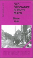
Bilston 1884 (Coloured Edition)

Bilston in 1884 in a fascinating series of reproductions of old Ordnance Survey plans in the Alan Godfrey Editions, ideal for anyone interested in the history of their neighbourhood or family. Two maps have been published for this area - the 1884 version, taken from the OS First Edition, is in colour. Most of the town of Bilston is covered on the map. Other features on the 1884 map include Bankfield Iron Works, Bradley Iron & Tin Works, Bradley Field Iron Works, Regent Iron Works, Bradley Lodge Colliery, Fiery Holes, Barbor`s Field Furnaces, Capponfield Iron Works, Factory Iron Works, Bilston Quarries, Bilston Foundry, Bovereux Furnaces (disused), The Lune, Mount Pleasant area, tramway, Birmingham Canal, GWR railway with station, GWR (OWW Branch) with station, Broad
Lanes Colliery, Finneywell Colliery, Lunt Colliery, Town Hall, Market Place, etc. The 1901 map covers the same area at a later stage, showing some expansion of the town but many of the factories now disused. About the Alan Godfrey Editions of the 25” OS Series:Selected towns in Great Britain and Ireland are covered by maps showing the extent of urban development in the last decades of the 19th and early 20th century. The plans have been taken from the Ordnance Survey mapping and reprinted at about 15 inches to one mile (1:4, 340). On the reverse most maps have historical notes and many also include extracts from contemporary directories. Most maps cover about one mile (1.6kms) north/south, one and a half miles (2.4kms) across; adjoining sheets can be combined to provide wider
coverage.FOR MORE INFORMATION AND A COMPLETE LIST OF ALL AVAILABLE TITLES PLEASE CLICK ON THE SERIES LINK.
RIP - This product is no longer available on our network. It was last seen on 25.09.2019

This page now acts as a permanent archive for this product. Add more information using the comments box below to ensure it can still be found by future generations.

Use our search facility to see if it is available from an alternative contributor.
  • Availability: Out Of Stock
  • Supplier: Stanfords
  • SKU: 9781847845061
Availability: In Stock
£4.50

Product Description

Bilston in 1884 in a fascinating series of reproductions of old Ordnance Survey plans in the Alan Godfrey Editions, ideal for anyone interested in the history of their neighbourhood or family. Two maps have been published for this area
- the 1884 version, taken from the OS First Edition, is in colour. Most of the town of Bilston is covered on the map. Other features on the 1884 map include Bankfield Iron Works, Bradley Iron & Tin Works, Bradley Field Iron Works, Regent Iron Works, Bradley Lodge Colliery, Fiery Holes, Barbor`s Field Furnaces, Capponfield Iron Works, Factory Iron Works, Bilston Quarries, Bilston Foundry, Bovereux Furnaces (disused), The Lune, Mount Pleasant area, tramway, Birmingham Canal, GWR railway with station, GWR (OWW Branch) with station, Broad Lanes Colliery, Finneywell Colliery, Lunt Colliery, Town Hall, Market Place, etc. The 1901 map covers the same area at a later stage, showing some expansion of the town but many of the factories now disused. About the Alan Godfrey Editions of the 25” OS Series: Selected towns in Great Britain & Ireland are covered by maps showing the extent of urban development in the last decades of the 19th & early 20th century. The plans have been taken from the Ordnance Survey mapping & reprinted at about 15 inches to one mile (1:4, 340). On the reverse most maps have historical notes & many also include extracts from contemporary directories. Most maps cover about one mile (1.6kms) north/south, one & a half miles (2.4kms) across; adjoining sheets can be combined to provide wider coverage.FOR MORE INFORMATION & A COMPLETE LIST OF ALL AVAILABLE TITLES PLEASE CLICK ON THE SERIES LINK.

Reviews/Comments

Add New

Price History

Vouchers

No voucher codes found.
Do you know a voucher code for this product or supplier? Add it to Insights for others to use.

Facebook

Jargon Buster

Contemporary - Modern era design
Contemporary - A design reference to indicate post war modern design
iron - An electrical deviced used for removing creases from fabrics
iron - A chemical element (FE). The most common element on earth
History - Anything that happens in the past. An acedemic subject.
Colour - The categorised spectrum of light visable to humans
Contemporary - An object that is living in the same time.
Hall - A room at the inside of an entrance of a house.
Ideal - Something that satisfies a perfect criteria.
Family - A group of people that live together made up from parents and children.

Supplier Information

Stanfords
Stanfords was established in 1853 and opened their iconic Covent Garden flagship store in 1901. They have become the top retailer of maps, travel books and accessories in the UK and arguably offer the largest selection of maps and travel books worldwide. Famous names such as Captain Robert Falcon Scott, Ranulph Fiennes and Michael Palin have purchased from Stanfords. They now have a shop in Bristol and both stores together with other venues operate a calendar of events including talks, book signings and exhibitions. As a specialist map retailer, the map selection is comprehensive and includes road maps, street maps and walking maps from worldwide destinations, as well as a selection of world atlases and wall maps. Books include travel guides and travel literature. Stanfords also stock globes, from miniatures made of blue marble to magnificent floor-standing globes. The website features a selection of interesting articles on travel topics.
Page Updated: 2023-11-12 20:15:36

Community Generated Product Tags

Oh No! The productWIKI community hasn't generated any tags for this product yet!
Menu