
 United Kingdom
 France
 Germany
 Netherlands
 Sweden
 USA
USA
 Italy
Italy
 Spain
Spain
More From Contributor


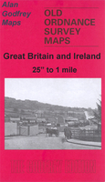
Birmingham East 1888 (Coloured Edition)
Birmingham East in 1888 in a fascinating series of reproductions of old Ordnance Survey plans in the Alan Godfrey Editions, ideal for anyone interested in the history of their neighbourhood or family. Two versions have been published for this area, covering the eastern side of Birmingham and stretching from St Andrew`s Road eastward to Blakeland Street, and from St Saviour`s Road southward to Grange Road. Features include the Bordesley Green area, Little Bromwich, Adderley Park, St Andrew`s church, LNWR railway with Adderley Park station, Gloucester Junction, St Andrew`s Junction, Britannia Works, Midland Works (carriage and wagon works), Saltley Training College, Wolseley car works, Union Paper Mill, Little Green Lane area, Saltley Reformatory etc. On the reverse are
extracts from early directories. The 1888 version is in colour, taken from the OS 1st Edition hand-coloured map. About the Alan Godfrey Editions of the 25” OS Series:Selected towns in Great Britain and Ireland are covered by maps showing the extent of urban development in the last decades of the 19th and early 20th century. The plans have been taken from the Ordnance Survey mapping and reprinted at about 15 inches to one mile (1:4, 340). On the reverse most maps have historical notes and many also include extracts from contemporary directories. Most maps cover about one mile (1.6kms) north/south, one and a half miles (2.4kms) across; adjoining sheets can be combined to provide wider coverage.FOR MORE INFORMATION AND A COMPLETE LIST OF ALL AVAILABLE TITLES PLEASE CLICK ON THE SERIES
LINK.
 "Pin It")
Product Description
Reviews/Comments
Add New
Vouchers
No voucher codes found.
Do you know a voucher code for this product or supplier? Add it to Insights for others to use.
Do you know a voucher code for this product or supplier? Add it to Insights for others to use.
 Denmark