
 United Kingdom
 France
 Germany
 Netherlands
 Sweden
 USA
USA
 Italy
Italy
 Spain
Spain
More From Contributor


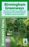
Birmingham Greenways Cycle Map
Birmingham Greenways Cycle Map at 1:30, 000 showing 150 miles of traffic-free cycling paths around Birmingham and the Black Country. With central Birmingham on both sides of the map, coverage extends to Walsall, Sutton Coldfield, Solihull, Barnt Green, Halesowen, Dudley and Bilston. Highlighting for the routes indicates off-road/towpath sections, off-road poorer surface, paths adjacent to a main road, and linking routes, as well as points where special care or dismounting is required. Symbols show locations of various facilities and places of interest, and given the number of canals within this area, information includes canal locks, boat hire or trips, and watersport facilities. The map has lines at 500m with coordinates of the British National Grid and has an index of
tourist attractions and heritage sites.The centre of Birmingham is shown in greater detail at 1:15, 000 approx, with more facilities such as pubs, car parks, etc. The map is surrounded by colour photos and descriptions of places of interest, plus general notes about the history of the area.
tourist attractions and heritage sites.The centre of Birmingham is shown in greater detail at 1:15, 000 approx, with more facilities such as pubs, car parks, etc. The map is surrounded by colour photos and descriptions of places of interest, plus general notes about the history of the area.

Product Description
Reviews/Comments
Add New
Vouchers
No voucher codes found.
Do you know a voucher code for this product or supplier? Add it to Insights for others to use.
Do you know a voucher code for this product or supplier? Add it to Insights for others to use.
 Denmark