More From Contributor

£3.50
Burnt Oak & Little Stanmore in 1895 in a fascinating series of reproductions of old Ordnance Survey plans in the Alan Godfrey Editions, ideal for anyone interested in the history of their neighbourhood or family. The map covers the western half of Burnt Oak, including the stretch of the Edgware Road or Watling Street between Red Hill & Edgware Bridge; here we find Hendon Workhouse, Burntoak Farm & a few others buildings. This group is at the east side of the map, which extends westward to Honeypot Lane, north to St Lawrence`s church & Whitchurch Lane. On the reverse is a large extract from the 1935 revision, showing the Burnt Oak area almost entirely built up. Features on this include the De Havilland Aircraft Works, Redhill County Hospital, while the Workhouse has become Redhill Institution; many streets have been laid out & built upon west of the Edgware Road. About the Alan Godfrey Editions of the 25” OS Series: Selected towns in Great Britain & Ireland are covered by maps showing the extent of urban development in the last decades of the 19th & early 20th century. The plans have been taken from the Ordnance Survey mapping & reprinted at about 15 inches to one mile (1:4, 340). On the reverse most maps have historical notes & many also include extracts from contemporary directories. Most maps cover about one mile (1.6kms) north/south, one & a half miles (2.4kms) across; adjoining sheets can be combined to provide wider coverage.FOR MORE INFORMATION & A COMPLETE LIST OF ALL AVAILABLE TITLES PLEASE CLICK ON THE SERIES LINK. ...
Archived Product
£7.99
In a prison cell in the US, a man stands trembling, naked, fearfully waiting to be shipped to Guantanamo Bay. How did it come to this? he wonders. August 9th, 1945, Nagasaki. Hiroko Tanaka steps out onto her veranda, taking in the view of the terraced slopes leading up to the sky. Wrapped in a kimono with three black cranes swooping across the back, she is twenty-one, in love with the man she is to marry, Konrad Weiss. In a split second, the world turns white. In the next, it explodes with the sound of fire & the horror of realisation. In the numbing aftermath of a bomb that obliterates everything she has known, all that remains are the bird-shaped burns on her back, an indelible reminder of the world she has lost. In search of new beginnings, she travels to Delhi two years later. There she walks into the lives of Konrad`s half-sister, Elizabeth, her husband James Burton, & their employee Sajjad Ashraf, from whom she starts to learn Urdu. As the years unravel, new homes replace those left behind & old wars are seamlessly usurped by new conflicts. But the shadows of history
- personal, political
- are cast over the entwined worlds of the Burtons, Ashrafs & the Tanakas as they are transported from Pakistan to New York, & in the novel`s astonishing climax, to Afghanistan in the immediate wake of 9/11. The ties that have bound them together over decades & generations are tested to the extreme, with unforeseeable consequences. Sweeping in its scope & mesmerising in its evocation of time & place, ” Burnt Shadows” is an epic narrative of disasters evaded & confronted, loyalties offered & repaid, & loves rewarded & betrayed.

...
Archived Product
£8.99
Shortlisted for the Orange Prize By the acclaimed winner of the Women`s Prize for Fiction 2018 August 9th, 1945, Nagasaki. Hiroko Tanaka steps out onto her veranda, taking in the view of the terraced slopes leading up to the sky. She is twenty-one & on the verge of marrying Konrad Weiss. In a split second, the world turns white In the numbing aftermath of a bomb that obliterates everything she has known, all that remains are the bird-shaped burns on her back, an indelible reminder of the world she has lost. In search of new beginnings, Hiroko travels to Delhi to find Konrad`s relatives & falls in love with their employee, Sajjad Ashraf. As the years unravel, new homes replace those left behind & old wars are seamlessly usurped by new conflicts. But the shadows of history
- personal, political
- are cast over the entwined worlds of different families as they are transported from Pakistan to New York, & in the novel`s astonishing climax, to Afghanistan in the immediate wake of 9/11.

...
Archived Product
£6.95
Topographic coverage of mainland Spain at 1:50, 000 in the MTN50 (Mapa Topográfico Nacional) series from the Centro Nacional de Información Geografica, the country’s civilian survey organization. The maps have contours at 20m intervals, enhanced by relief shading, plus colouring and/or graphics to show different types of terrain, vegetation or land use. Boundaries of national parks & other protected areas are marked. In addition to all the usual information featured on topographic mapping at this scale, detailed presentation of the road & rail networks, rural tracks & paths, etc, the maps also show campsites & mountain refuges. On more recent editions some GRs, the official long-distance hiking routes, are also marked (although not as clearly as on hiking maps from other publishers). Each map covers 29.5x 18.5 km (with adjustments in the border or coastal areas). The maps have a 1-km UTM grid, plus margin ticks for latitude & longitude at 1` intervals. Map legend is in Spanish only.HOW TO CHOOSE THE RIGHT 50K MAP: all the titles in CNIG’s 200K Provincial Road Maps series at 1:200, 000 are overprinted with the grid for the 1:50, 000 maps & can be used to see the area covered by each 50K title. TO SEE THE LIST OF TITLES IN THIS SERIES PLEASE CLICK ON THE SERIES LINK.PLEASE NOTE
- MAP TITLES: the grids shown on our website serve both the civilian & the military 1:50, 000 topographic series. Although the areas covered by maps in both series are identical (apart from some border or coastal sheets), occasionally map titles differ – only one title is shown on the grid, usually the military one. In Galicia, the Basque country & in the Catalan speaking areas the tendency now is to use local place names rather than the often better known Castilian ones. Where possible, both versions are included in our titles. Map titles listed on our website are based on information received by us at the time of publication, but sometimes maps arrive showing a completely different title! As long as the map number is as ordered, the correct map has been supplied.
...
Archived Product
£5.99
Why are bogies green? Are boys smellier than girls? Does everybody fart
- even teachers? Dirty Bertie
- the boy with nose-pickingly

...
Archived Product
£12.99
The Burren in County Clare is slow to For years Paul Clements has been drawn to its history, mystery & peculiarities. Here he writes absorbingly about the rocks, hills & walls, the colours, the animals, & subjects that excite him, such as the exotic wild flowers, ancient ruins, early morning birdsong, and the smell of whiskey in historic pubs. A hunter & gatherer of information, the author ferrets out little-known facts & lore on the Burren & weaves them together. Burren Country is infused with warmth & wit, with the ordinary & the extraordinary. It celebrates outdoor life & uncovers what the Burren means to writers, painters & musicians who know it intimately. It focuses on particularities of place: Poulnabrone dolmen seen through the eyes of photographers; a patch of ground at Gleninagh where he joins a pilgrimage; a tour of the wandering boulders; & an epiphany on the summit of Mullaghmore Mountain. Join him in a fascinating odyssey into one of Ireland`s magical & unique places. ...
Archived Product
£8.99
Bursa Main Roads Plan at 1:25, 000 from Mepmedya is an indexed, double-sided road map of the area surrounding the city. Shows main transport routes & many places of interest, &

Includes::
insets of Uludag University & Kestel. * Map legend also in English.* Major & secondary roads & main streets are named; & many more streets are shown but not named. The light metro & cable car systems are displayed, & local bus stations & airports are marked. Local districts are named & demarcated, & many places of interest are annotated on the map. These include: museums & parks; public buildings, shops, emergency services & university buildings; & sports & entertainment venues. The map coverage appears on two side of the sheet, with a north-south split at a point just south of Bursa airport (no overlap). It covers the central areas of Osmangazi & Yildirim Districts in Bursa Province.
Includes: an enlarged inset of the city centre (scale unknown), with greater detail of transport routes, local districts & numerous places of interest. An index appears on the map, listing streetnames, & a small inset shows the location of Bursa within its province.


...
Archived Product
£4.50
Burslem in 1877 in a fascinating series of reproductions of old Ordnance Survey plans in the Alan Godfrey Editions, ideal for anyone interested in the history of their neighbourhood or family. Two versions have been published for this area. The maps cover most of Burslem, one of the Potteries ` Six Towns`, together with the smaller settlements of Cobridge & Sneyd Green. Coverage stretches from Newport Lane eastward to Burslem Cemetery & from Moor Lane southward to Port Vale football ground. Features include NSR Potteries Loop Line with Cobridge & Burslem stations, stretch of Trent & Mersey Canal, Burslem Canal, St Paul`s church, Newport Pottery, Mersey Pottery, numerous earthenware manufactories, Hill Works, Town Hall, Butchers` Market, St John`s church, NSR Grange Branch, Grange Colliery, Grange Farm, Sneyd Colliery & Brick Works, Adelaide Pottery, Port Vale Football Ground, Haywood Home hospital, old coal shafts, Burslem Cemetery, old ironstone shafts, Sneyd Green, tramways, etc. The 1877 version is in colour, taken from the beautifully h&-coloured OS 1st Edition. This map has extracts from a trade directory on the reverse. The 1898 version has a list of private residents from a 1900 directory. About the Alan Godfrey Editions of the 25” OS Series: Selected towns in Great Britain & Ireland are covered by maps showing the extent of urban development in the last decades of the 19th & early 20th century. The plans have been taken from the Ordnance Survey mapping & reprinted at about 15 inches to one mile (1:4, 340). On the reverse most maps have historical notes & many also include extracts from contemporary directories. Most maps cover about one mile (1.6kms) north/south, one & a half miles (2.4kms) across; adjoining sheets can be combined to provide wider coverage.FOR MORE INFORMATION & A COMPLETE LIST OF ALL AVAILABLE TITLES PLEASE CLICK ON THE SERIES LINK. ...
Archived Product
£3.50
Burslem in 1898 in a fascinating series of reproductions of old Ordnance Survey plans in the Alan Godfrey Editions, ideal for anyone interested in the history of their neighbourhood or family. Two versions have been published for this area. The maps cover most of Burslem, one of the Potteries ` Six Towns`, together with the smaller settlements of Cobridge & Sneyd Green. Coverage stretches from Newport Lane eastward to Burslem Cemetery & from Moor Lane southward to Port Vale football ground. Features include NSR Potteries Loop Line with Cobridge & Burslem stations, stretch of Trent & Mersey Canal, Burslem Canal, St Paul`s church, Newport Pottery, Mersey Pottery, numerous earthenware manufactories, Hill Works, Town Hall, Butchers` Market, St John`s church, NSR Grange Branch, Grange Colliery, Grange Farm, Sneyd Colliery & Brick Works, Adelaide Pottery, Port Vale Football Ground, Haywood Home hospital, old coal shafts, Burslem Cemetery, old ironstone shafts, Sneyd Green, tramways, etc. The 1877 version is in colour, taken from the beautifully h&-coloured OS 1st Edition. This map has extracts from a trade directory on the reverse. The 1898 version has a list of private residents from a 1900 directory. About the Alan Godfrey Editions of the 25” OS Series: Selected towns in Great Britain & Ireland are covered by maps showing the extent of urban development in the last decades of the 19th & early 20th century. The plans have been taken from the Ordnance Survey mapping & reprinted at about 15 inches to one mile (1:4, 340). On the reverse most maps have historical notes & many also include extracts from contemporary directories. Most maps cover about one mile (1.6kms) north/south, one & a half miles (2.4kms) across; adjoining sheets can be combined to provide wider coverage.FOR MORE INFORMATION & A COMPLETE LIST OF ALL AVAILABLE TITLES PLEASE CLICK ON THE SERIES LINK. ...
Archived Product
£16.95
Based on a series of articles published in The World of Fine Wine, Bursting Bubbles is a ground-breaking new book that offers the reader an alternate history of Champagne & its greatest growers. Often controversial, it is a no-holds barred look at the world`s most famous wine region & the sparkling wine that it produces. It has the potential to change the way wine lovers think about Champagne. In his foreword, multi award winning author Andrew Jefford has called Bursting Bubbles, ` The most engaging book about leading Champagne growers I`ve read, full of insight & detail` & `...the most refreshing, pretension-pricking, myth-busting & amusingly unfrothy book on the subject I`ve read.` ...
Archived Product

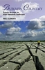
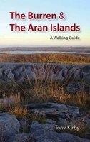
Burren And Aran Islands - Walking Guide

The Burren and the Aran Islands, with their unique combination of flora, fauna and landscape, are explored by large numbers of walkers annually. This is a guide to some of the best walking routes in the region, with lucid descriptions and additional information to enhance the walkers` enjoyment and appreciation of the place. From the rugged interior to spectacular coastal scenery, from challenging upland walks to shorter road and waterside excursions, this selection has something for everyone. Every part of the region is covered. Walks vary from two-hour strolls to the longer Burren Way, a six-hour walk from Lisdoonvarna to Ballyvaughan. The author has put his considerable experience and detailed knowledge of the area to great use in putting together an easy-to-use guide that
introduces the best of this region for locals and visitors alike. Each route, prefaced with a quick-reference summary, is illustrated with a clear sketch map; descriptions include detailed access information while points of interest are highlighted - geology, flora and fauna, history, archaeology and folklore.
RIP - This product is no longer available on our network. It was last seen on 25.09.2019

This page now acts as a permanent archive for this product. Add more information using the comments box below to ensure it can still be found by future generations.

Use our search facility to see if it is available from an alternative contributor.
  • Availability: Out Of Stock
  • Supplier: Stanfords
  • SKU: 9781905172979
Availability: In Stock
£12.99

Product Description

The Burren & the Aran Islands, with their unique combination of flora, fauna & landscape, are explored by large numbers of walkers annually. This is a guide to some of the best walking routes in the region, with lucid descriptions & additional information to enhance the walkers` enjoyment & appreciation of the place. From the rugged interior to spectacular coastal scenery, from challenging upland walks to shorter road & waterside excursions, this selection has something for everyone. Every part of the region is covered. Walks vary from two-hour strolls to the longer Burren Way, a six-hour walk from Lisdoonvarna to Ballyvaughan. The author has put his considerable experience & detailed knowledge of the area to great use in putting together an easy-to-use guide that introduces the best of this region for locals & visitors alike. Each route, prefaced with a quick-reference summary, is illustrated with a clear sketch map; descriptions include detailed access information while points of interest are highlighted
- geology, flora & fauna, history, archaeology & folklore.

Reviews/Comments

Add New

Intelligent Comparison

Oooops!
We couldn't find anything!
Perhaps this product's unique.... Or perhaps we are still looking for comparisons!
Click to bump this page and we'll hurry up.

Price History

Vouchers

No voucher codes found.
Do you know a voucher code for this product or supplier? Add it to Insights for others to use.

Facebook

Jargon Buster

Hour - A measurement of time, 60 minutes is equal to one hour
History - Anything that happens in the past. An acedemic subject.
Quick - Something that is fast
Large - something that takes up more space than normal.
Road - a manmade lane or a path that is used to speed up travel.
Spectacular - Something that catches that eye due to its eye catchingness.
Experience - To gain further knowledge by practising.
Interior - The inside of something, usually what is not visible.
Reference - To prove evidence with a back up source.
Combination - The process of two of more things being mixed or combined together.

Supplier Information

Stanfords
Stanfords was established in 1853 and opened their iconic Covent Garden flagship store in 1901. They have become the top retailer of maps, travel books and accessories in the UK and arguably offer the largest selection of maps and travel books worldwide. Famous names such as Captain Robert Falcon Scott, Ranulph Fiennes and Michael Palin have purchased from Stanfords. They now have a shop in Bristol and both stores together with other venues operate a calendar of events including talks, book signings and exhibitions. As a specialist map retailer, the map selection is comprehensive and includes road maps, street maps and walking maps from worldwide destinations, as well as a selection of world atlases and wall maps. Books include travel guides and travel literature. Stanfords also stock globes, from miniatures made of blue marble to magnificent floor-standing globes. The website features a selection of interesting articles on travel topics.
Page Updated: 2023-11-12 20:15:36

Community Generated Product Tags

Oh No! The productWIKI community hasn't generated any tags for this product yet!
Menu