
 United Kingdom
 France
 Germany
 Netherlands
 Sweden
 USA
USA
 Italy
Italy
 Spain
Spain
More From Contributor


Belfast East 1902
Belfast East in 1902 in a fascinating series of reproductions of old Ordnance Survey plans in the Alan Godfrey Editions, ideal for anyone interested in the history of their neighbourhood or family. The map covers part of east Belfast, east of the Lagan. Note that the Co Antrim area west of the Lagan is left blank. Coverage stretches from Albert Bridge and Ormeau Park eastward to Castlereagh Road, and from Newtownards Road southward to Ravenhill Avenue. Features include Ormeau Park, Cromac Distillery, Lagan Engine Works, Albert Bridge, Queen`s Bridge (at top margin), Chemical Manure Works, Cromac Brewery, tramways and Mountpottinger depot, St Ann`s Iron Works, Belfast Felt Works, Willowfield House, Loopbridge Weaving Factory, jam factory, Castlereagh Laundry, Loopbridge
Printing Works, Avoneil Distillery, St Patrick`s church, Nettlefield, Ravenhill Presbyterian church, St Clement`s church, etc. On the reverse are street directory entries for Albertbridge Road, Castlereagh Street, Ravenhill Road, Ravensdale Street and Templemore Avenue. About the Alan Godfrey Editions of the 25” OS Series:Selected towns in Great Britain and Ireland are covered by maps showing the extent of urban development in the last decades of the 19th and early 20th century. The plans have been taken from the Ordnance Survey mapping and reprinted at about 15 inches to one mile (1:4, 340). On the reverse most maps have historical notes and many also include extracts from contemporary directories. Most maps cover about one mile (1.6kms) north/south, one and a half miles
(2.4kms) across; adjoining sheets can be combined to provide wider coverage.FOR MORE INFORMATION AND A COMPLETE LIST OF ALL AVAILABLE TITLES PLEASE CLICK ON THE SERIES LINK.

Product Description
Reviews/Comments
Add New
Intelligent Comparison
Archived Product
Weston East 1902 Stanfords
£3.50
Archived Product
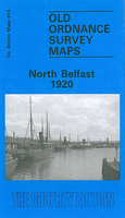
Belfast North 1920 Stanfords
£3.50
Archived Product
Belfast South 1920 Stanfords
£2.95
Archived Product
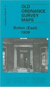
Bolton East 1908 Stanfords
£2.95
Archived Product
Bolton East 1908 Stanfords
£3.50
Vouchers
No voucher codes found.
Do you know a voucher code for this product or supplier? Add it to Insights for others to use.
Do you know a voucher code for this product or supplier? Add it to Insights for others to use.
 Denmark