
 United Kingdom
 France
 Germany
 Netherlands
 Sweden
 USA
USA
 Italy
Italy
 Spain
Spain
More From Contributor


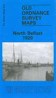
Belfast North 1920
Belfast North in 1920 in a fascinating series of reproductions of old Ordnance Survey plans in the Alan Godfrey Editions, ideal for anyone interested in the history of their neighbourhood or family. The map covers a busy area of north central Belfast, including several of the docks. Coverage stretches from Clifton Park Avenue eastward to Spencer Dock and Albert Quay, and from Limestone Road and Mountcollyer Road southward to North Street and Albert Square. Note that the small area of Co Down east of the Lagan is left blank. Features include Library & Art Gallery, New Smithfield Mill, Custom House, St Anne`s Cathedral, tramways, York Road terminus with goods sheds and engine depot, dockside lines, York Street Weaving Factory, Tobacco Factory, Victoria Barracks, Carlisle Circus
area, Belfast Charitable Institution, Court House, Prison (left blank), Belfast Royal Academy, Corporation Square, Donegall Quay, Albert Quay, Clarendon Dock and graving docks, York Dock, Dufferin Dock, Spencer Dock, Milewater Basin, timber ponds, etc. On the reverse are street directory entries for Dock Street, York Lane and York Street. About the Alan Godfrey Editions of the 25” OS Series:Selected towns in Great Britain and Ireland are covered by maps showing the extent of urban development in the last decades of the 19th and early 20th century. The plans have been taken from the Ordnance Survey mapping and reprinted at about 15 inches to one mile (1:4, 340). On the reverse most maps have historical notes and many also include extracts from contemporary directories. Most
maps cover about one mile (1.6kms) north/south, one and a half miles (2.4kms) across; adjoining sheets can be combined to provide wider coverage.FOR MORE INFORMATION AND A COMPLETE LIST OF ALL AVAILABLE TITLES PLEASE CLICK ON THE SERIES LINK.

Product Description
Reviews/Comments
Add New
Intelligent Comparison
Archived Product
Belfast South 1920 Stanfords
£2.95
Archived Product

Bolton North 1908 Stanfords
£3.50
Archived Product

Belfast East 1902 Stanfords
£3.50
Archived Product

Bedford North 1924 Stanfords
£3.50
Archived Product

Halifax North 1930 Stanfords
£3.50
Archived Product
Halifax North 1905 Stanfords
£2.95
Archived Product
Beverley North 1908 Stanfords
£3.50
Vouchers
No voucher codes found.
Do you know a voucher code for this product or supplier? Add it to Insights for others to use.
Do you know a voucher code for this product or supplier? Add it to Insights for others to use.
 Denmark