
 United Kingdom
 France
 Germany
 Netherlands
 Sweden
 USA
USA
 Italy
Italy
 Spain
Spain
More From Contributor


Canada Satellite Image Wall Map
Assembled from satellite images data, this mostly cloud-free image shows Canada as if viewed from the air.It is enhanced with natural-looking colours to depict vegetation distribution, urban sprawl and other landscape variations.Printed on thick paper.
Product Description
Reviews/Comments
Add New
Intelligent Comparison
Archived Product
Antarctica Satellite Image Wall Map Stanfords
£13.95
Archived Product

Canada Relief Wall Map Stanfords
£29.99
Archived Product
New York City Satellite Image Wall Map Stanfords
£10.99
Archived Product
Europe And North Africa Satellite Image Wall Map Stanfords
£10.99
Archived Product
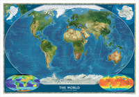
World Satellite Image NGS Wall Map PAPER Stanfords
£12.99
Archived Product
The Living Earth Satellite Image Wall Map Stanfords
£11.99
Archived Product
Antarctica NGS Satellite Image Wall Map PAPER Stanfords
£14.95
Vouchers
No voucher codes found.
Do you know a voucher code for this product or supplier? Add it to Insights for others to use.
Do you know a voucher code for this product or supplier? Add it to Insights for others to use.
 Denmark