
 United Kingdom
 France
 Germany
 Netherlands
 Sweden
 USA
USA
 Italy
Italy
 Spain
Spain
More From Contributor


Bradford North 1906
Bradford North in 1906 in a fascinating series of reproductions of old Ordnance Survey plans in the Alan Godfrey Editions, ideal for anyone interested in the history of their neighbourhood or family. The map covers the northern part of central Bradford, including the eastern part of Manningham. Coverage stretches from Salt Street eastward to Undercliffe Street and from the Midland (Forster Sq) station northward to Queen`s Road and Clifton Villas. Features include the railway approaches to the Midland station, including full track layout, turntable, goods shed, sidings etc; much of Peel Park; Cliffe Wood & Spinkwell Quarries, Otley Road, Bolton Road, Hill Side Villas, Bradford Cemetery, Sunnybank Laundry, Wapping, Bradford Canal with wharf and warehouses, Manningham Lane,
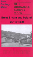
Infirmary, Lumb Lane Mills, Clifton Villas, Valley Mills, Valley Road Gas Works, tramways, Valley Parade and football ground. On the reverse are street directory entries for Bolton Road and Manningham Lane.About the Alan Godfrey Editions of the 25” OS Series:Selected towns in Great Britain and Ireland are covered by maps showing the extent of urban development in the last decades of the 19th and early 20th century. The plans have been taken from the Ordnance Survey mapping and reprinted at about 15 inches to one mile (1:4, 340). On the reverse most maps have historical notes and many also include extracts from contemporary directories. Most maps cover about one mile (1.6kms) north/south, one and a half miles (2.4kms) across; adjoining sheets can be combined to provide wider
coverage.FOR MORE INFORMATION AND A COMPLETE LIST OF ALL AVAILABLE TITLES PLEASE CLICK ON THE SERIES LINK.

Product Description
Reviews/Comments
Add New
Intelligent Comparison
Archived Product

Bradford East 1906 Stanfords
£3.50
Archived Product

Bedford North 1924 Stanfords
£3.50
Archived Product

Haydock North 1906 Stanfords
£3.50
Archived Product

Bradford Central 1906 Stanfords
£3.50
Archived Product

Hertford North 1897 Stanfords
£3.50
Archived Product
Bootle North 1906 Stanfords
£3.50
Archived Product

Blandford Forum 1901 Stanfords
£3.50
Archived Product
Knutsford North 1908 Stanfords
£3.50
Vouchers
No voucher codes found.
Do you know a voucher code for this product or supplier? Add it to Insights for others to use.
Do you know a voucher code for this product or supplier? Add it to Insights for others to use.
 Denmark