
 United Kingdom
 France
 Germany
 Netherlands
 Sweden
 USA
USA
 Italy
Italy
 Spain
Spain
More From Contributor

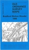


Bradford East 1906
Bradford East in 1906 in a fascinating series of reproductions of old Ordnance Survey plans in the Alan Godfrey Editions, ideal for anyone interested in the history of their neighbourhood or family. The map covers the eastern part of Bradford, including Laisterdyke and Tyersall. Coverage stretches from Birksland Street eastward to Tyersall Hall and from Maidstone Street southward to Tyersall Gate. Features include Holy Trinity church, Fever Hospital, Penny Oaks Mill, Hillside Mills, Hubert Shed, Gas Works, Albion Works, Bowling Iron Works, St John`s church, Upper Croft Mills, Swain Green, Alexandra Shed, New Lane Mills, Quarry Gap Row, Laisterdyke Brick Works, Tyersall Mill (disused), Tyersall House, Cutler Heights, etc. Several sections of the GNR Bradford Branch are
shown, including Laisterdyke station, Quarry Gap Junction, Cutlers Junction, Broad Lane Junction and Tyersall Junction. On the reverse are street directory entries for Amberley Street, Bowling Back Lane, Birksland Street, Laisterdyke, Leeds Road, Rochester Street and Sticker Lane.About the Alan Godfrey Editions of the 25” OS Series:Selected towns in Great Britain and Ireland are covered by maps showing the extent of urban development in the last decades of the 19th and early 20th century. The plans have been taken from the Ordnance Survey mapping and reprinted at about 15 inches to one mile (1:4, 340). On the reverse most maps have historical notes and many also include extracts from contemporary directories. Most maps cover about one mile (1.6kms) north/south, one and a half
miles (2.4kms) across; adjoining sheets can be combined to provide wider coverage.FOR MORE INFORMATION AND A COMPLETE LIST OF ALL AVAILABLE TITLES PLEASE CLICK ON THE SERIES LINK.

Product Description
Reviews/Comments
Add New
Intelligent Comparison
Archived Product

Bradford North 1906 Stanfords
£3.50
Archived Product

Bradford Central 1906 Stanfords
£3.50
Archived Product

Bangor East 1901 Stanfords
£3.50
Archived Product

Bradford Girlington 1906 Stanfords
£3.50
Archived Product
Maldon East 1920 Stanfords
£3.50
Vouchers
No voucher codes found.
Do you know a voucher code for this product or supplier? Add it to Insights for others to use.
Do you know a voucher code for this product or supplier? Add it to Insights for others to use.
 Denmark